Category Archives: Synagogue

Tiberias from 1st Century to Ottoman Conquest

Map after HerodThe city of Tiberias is on the western side of the Sea of Galilee. it was Herod Antipas, one of the sons of Herod the Great, who inherited the areas of Galilee and Perea and ruled as tetrarch. The boys took after their father, Antipas built the city of Tiberias as his capital in 18 CE on an existing settlement, which he named after his patron the Roman emperor Tiberius and built an impressive palace there. His half-brother Philip built his capital at Banias In 3 BCE and made improvements in 14 CE after which Agrippa II also carried out urban improvements. During the First Jewish–Roman War, Vespasian rested his troops at Caesarea Philippi in July 67 CE before advancing on Tiberias to crush the Jewish resistance in Galilee. Today you can visit the archaeological site at Banias but although archaeologists have excavated Tiberias since 1934 (Makhouli, Guy and Rabani, Druks, Foerster, Berman, Hirschfeld, also with Gutfeld) only recently has it been possible to visit the site.

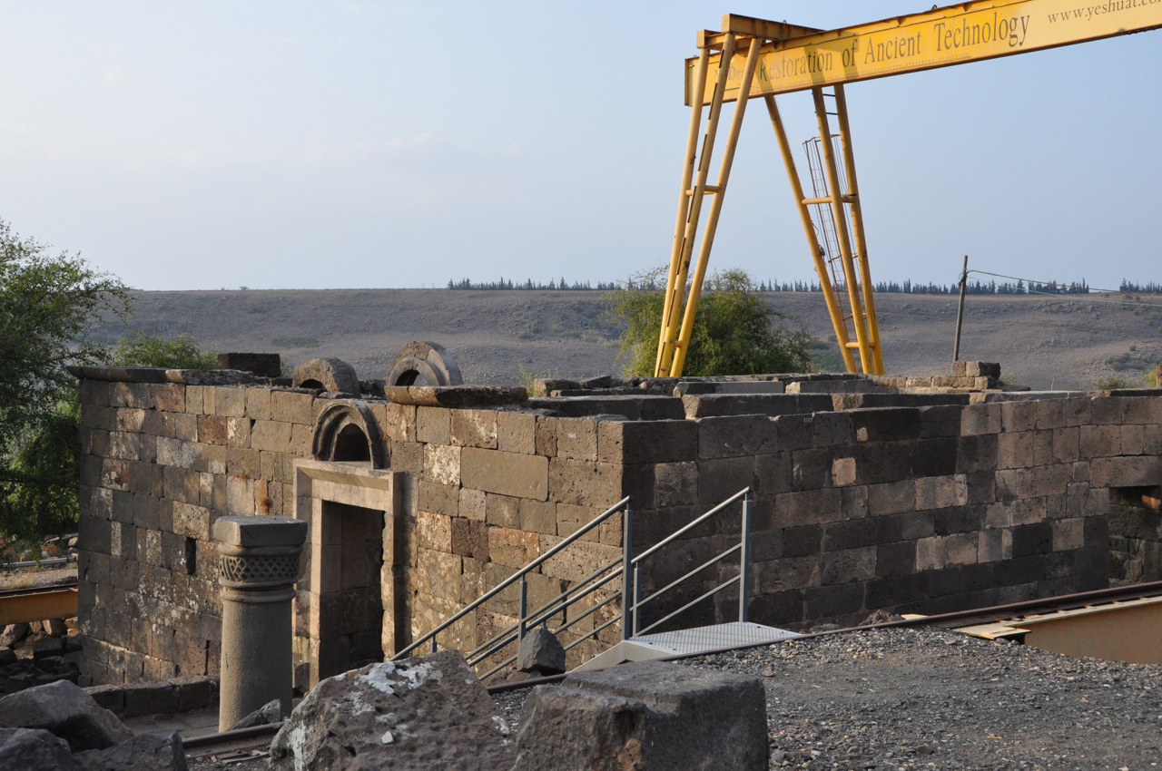
The site and its surroundings boast an array of archaeological finds from almost every period from its establishment during the first century to the Crusader period and you’ll need a knowledgeable guide to make sense of it.

Tiberias excavations

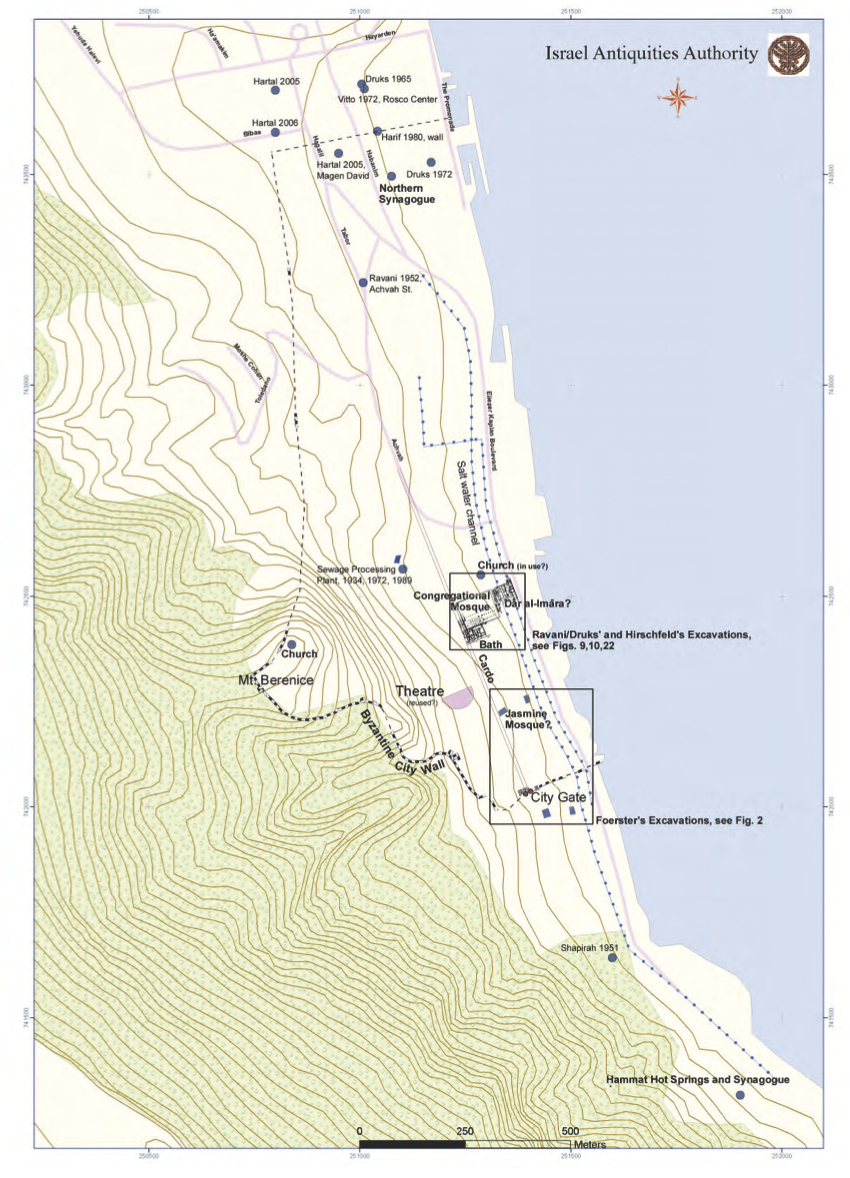
map by Leticia Barda of the Israel Antiquities Authority

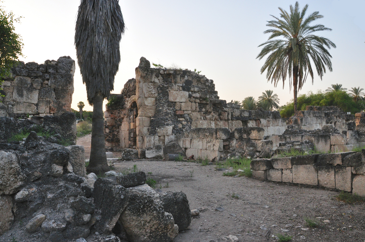
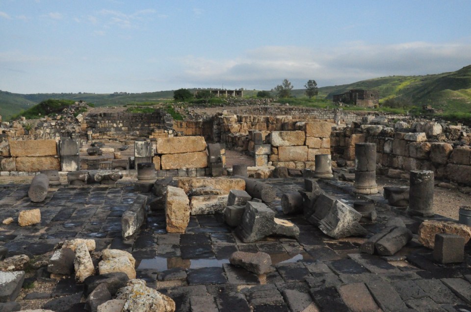
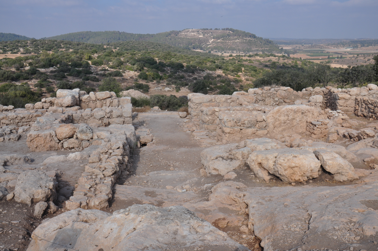
At the southern edge of the city are the remains of a decorative gate built by Antipas, the entrance flanked by two cylindrical towers. This gate and the Cardo leading from it continued to be used through the Early Islamic period, more than 700 years. South of the gate is a drainage system channeling the water from the winter floods into the lake – a bridge enables access to the gate and the Cardo. During the Byzantine period, the gate was connected to a wall encompassing the city and the eastern slopes of Mt. Berenice.

City Gate, Tiberias

Foerster Area C


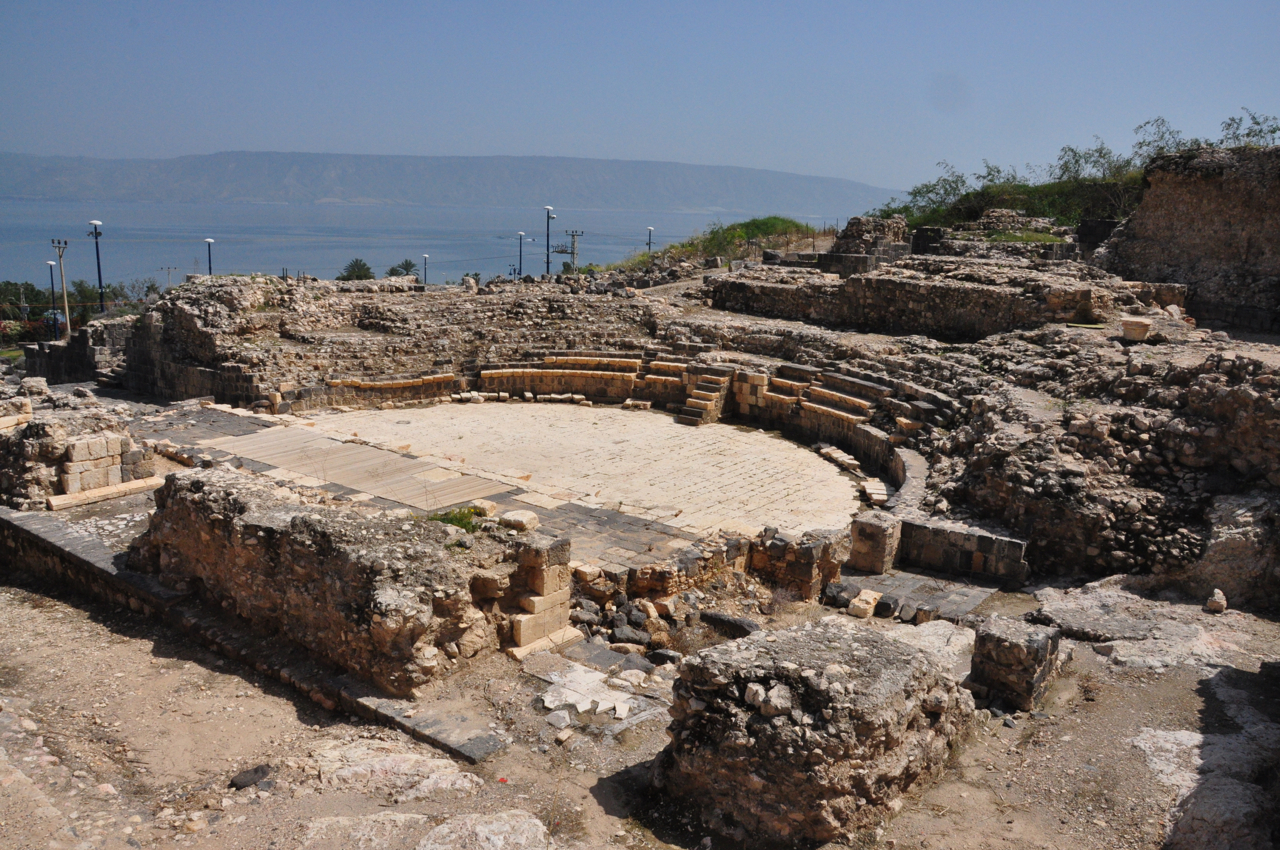
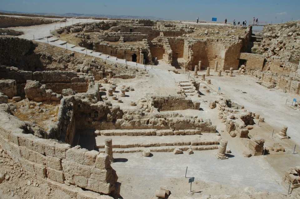
The other monumental structure uncovered is a Roman theater built by Antipas, with 7,000 seats, more than the theater at Caesarea built by Herod.

Roman Theater, Tiberias

Over the years, archaeological expeditions have uncovered, a large Late Roman-Byzantine bathhouse, a broad pillared building built over what has been identified as an unfinished Roman temple (Hadrianeum), and a basilical building to the east, lying between the Cardo and the Sea of Galilee.

Hirschfeld excavations Tiberias

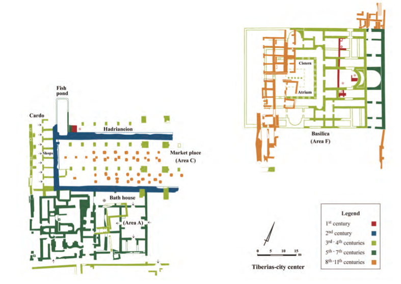
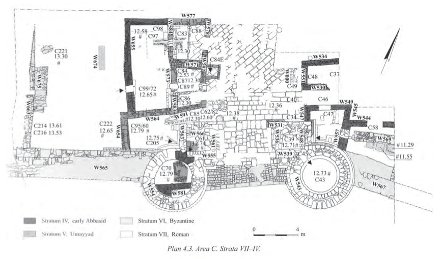
Excavation Plans Tiberias (2005). (Dov Porotsky, courtesy of Hirschfeld Expedition team)

The following are excerpts from Israel Antiquities Authority article by Hirschfeld and Meir from 2006 at http://www.hadashot-esi.org.il/report_detail_eng.aspx?id=337&mag_id=111.

In excavating down to Stratum VII (first century CE), they reached the Herodian level on which the basilica was erected. Parts of a floor that consisted of divided marble slabs in opus sectile pattern and a long wall with traces of a red fresco below the basilica’s foundations were found. It is presumed that this was the remains of Herod Antipas’ magnificent palace, which Josephus Flavius described in his writings. Further exposed remains of this building included pieces of frescos painted in red, ochre, as well as blue and green, which were scattered in abundance throughout the excavation area.

At Stratum VI dated to the Roman period (second–third centuries CE) remains in Area A included the bathhouse and Area C consisted of the “covered marketplace”. Remains of the Hadrianeum––a temple dedicated to Hadrian whose construction was never completed––were discovered to the north of Area C. The Cardo was also paved during this period.

Hirschfeld excavated, among others, a large building from the late Roman period (Area B, stratum IV), which he identified as the Great Academy (Beth Midrash) of Tiberias.

Among the recovered coins from Stratum II (10th-11th Century) were 4–5 anonymous folles (‘Jesus coins’), dating to the middle of the eleventh century CE. The image of Jesus was depicted on one side of the coin and an inscription in Greek: “Jesus the messiah, king of the kings” was on the other side.

Cytryn-Silverman, who now heads the Tiberias excavation, claims that the “covered marketplace” is a mosque, in fact, it resembles the plan of the Great Mosque in Damascus, Syria.

A church that predates the mosque has also been uncovered at the site. Unlike at other sites, however, the mosque was built not over the church, but nearby.

The mosque, which symbolized the power of Muslim Tiberias, stood for 330 years, until an earthquake toppled it in 1068. In 1099, the Crusaders conquered Tiberias and used the mosque’s building stones for another structure. That, too, has been uncovered by the dig, and by the type of clay vessel found there, has been shown to be a sugar cane production plant, part of one of the country’s most important export industries at the time.

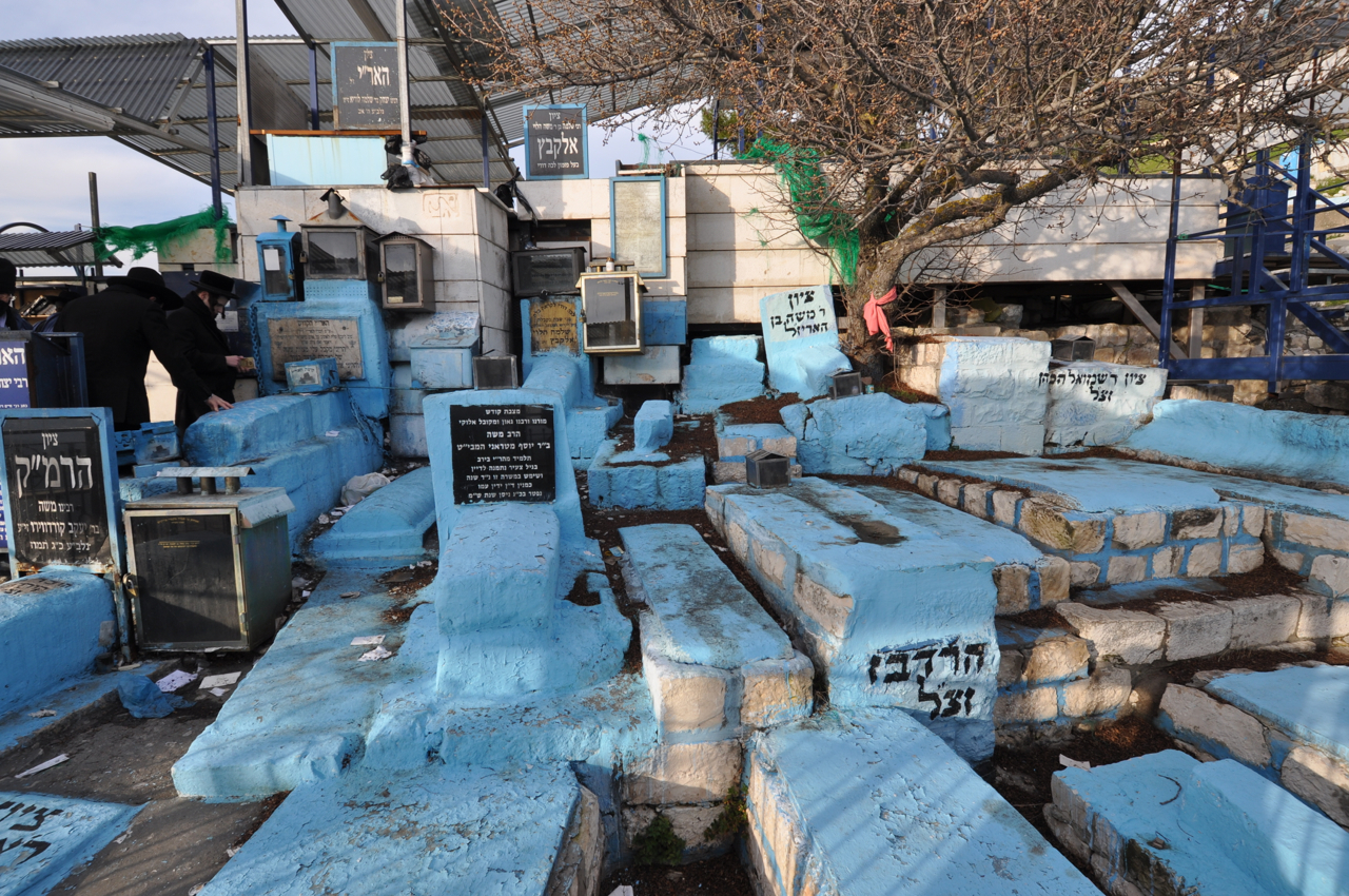
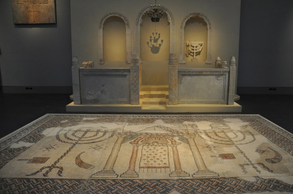
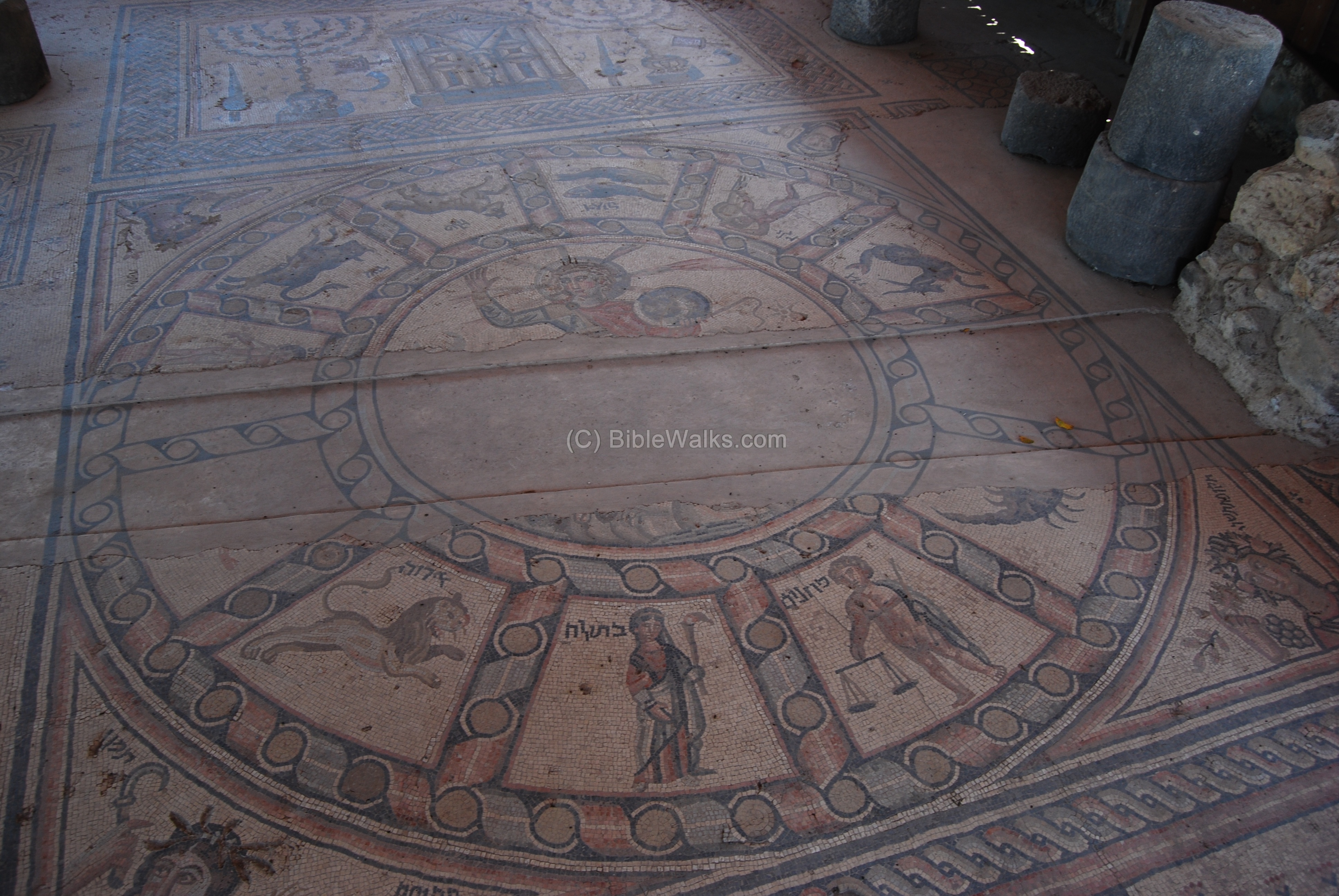
South of ancient Tiberias is a suburb by the name of Hammat Tiberias built around 17 hot springs. Within the small archaeological park are some of the remains of the ancient town of Hammat, including a synagogue from the Late Roman–Byzantine period, boasting a spectacular mosaic floor. In addition to the synagogue are the remains of an Ottoman Hammam (bathhouse complex) and the springs themselves. You can experience these hot springs at the modern spa across the road.

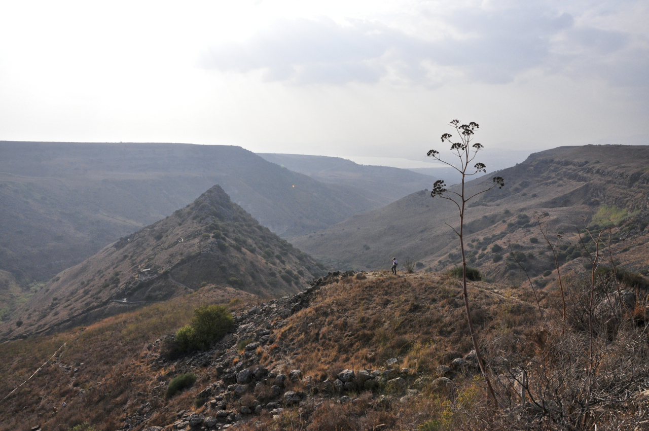
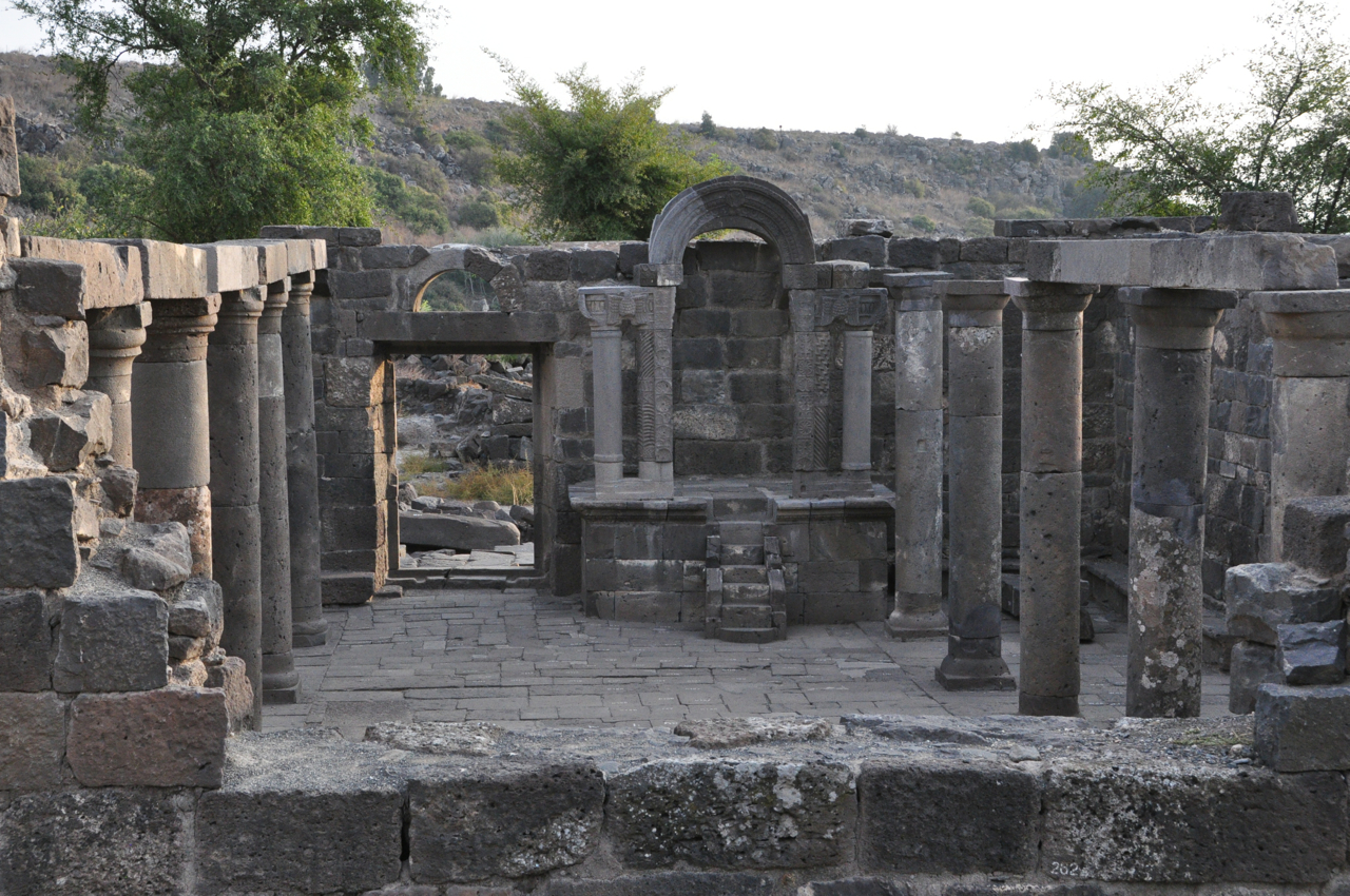
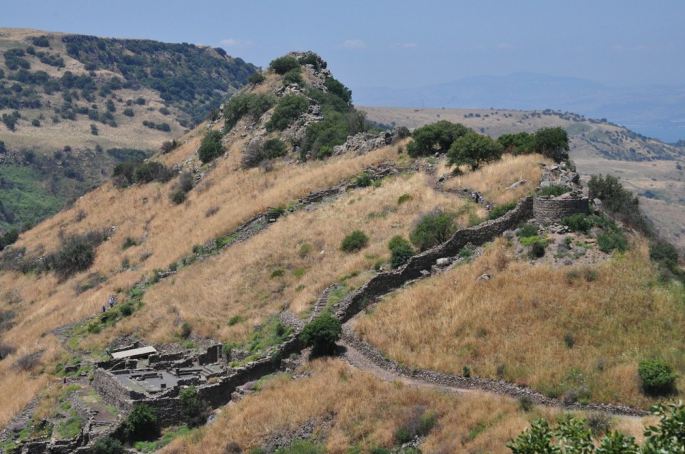
The remains of a Byzantine monastery and church were discovered on the summit of Mt. Berenice from which there is a spectacular view of the Galilee, the lake and across to the Golan Heights.

1st C Synagogue planIn the center of the present city of Tiberias a small, open-air archaeological park can be found. Within it are the remains of a synagogue dated to the Byzantine period, with a small section of mosaic floor with an inscription in Greek, Proclos son of Krispos framed by images of a palm branch and citron. In addition there is a display of architectural elements found in archaeological sites around Tiberias.

To the north of Tiberias the Umayyad caliphs built a winter palace at Khirbat al-Minya which can be visited.

Khirbat al-Minya

The eighth century was Tiberias’ golden age, as shown by both excavations and historical writings. A large Jewish community also flourished in the lakeside city, and that community produced the copy of the Bible that became known as the Aleppo Codex.

In 1187 Saladin’s force left Caesarea Philippi to engage the fighting force of the Knights Templar in which the Crusader force was destroyed. Saladin then besieged Tiberias which fell after six days. On July 4, 1187 Saladin defeated the Crusaders coming to relieve Tiberias at the Battle of Hattin, 10 kilometres (6 miles) outside the city making the Islamic forces the eminent military power in the Holy Land. During the Third Crusade, the Crusaders drove the Muslims out of the city and reoccupied it. In 1265 the Crusaders were driven from the city by the Mamluks, who ruled Tiberias until the Ottoman conquest in 1516.


Magdala on Sea of Galilee

Magdala Nunayya (Magdala of the fishes) was an important Jewish city on the western shore of the Sea of Galilee established during the Hasmonean period, centuries before neighboring Tiberias. In Christian tradition, it is the birthplace of Mary Magdalene and where Jesus went after he fed the five thousand (Mark 8:10).

Q: What do you get when you cross a hotel, a new spiritual center and an archaeological site at the historical location of Magdala/Tarichaea overlooking the Sea of Galilee?

A: The Magdala Center, a new tourist and pilgrim destination.

The original excavations at the site were done by the Franciscan Corbo in the 1970s. Paved streets and a large colonnaded square typical of a Roman city were found, along with buildings with mosaic floors. On the floor of one urban villa an image of a sailing ship, a type of Mediterranean vessel, modified for the lake was found in mosaic. Scholars think that boats like this were used to transport goods between Magdala and the Decapolis on the eastern shore of the lake. The shape of the hull and the additional cutwater (forward curve of the stem of a ship) resembles the features of the boat discovered in the mud near Ginnosar.

In excavations from 2007 carried out by De Luca large portions of the paved Cardo and the Decumanus were uncovered. Underneath these streets were drainage channels which fed numerous wells and fountains, part of the city’s sophisticated water system. In 2008 thermal pools were discovered. The water supply system serves primarily the large thermal complex east of the Cardo and the large Quadriporticus which served as palaestra (rectangular court surrounded by colonnades with adjoining rooms) for the visitors of the thermae. The newly discovered harbour of Magdala includes in situ: massive foundations of a tower with casemate, a Hasmonean wall built of ashlar stones with dressed margins, ramps for recovering ships, a staircase, a large L-shaped basin with breakwater and six mooring stones incorporated in the painted plastered wall – the largest and best preserved harbour on the Sea of Galilee discovered so far. Everywhere in the excavations De Luca encountered damage caused by the First Jewish Revolt in which Magdala played a major role (as recorded by Josephus). Plans are to re-open this site in the near future.

In the most recent excavations by archaeologists Avshalom-Gorni and Najar of the Israel Antiquities Authority as part of a salvage dig a building that covers about 120 square meters with simple mosaics covering the floor and frescoes of colored wall panels was found. The building has stone benches along the walls and columns that would have supported the roof and has been identified as a first century synagogue.

Synagogue 1st C at Magdala aerial

from IAA

from IAA

Perhaps the most interesting find is a nearly 3-foot-long limestone block found on the floor in the center of the synagogue elaborately carved on the sides and top. On one side is the first and only pre-70 Galilean depiction of a seven-branched menorah between 2 amphorae and fluted columns (another early menorah is the drawing in plaster found in a mansion in the Herodian quarter in Jerusalem). The precise function of the stone remains uncertain – it may have been used as a table on which Torah scrolls were rolled out and read. Perhaps less impressive but still very interesting is a series of mikva’ot (ritual baths) that have been uncovered that fill from underground springs.

Mikva at Magdala

The excavations have also found the fish market and some pools used for holding and sorting the fish brought in by the fishermen, attesting to the importance of fishing to the economy of Magdala.

In the plans, besides the hotel, a church or Spirituality Center is being built called “Duc in altum” based on the words from Luke 5:4 that Pope John Paul II chose, “Put out into the deep” to say, that with God’s help, anything and everything can be accomplished. The building is in the shape of an octagon which is usual for a martyrium as opposed to the traditional Byzantine basilica (rectangular, central nave with apse, and two or more aisles). Not only the shape is reminiscent of early Orthodox churches but the interior of the main chapel is decorated with paintings of holy figures like in an Orthodox church, in the spirit of ecumenism. The area of the altar has a replica of a wooden boat so that as you sit in the chapel, you face the boat with a view of the lake behind it.

Getting into one of the boats, the one belonging to Simon, Jesus asked him to put out a short distance from the shore. Then he sat down and taught the crowds from the boat.  Luke 5:3

Duc in Altum sanctuary

There are 4 smaller chapels off the main hall, each decorated with beautiful mosaics by artist Maria Jesus Fernández depicting scenes from Jesus’ ministry: the resurrection of  Jairus’ daughter, Jesus calling the disciples, the exorcism of Mary Magdalene and Jesus calming the waters of the Sea of Galilee. Below is an ecumenical chapel where the floor paving stones are from Magdala’s first century market.

Golan Heights Tour

The Golan Heights, Israel’s mountainous north-eastern region, is one of the most beautiful areas of the country. In the Golan, rather than desert, we have streams and waterfalls. There are also numerous archeological sites and ancient synagogues dating back to the Roman and Byzantine periods, evidence of flourishing Jewish communities in the area going back 2000 years. The remains of 25 synagogues from the period between the Great Revolt in 66 and the Islamic conquest in 636, when organized Jewish settlement on the Golan came to an end, have been discovered – 6 have been excavated.

The Golan was settled in the modern period beginning in 1886 when Jews from Tzfat and Tiberias settled there. The Bnei Yehuda society of Tzfat purchased a plot of land in the village of Ramataniya in central Golan (4 km north-west of the present day religious moshav of Keshet) and named their settlement “Golan BeBashan” and settled there for about a year.

In 1887, they purchased lands between the modern day Bnei Yehuda and Kibbutz Ein Gev. This community survived until 1920, when two of its last members were murdered in the anti-Jewish riots which erupted in the spring of that year. In 1891, Baron Rothschild purchased approximately 18,000 acres of land about 15 km east of Ramat Hamagshimim, in what is now Syria. First Aliyah (1881-1903) immigrants established five small communities on this land, but were forced to leave by the Turks in 1898. The lands continued to be farmed until 1947 by the Palestine Colonization Association and the Israel Colonization Association, when they were seized by the Syrian army. Most of the Golan Heights were included within Mandatory Palestine when the Mandate was formally granted in 1922, but Britain ceded the area to France in the Franco-British Agreement of 7 March 1923. Consequently, the Golan Heights became part of Syria after the termination of the French mandate in 1944.

During the 1948-49 War of Independence  the Syrians army attacked the adjacent Jewish areas and managed to advance beyond the international border. After the war, the Syrians built extensive fortifications on the Heights, which were used for shelling of civilian targets in Israel. 140 Israelis were killed and many more were injured in these attacks between 1949 and 1967, and particularly in the spring of 1957. Because of this pounding, Israel Defense Forces captured the Golan Heights during the Six-Day war.

Gamla view

On a recent tour of the Golan I took clients to the archaeological park with ruins of the ancient Jewish city of Gamla to see the Second Temple period synagogue, hiked through dolmens to a 50 meter waterfall and from a panoramic lookout with a view of the Sea of Galilee watched the Griffon vultures soar through the canyon.

Griffon vulture, Gamla

From there we visited Um el-Kanatir (Arabic for Mother of the Arches) an impressive set of standing ruins of a Jewish village from the Byzantine era to see the ongoing reconstruction of the synagogue there. The ruins of a very large synagogue of local basalt stone were found, destroyed by the earthquake of 749 CE. I hadn’t visited in a year and there has been a lot of progress in the reconstruction of the synagogue, the walls extend to ceiling height now and the bima has been set in place (the work has now been completed).

Um el Kanatir synagogue

Um el Kanatir synagogue interior

Katzrin is also well worth a visit. The Talmudic Village lets us explore the 4th century CE village of Katzrin which includes a 6th century synagogue (built on an earlier more modest one) similar to the one at Um el Kanatir. The nearby Archaeological Museum displays artifacts uncovered on the Golan. One fascinating find is an 1,800-year-old door lintel carved of basalt with a Hebrew inscription “this is the beit midrash (study house) of Rabbi Eliezer HaKapar” that was  discovered in the village of Daburiye, situated near a steep ravine with a pair of spectacular waterfalls. We know of the tanna (70-200 CE) Eliezer HaKapar, whose name refers to his work, making wine from the fruit of the caper. There is a discussion in the Talmud about wearing new shoes on the Sabbath: What are new shoes? Shoes that have not “walked” a certain distance, the distance between the synagogue at Katzrin and the beit midrash of Rabbi Eliezer KaKapar.

The Golan Heights Winery which changed the world’s impression of Israeli wines and placed Israel firmly on the international wine map or one of a number of smaller wineries is definitely worth a visit if you are into wine. One of my favorites is the Pelter winery on Kibbutz Ein Zivan where you can have a tour and learn how Tal Pelter produces a sparkling white wine in the traditional way, as well as an unwooded Chardonnay and a Gewurztraminer described as “Sweet peach, liche, melon, citrus on a lively acidic background” and taste the wine along with the artisan goat cheeses that Tal’s spouse/partner makes.

Hamat Gader is the site of natural hot mineral springs with temperatures reaching 50 °C (122 °F) and includes a 2000 seat Roman theatre built in the 3rd century CE and a large synagogue from the 5th century CE.

Tzfat Synagogues

Visitors who are impressed with the architecture and style of the churches in the Holy Land often ask to see similar synagogues. When in Tzfat it’s worth visiting some of the synagogues.

The Ari Ashkenazi Synagogue

The synagogue was built in the sixteenth century on the northern edge of the Sephardic neighborhood by Spanish exiles who had emigrated from Gerigos, Greece. Kabbalists, mostly followers of Rabbi Moshe Cordovero frequented the synagogue and in 1570 Rabbi Isaac Luria (known by his acronym “the Ari”) joined them – for a short two years until his death. On the Eve of Sabbath, they walked to a nearby field, the Hakal Tapuchin, (apple orchard) to welcome the Sabbath bride to the melody of Lecha Dodi written by Rabbi Shlomo Alkabetz. Cordovero, the Ari, Alkabetz and other kabbalists are buried in the cemetery, their graves covered in bright, sky blue paint.

Tzfat cemeteryIn the eighteenth century, a large group of Hasidim from Europe arrived and the synagogue began to be called “the Ashkenazi Ari Synagogue.” It was destroyed in the earthquake of 1837, and rebuilt in 1857. Notice the inscription in Hebrew that appears above the entrance, which in Hebrew numerology is equivalent to “and My Temple shalt thou revere”.

Ari synagogueThe Holy Ark was carved from olive wood by a craftsman from Galicia, Poland, in the style of the synagogues of Eastern Europe. The craftsman was a non-Jew who was unaware of Judaism’s adherence to the second commandment against graven images. At the top of the ark he placed a human face – this was transformed into an anthropomorphic image of a lion, alluding to the acronym Ari, which means lion.

Ark in Ari synagogue

The Ari Sephardic Synagogue

Down by the cemetery there is another synagogue, Eliyahu HaNavi, the oldest synagogue in Safed that historical sources tell us existed as early as 1522 and was used by North African Jews. The Ari frequently prayed in this synagogue, preferring this location over others because of the view of Mt. Meron and the tomb of Rabbi Shimon Bar Yohai. The Ari liked to sit in a little alcove on the eastern side of the synagogue studying Kabbalah, and that while he was absorbed in his studies, the prophet Elijah appeared to him.

Ari Sephardic synagogueMost of the structure was destroyed in the massive earthquakes that struck Tzfat in 1759 and 1837. In 1840, the Italian Jewish philanthropist Yitzhak Guetta donated money for the renovation of the synagogue.

Alsheikh synagogue

The only synagogue in Tzfat which was not destroyed by either the 1759 or the 1837 earthquake is the Alsheich synagogue named after Rabbi Moshe Alsheich, one of the foremost kabbalists of his day. He gave weekly sermons on the Torah portion of the week at the synagogue with kabbalistic commentaries to which the Ari and Rabbi Yosef Karo attended.

Alsheich synagogueThe Alsheich oversaw the construction of the synagogue which was erected in the style of 16th century Sephardic synagogues but had no women’s gallery. After 1759, the synagogue was renovated and the workmen inserted beams and peaked arches in the style of the Bukharan Jews of Samarkand which enabled it to withstand the devastating earthquake of 1837. One of the most valued items in the synagogue is the Torah scroll cover inscribed with the year 1434.

Abuhav synagogue

The synagogue is named after the fifteenth century kabbalist, Rabbi Isaac Abuhav, who is considered one of the great sages of Castile, Spain.

Tradition states that Abuhav, who never left Spain, designed the synagogue and his disciples erected the building when they arrived in the 1490s after their expulsion from Spain. Another legend claims that Abuhav came to Rabbi Ohana, a kabbalist from Fez, Morocco in a dream and asked for his help to transport the synagogue miraculously from Spain to Safed. The kabbalists gathered together at midnight in the House of Study, after fasting and immersing in the mikve (ritual bath) – in Toledo, a whirlwind with frightening power ripped up the synagogue from its foundations and set it down in an empty field in Tzfat.

Abuhav synagogueThe synagogue has three Arks on its southern wall, the only wall left standing in the 1837 earthquake. The bima is in the center and the benches for the congregation are arranged around it, as was customary. The interior of the synagogue dome is decorated with paintings of musical instruments that were used in the Temple in Jerusalem. The crowns mentioned in Pirkei Avot 4:13 represent the crowns of Torah, the priesthood, royalty, “a good name” and a crown unique to Tzfat, the crown of redemption. In keeping with the numerological tradition of Kabbalah, the design of the synagogue has numerical significance: 1 bima, 3 Arks, 4 central columns that represent earth, water, air and fire, 6 steps up to the bima, 10 windows in the dome represent the Ten Commandments and there are pictures symbolizing the 12 tribes of Israel.

In the rightmost ark, is a Torah scroll that is 650 years old, written by Rabbi Abuhav, conceivably the oldest Torah scroll still in use. It is only taken out for reading three times a year: Rosh Hashanah, Yom Kippur and Shavuot. Among Abuhav’s pupils was Rabbi Ya’acov Beirav, who later moved to Tzfat and became one of its foremost sages. It may have been Beirav who brought the Torah scroll to Tzfat. Another Torah scroll in the Abuhav Synagogue is the scroll of Rabbi Ohana.

Archaeology in Israel Tour

I’m delighted to announce that Dan McLerran at Popular Archaeology and I are creating a phenomenal tour of archaeological sites in Israel that I will be guiding October 2013.
I invite you to join us on this adventure, 12 days of touring in Israel, where we’ll cover the famous sites like Megiddo and Hazor and uncover some of the less well-known gems like Sussita-Hippos, one of the Decapolis cities overlooking the Sea of Galilee that was destroyed in the earthquake of 749CE and never rebuilt.

Sussita excavation

We’ll start by going back 6500 years to the Chalcolithic period and tour up on the Golan Heights to learn about burial at that time. We’ll see dolmens, the megalithic tombs consisting of a flat rock resting on two vertical rocks that mark a grave. We’ll hike to the cultic site of Rujm el Hiri – is it a site that is connected to the calendar or to burial? At Ein Gedi we’ll see the ruins of a Chalcolithic temple. We’ll see artifacts at the Israel museum, examples of clay ossuaries and fine bronze castings of ritual objects.

We’ll follow in the path of the Kings from 1000BCE to 586BCE by traveling from Dan where a piece of a basalt victory stella in Aramaic was found mentioning the kings of Israel and the house of David. We will explore the City of David, the walled Jebusite city on the ridge between the Kidron and Tyropean valleys. We’ll walk through Hezekiah’s tunnel that brought the water of the Gihon spring to the Siloam pool inside the walls. From there we will follow in the steps of pilgrims to the Temple mount. Part of the 650m distance will be in Jerusalem’s drainage channel until we come out right under Robinson’s Arch. We’ll see the Broad wall, the remains of an 8 meter high wall that protected Jerusalem from the north in the time of the Kings.

Khirbet Qeiyafa

We’ll explore the walled Judean city of Khirbet Qeiyafa, with two gates and hence identified as Shaarayim, situated on the border of Judea facing the Phillistines.

We’ll learn about the Second Temple Period, specifically the time of the Hasmoneans and King Herod who ruled under the auspices of the Romans. We’ll check out Herod’s impressive building projects. At Caesarea, we have the temple to Augustus, the protected harbor, the palace as well as a theater and a hippodrome later used as an amphitheater. At Sebaste there is another temple to Augustus. Josephus writes that Herod built a third temple at Banias. It’s unclear whether the temple was at Banias or nearby, perhaps at Omrit. We’ll visit Herod’s palaces at Masada, the Western palace and the 3 tier hanging palace on the northern end of the site. We’ll explore the palace and administrative complex at Lower Herodium and the palace/fortress on the top of a manmade mountain where the base of a mausoleum was discovered by Prof. Ehud Netzer in 2007.

Herodium Palace:fortress

We’ll visit the newly opened exhibit at the Israel museum Herod the Great: The King’s Final Journey, artifacts from Herodium on display for the first time. We’ll also visit the Second Temple period model that displays Jerusalem at its peak just before its destruction at the hand of the Romans. We’ll visit the Shrine of the Book that houses the Dead Sea scrolls and other artifacts and combine that with the archaeological site of Qumran by the Dead Sea where the scrolls were found.

We’ll focus on the architecture of sacred space and check out various churches, in the basilica and martyrium form from the Byzantine period (4th to 7th century) and synagogues from the same period. We’ll see some amazing mosaics by visiting the  museum at the Inn of Good Samaritan, the archaeological sites of Sepphoris/Tzippori, and the synagogue at Beit Alfa. We’ll visit sites off the beaten path like the Kathisma church on the way to Bethlehem and Samaritan site on Mount Gerizim.

Synagogue mosaic floor at Israel Museum

Besides the Western wall, Judaism’s holy site, we will visit the Church of the Holy Sepulcher, the holiest site to Christianity and go up onto the Haram el-Sharif to see the Dome of the Rock and the Al Aqsa mosque, the third holiest site to Islam.

We’ll travel around the Sea of Galilee stopping at sites important to Christianity like Kursi, Capernaum and Magdala. We’ll even go up to the Golan Heights to the Jewish city of Gamla, the Masada of the north.

Gamla

For anyone who enjoys taking photographs, there will be plenty of opportunities and as an special incentive to join the tour, participants will be able to submit their best photographs from the tour to a special Pinterest site and will have a chance to win up to $1000. for the “best photo”.

If you’re interested in participating in an archaeological tour of the Holy Land, contact  me.

Probably very few people have visited this site although it is in the middle of the country, on the edge of the Yatir Forest in the northern Negev, the largest planted forest in Israel. You can click on the image for a larger view (which may take some time to load depending on your Internet connection). Please share this post with your friends by clicking on the icons at the end of this message.

The photo was taken at Khirbet Anim – olive trees with the ruins of a 4thC synagogue in the background. The technical details – the photo was taken with a Nikon D90 DSLR camera on January 7 (ISO 200, 18mm, F10 at 1/400 sec).

For a closer view of the ruins of the synagogue see my post at https://israeltours.wordpress.com/2009/03/22/yatir-forest/

Photographs on this website are © Shmuel Browns (unless marked otherwise) – if you are interested in purchasing one of my photos or using one of my photos for your own project please contact me.