Tag Archives: postaweek2011

Gamla – Nature, Archaeology and History

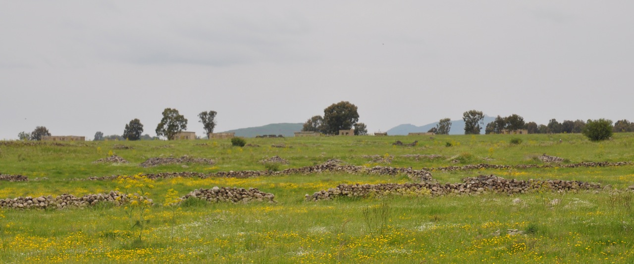
Gamla is both a nature reserve and archaeological site making it a great place to visit. We started with an easy hike, through a field of dolmens, prehistoric megalith tombs erected in the early Middle Bronze period about 2200BCE. A dolmen is made up of three large basalt stones, one lying on two other stones standing vertically. The hike takes us across a wooden bridge to the other side of Nahal Gamla for a view of the waterfall, at 51m the highest in Israel.

Gamla Waterfall

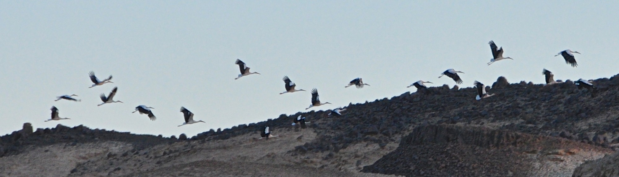
Take the trail past a Byzantine town to the Raptor lookout – the nahal is home to a large nesting population of Griffon vultures (that Israel has successfully resettled there) who did a fly past for us over the valley, it’s an incredible sight to see them gliding on the thermals.

The ancient city is situated on a steep hill (a horst like Masada) shaped like a camel’s hump, from which it derives its name (gamal means ‘camel’ in Hebrew). Jews inhabited it from the last quarter of the 2nd century BCE, and it was annexed to the Hasmonean state under Alexander Jannaeus in about 81BCE. Josephus Flavius, commander of the Galilee during the Jewish Revolt against Rome fortified Gamla as the main stronghold on the Golan. It’s fascinating to compare Gamla, a city and one of the first to stand against Vespasian’s legions with Masada, a fortress and the last to fall to the Romans.

Josephus provides a detailed description of the Roman siege and destruction of Gamla (like at Masada). Vespasian and his son Titus led the X Fretensis, XV Apollinaris and V Macedonica legions against Gamla, built a siege ramp in an attempt to take the city but were repulsed by the defenders. Only on the second attempt did the Romans succeed in breaching the wall at three different locations and invading the city. There they engaged the Jewish defenders in hand-to-hand combat up the steep hill. Fighting in the cramped streets from an inferior position, the Roman soldiers climbed onto the roofs that subsequently collapsed under the heavy weight, killing many soldiers and forcing a Roman retreat. The legionnaires re-entered the town a few days later, eventually beating Jewish resistance and completing the capture of Gamla.

According to Josephus, some 4,000 inhabitants were slaughtered, while 5,000, trying to escape down the steep northern slope, were either trampled to death or fell or threw themselves into the ravine (perhaps exaggerated by Josephus, the number of inhabitants has been estimated at less than 4,000 – at Masada 960 lost their lives).

Abandoned after its destruction, Gamla lay in ruins for almost 2000 years and was only identified in 1968 by Itzhaki Gal who was doing an archaeological survey of sites in the Golan after the Six Day War. It was excavated by Shemaryahu Gutmann (who did the original survey at Masada and who excavated there with Yigal Yadin) and Danny Syon for 14 seasons from 1976. The excavations uncovered 7.5 dunam, about 5% of the site, revealing a typical Jewish city.

The Gamla excavations revealed widespread evidence of the battle, about 100 catapult bolts, 1600 arrowheads and 2000 ballista stones, made from local basalt, 200 artifacts of Roman army equipment, quantities unsurpassed anywhere in the Roman Empire. Most were collected near the wall, placing the heavy fighting in the vicinity of the wall and the Roman siege engines to the northeast of the town.

Only one human jawbone was found during the exploration of Gamla, raising a question about what happened to the bodies of the Jewish defenders (like Masada). A tentative answer is suggested by archaeologist Danny Syon – he suggests that the dead would have been buried at nearby mass graves that have yet to be found (as at Yodfat).

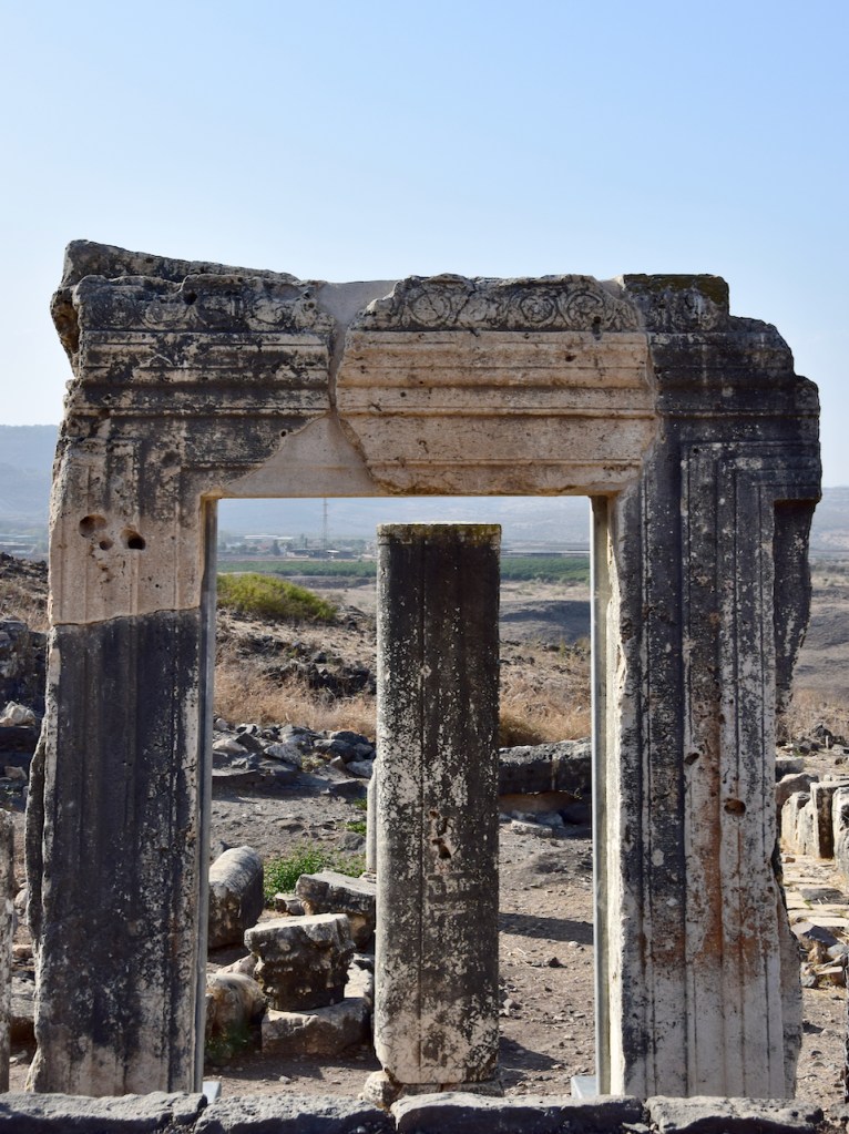
One of the most interesting finds is the remains of a typical “Galilean” style synagogue inside the city walls, with rows of columns, tiers of side benches, heart-shaped corner pillars and an alcove for Torah scrolls in the northwest corner. A mikveh (ritual bath) was found nearby. Interesting to compare this to the synagogue found at Masada. The synagogue is thought to date from the late 1st century BCE making it one of the oldest synagogues in the world.

Also found were six coins minted at Gamla during the Revolt, with the inscription “For the redemption of Holy Jerusalem” in a mixture of paleo-Hebrew and Aramaic that shows that the defenders of Gamla saw their fight against the Romans as no less than a struggle for national independence.

The Golan Archaeological Museum in nearby Katzrin displays artifacts from Gamla and other sites on the Golan and a moving film about Gamla – definitely worth a visit.

Springs in Jerusalem Hills

Around Jerusalem there are some special hikes that let you combine nature, history and archaeology. Two that I’ve already written about are Nahal Katlav and Shaar HaGai. Before heading out pick up some artisan bread, cheese, wine, hummus (you can find zatar growing wild) and salads for a picnic, drive into the hills, hike the trail and enjoy. In Psalms it says

הַמְשַׁלֵּחַ מַעְיָנִים בַּנְּחָלִים בֵּין הָרִים יְהַלֵּכוּן God sends the springs into the valleys, between the mountains. (Psalms 104:10)

A hike to a maayan, a natural spring where water finds its way out of the limestone hillside, is a great outing for the whole family. At some point someone cut into the bedrock to make a pool, perfect for a dip on a hot summer day. There is even a trail, Shvil HaMayaanot, from just before Even Sapir that goes by a number of springs and pools. Drive out to the Jerusalem Biblical Zoo near Malcha (itself a fun destination for the whole family) and park the car at the farthest parking lot, a road with a blue trail marker continues west to 2 springs (it’s also possible to drive it but then it won’t be a hike).  To your right the hill above the trail is called Rekhes Lavan (White Ridge) because of the kirton (chalk, a soft kind of limestone) and the valley below to the left with the train tracks is Nahal Refaim (Valley of Ghosts). After following the winding road you will come to a small parking area, a green Parks sign and steps on your right. Climb the stairs to Ein Lavan that fills 2 pools, a shallow one for smaller children or for cooling your feet and a deeper one, about 1.5 meters, great for swimming. After your picnic follow the spring back towards it source to find a burial cave from the Second Temple period. The second spring, Ein Itamar (also known as Ein Balad), is farther and more challenging to find. Our youngest son, AdirChai, who is the family expert on maayanot told me about it.
 

From Ein Lavan descend the steps and continue along the road. At the fork stay right, you will see that the blue trail joins the black. The road becomes paved again, there is a gravel path that forks to the left (don’t take it, follow the black trail). When the road turns right and is climbing there’s a dirt path to the left that leads down (marked with a blue trail marker), follow it until it turns sharply to the left. Look for the ruins of a stone building, the pool is below it. If you need a guide contact me.

Mount Arbel

Rising majestically above the western shore of the Sea of Galilee (in Hebrew, Kinneret) are two sheer limestone and dolomite cliffs, facing each other. The Arbel stream flows in the valley between them past Migdal (the home town of Mary Magdalene). Part of a national park and nature reserve, it’s a great place to hike.

The higher mountain is Mount Arbel, 181 meters above sea level but since the Kinneret is the lowest freshwater lake in the world at 209 meters below sea level Arbel is actually 390 meters above the valley and lake below. The second mountain, north of the stream, is Mount Nitay (98 meters above sea level) but this part of the reserve is closed to visitors to protect the flora and fauna. Looking down over the cliff it is easy to forget that you are standing on a broad plateau and not flying over the valley.

As early as the Hasmonean period there was a town Arbel that overlooked the ancient road from Galilee to the town on the Kinneret. The sage Nittai of Arbela, one of the Tanaim is recorded in Mishna Avot 1,7 where he advises “Keep far from an evil neighbor and do not associate with the wicked and do not lose belief in retribution”. Josephus mentions Arbel when he describes the battle in 37BCE between Herod and Jewish rebels who barricaded themselves in the caves in the cliff. Because the access to the caves was by extremely narrow paths, Herod had soldiers lowered over the cliff in baskets to reach the caves. In the early first century CE, Jesus of Nazareth performed miracles at the foot of the Arbel, moving between Migdal and Capernaum with his followers.

Outside the park, closer to Moshav Arbel are the remains of an ancient synagogue from the 4th century . It was first discovered in 1852 by the explorer and scholar Edward Robinson (who also recognized Herodium, Ein Gedi and Masada and after whom the arch at the the southern end of the Western Wall is named). Situated in the center of the village, it was built from large limestone blocks, in contrast to the other buildings which were of black basalt common to the region.

Drawing of Arbel synagogue by Leen Ritmeyer

The synagogue’s facade faced east which was rare for Galilean synagogues. The entranceway was cut out of a single large stone – three quarters of the frame remain in situ and was reconstructed in 1990.  The synagogue consisted of a main hall with three rows of columns topped by Corinthian capitals in the shape of a “U” that supported a second-story gallery. The hall was lined with stone benches and the floor was about 1.5 m lower than the threshold alluding to Psalm 130 “Out of the depths have I called you O Lord”.

The building seems to have been destroyed and rebuilt in the 6th century. At this time the orientation was changed – a doorway in the northern wall, a round niche in the southern wall facing Jerusalem for the Torah scroll and a platform for Torah reading were added. This synagogue was apparently destroyed by a fire in 749CE, conceivably resulting from the devastating earthquake that destroyed Bet Shean, Zippori, Sussita and other sites.

Related articles

Transfiguration on Mount Tabor

Mount Tabor’s distinctly rounded shape rises 575 meters above the eastern end of the Jezreel Plain and 11 km west of the Sea of Galilee making it easily recognizable. It is a sacred mountain that goes back at least to the second millennium BCE when there was a shrine for the worship of the Canaanite god Baal on the summit. In the 14th century Deborah chose Barak of the tribe of Napthali who gathered 10,000 men and descending from the mountain attacked and vanquished Sisera and his army (Judges 4:5). There was a military fort on top of the mountain during the Hasmonean period and the time of the Jewish Revolt, and likely in Jesus’ day as well. Tabor (along with Sartaba another distinctly shaped mountain rising above the Jordan valley) was one of the mountains where bonfires were lit to relay the beginning of the New Month from the Temple in Jerusalem to the Diaspora.

Early Church fathers considered Tabor to be the mountain on which Jesus was transfigured before his disciples, Peter, James, son of Zebedee and John the Apostle and was seen to converse with Moses and Elijah (recorded in the Gospels, Matthew 17:1-9, Mark 9:2-8, Luke 9:28-36). Other possible candidates are mountains nearer to Caesarea-Philippi, Mount Panium (Banias) and Mount Hermon. In Christian teaching, the Transfiguration is a pivotal moment, and the setting on the mountain is presented as the point where human nature meets God: the meeting place for the temporal and the eternal, with Jesus himself as the connecting point, acting as the bridge between Heaven and Earth.

The Anonymous Pilgrim of Piacenza wrote that he saw three basilicas on Mount Tabor in 570. The current church was built in 1924 by Barluzzi on the ruins of a Byzantine church from the fifth or sixth century and a Crusader church from the 12th century, which was built in honor of Tancred, Prince of Galilee, instrumental in capturing Jerusalem for the Crusaders in 1099. The Franciscan friars live next to the church in a monastery established in 1873. There is also a modest East Orthodox church built in 1862.

When archaeological excavations uncovered an ancient crypt with a stairway down to it and the remains of walls of the apse from earlier periods Barluzzi respectfully incorporated these into the new church. Barluzzi chose the west front of the church in Roman-Syrian style (decadent classical with a slightly eastern decoration) of the fourth to seventh centuries with an open arch headed narthex set flush between two towers leading to large bronze doors, designed by Tonnini, each weighing one and a half tons. The two towers allowed Barluzzi to include the remains of the Byzantine-Crusader chapels in the body of the church. In the southern tower are the bells, cast by Bassano del Grappa.

Inside the church has a split level plan with open views down to the barrel vaulted lower level, and upwards to the domed apse. The nave roof is higher on heavy timber trusses with clerestorey windows. The roof tiles and the windows are made of alabaster to let in light. The ornamentation of the central nave is simple, with two friezes, one of stone engraving that follows the line of the arches and the other in a straight line of mosaic under the windows.

Madden described the interior as “a striking vision, a wonderful transfiguration of stone, marble and mosaic [by Umberto Noni]. The central nave gives us a full view of the eastern apse. It has two levels, the upper level commemorating the divine nature of Christ and the lower recalling different manifestations of his humanity.”

The aisles are narrower than the nave and like it end in elevated apses. In the south apse the altar is consecrated to St Francis. The two bronze statues with the sanctuary lamps and the candlesticks are also the work of Tonnini.

The tower chapels have eastern apses and therefore are entered through doors in their apses. In the southern chapel the apse is decorated with a painting of the prophet Elijah in his confrontaition with the false prophets of Ba’al on the Carmel. On the floor is the original Byzantine mosaic floor with white, black and red tesserae, which was restored once in the Crusader period and which has been taken up and recomposed partially in a new location. The crosses portrayed in the mosaic floor indicate that it must have been laid before 422, when the Emperor Theodosius II prohibited the use of crosses in pavement mosaics out of respect.

The northern chapel, dedicated to Moses, has a modern mosaic floor. In the apse is a painting: Moses holds the Tablets of the Law in his left hand; behind him there is Sinai and on the sides a large burning bush and a rock with water flowing from it (Exodus 17:6).

To conclude with Madden’s words, “Within the building itself we are immediately struck by the skill of an architect who could seize on the essentials of a site a situation and a mystery, express its meaning in stone, mosaic and bronze, and illumine it all through alabaster with the light of the sun itself. It is small wonder that many people think the basilica to be the finest in the Holy Land.”

Wind Turbines on Golan Trail

Whenever I spend some time on the Golan I am struck by its quiet expansiveness (compared to other parts of Israel). This time over the Passover holiday it was especially beautiful, everything was so green and the fields were covered with early wheat and wildflowers, poppy, lupine, asphodel, daisy, mustard, clover and some I had never seen.


The Golan trail is a 130km trail that snakes along from Mount Hermon in the north at an altitude of 1500 meters above sea level to the Taufik spring above Hamat Gader. I went up to hike 3 days of the Golan Trail from Har Bental to Alonei HaBashan and from there to Faraj intersection. On the first day we could see the snow-capped Hermon to the north and the Sea of Galilee below us to the south.

Unfortunately the third day to Nahal Daliyot and Rujm el-Hiri was cancelled due to inclement weather. These couple of days hiking were the closing parenthesis of the 8 days I hiked from Eilat in March.

The Golan Trail goes by and then climbs a hill, the Bashan ridge on which 10 wind turbines, 30 meters high were installed in 1992. When I went by only 5 were working, producing about 3 megawatts of electricity that is used by the Mey Eden and Golan Heights winery and some 20,000 residents of the Golan in 32 settlements.

Plans have been in place for 150 new, larger wind turbines to be installed over an area of 140 square kilometers of the northern Golan that would cost about $500 million and produce 400 megawatts of electricity, enough to power the entire eastern Galilee. A company has been established to build a wind farm in the northern Golan, in the valley known as the Vale of Tears with investments in place amounting to some $120 million. The Golan has some of the strongest levels of wind energy in the entire region but there are problems. One is that such a large number of tall (80 meters high) wind turbines could be hazardous to the migratory birds that pass over the Golan in the thousands. Also, photovoltaic panels have become more efficient and less expensive. Individuals and companies can install the panels and the electric company buys the electricity generated at 4 times the current rate. So far, some 150 photovoltaic systems have been installed generating 7 megawatts of electricity with another 200 installations approved.

Golan landscape

Last Supper Passover

Every year the Passover seder concludes with a rousing “Next Year in Jerusalem”. As we clean and make our preparations this year I am struck at how fortunate I am to be living in Jerusalem and celebrating Passover here.

Just this week I went for a walk with a friend to the Old City. Our steps led us to Mount Zion and we visited the Coenaculum, the Upper Room where according to Christian tradition Jesus celebrated the Passover, the Last Supper.

… Where is my guest room, where I may eat the Passover with my disciples? He will take you upstairs to a large room that is already set up. That is where you should prepare our meal. The disciples left, went into the city and found things just as Jesus had told them. So they prepared the Passover.          Mark 14: 14-16

There are various suggestions about the date of the present chapel. It may have been built by the Franciscans in 1335 on the remains of an earlier Crusader church or by Crusaders just before Saladin’s conquest of Jerusalem in 1187 or later by Holy Roman Emperor Frederick II, after he arrived in the city in 1229. From repair work on the flooring it seems that the original building was a domus ecclesia that existed at the time of the Second Temple and perhaps used by early Jewish-Christians. Note that the building was converted to a mosque in 1523 by the Ottoman Turks with the addition of a michrab.


To bake matzah, the unleavened bread for the Passover seder, you need flour which we will freshly grind from organic wheat berries. We need spring water to mix with the flour and bake the dough (in less than 18 minutes). So today we went to Ein El Henya, a spring in the valley of Nahal Refaim, just south of Jerusalem.

The spring is typical of those found in the Jerusalem area, consisting of a dugout chamber where the water flows from the contact between the water porous limestone and a layer of marl which as it contains clay is more impervious to water. A 39 meter underground tunnel channels the water to the ruins of a building, the apse of a 6th C Byzantine church, where it cascades down into a small pool in front of the apse framed by two pilasters. The apse gave the spring its Arabic name because henya is a round niche carved out of stone. From there it follows a channel to fill a large (11 x 7 meter, 2 meters deep) rectangular pool (though I noticed that now the pool is almost empty).

The church is named after Philip the Evangelist according to the story in Acts 8:26-40

Then an angel of the Lord said to Philip, “Get up and go towards the south to the road that goes down from Jerusalem to Gaza.”

There he met a court official of the Queen of Ethiopia in charge of her entire treasury who was sitting in his chariot reading from the prophet Isaiah. He had come to Jerusalem to worship at the Temple and was returning home. The official/eunuch asked Philip to explain what was written and was so impressed that when they came to the spring he requested that Philip baptize him there.