Rising majestically above the western shore of the Sea of Galilee (in Hebrew, Kinneret) are two sheer limestone and dolomite cliffs, facing each other. The Arbel stream flows in the valley between them past Migdal (the home town of Mary Magdalene). Part of a national park and nature reserve, it’s a great place to hike.

The higher mountain is Mount Arbel, 181 meters above sea level but since the Kinneret is the lowest freshwater lake in the world at 209 meters below sea level Arbel is actually 390 meters above the valley and lake below. The second mountain, north of the stream, is Mount Nitay (98 meters above sea level) but this part of the reserve is closed to visitors to protect the flora and fauna. Looking down over the cliff it is easy to forget that you are standing on a broad plateau and not flying over the valley.

As early as the Hasmonean period there was a town Arbel that overlooked the ancient road from Galilee to the town on the Kinneret. The sage Nittai of Arbela, one of the Tanaim is recorded in Mishna Avot 1,7 where he advises “Keep far from an evil neighbor and do not associate with the wicked and do not lose belief in retribution”. Josephus mentions Arbel when he describes the battle in 37BCE between Herod and Jewish rebels who barricaded themselves in the caves in the cliff. Because the access to the caves was by extremely narrow paths, Herod had soldiers lowered over the cliff in baskets to reach the caves. In the early first century CE, Jesus of Nazareth performed miracles at the foot of the Arbel, moving between Migdal and Capernaum with his followers.
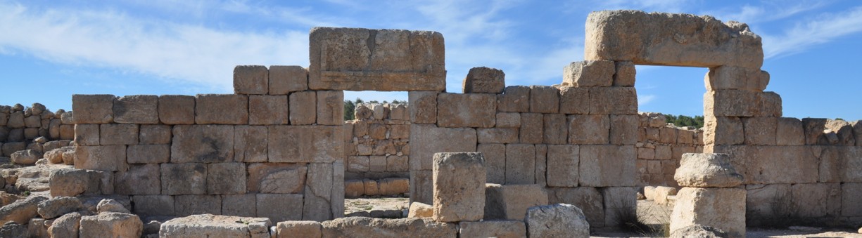
Outside the park, closer to Moshav Arbel are the remains of an ancient synagogue from the 4th century . It was first discovered in 1852 by the explorer and scholar Edward Robinson (who also recognized Herodium, Ein Gedi and Masada and after whom the arch at the the southern end of the Western Wall is named). Situated in the center of the village, it was built from large limestone blocks, in contrast to the other buildings which were of black basalt common to the region.

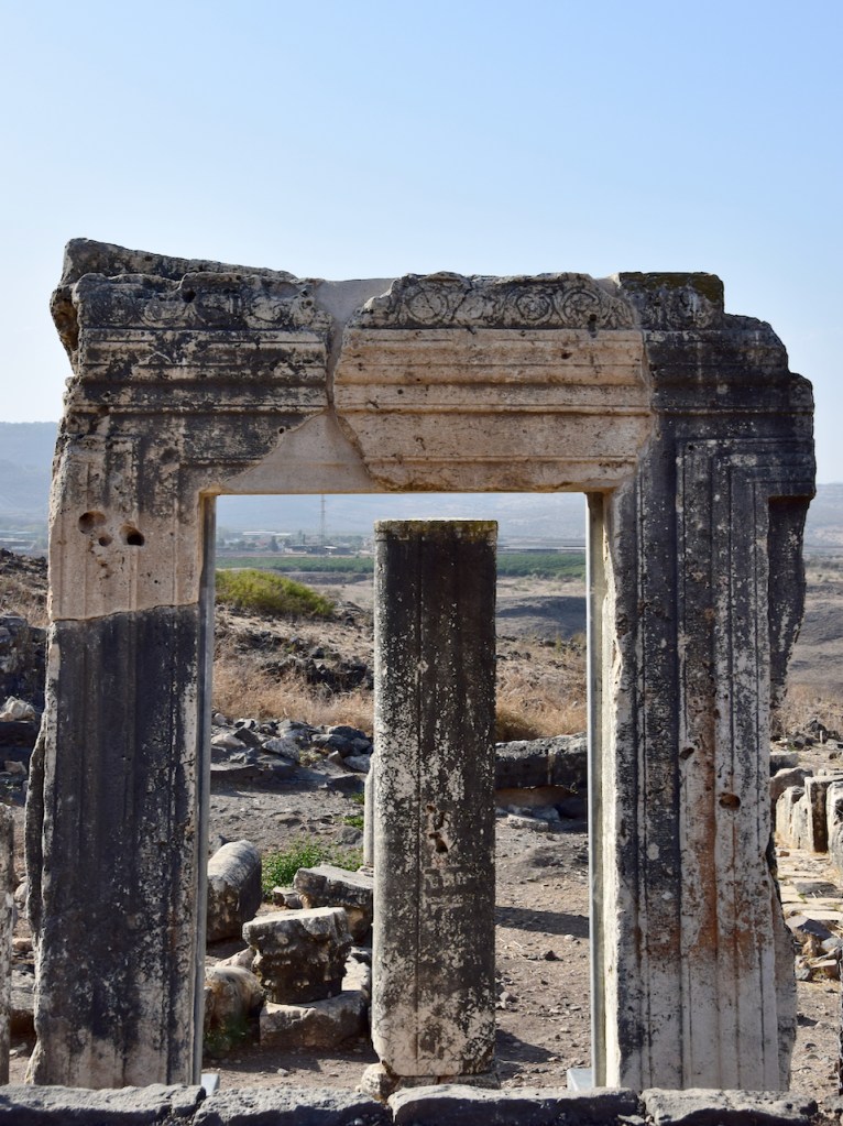

The synagogue’s facade faced east which was rare for Galilean synagogues. The entranceway was cut out of a single large stone – three quarters of the frame remain in situ and was reconstructed in 1990. The synagogue consisted of a main hall with three rows of columns topped by Corinthian capitals in the shape of a “U” that supported a second-story gallery. The hall was lined with stone benches and the floor was about 1.5 m lower than the threshold alluding to Psalm 130 “Out of the depths have I called you O Lord”.
The building seems to have been destroyed and rebuilt in the 6th century. At this time the orientation was changed – a doorway in the northern wall, a round niche in the southern wall facing Jerusalem for the Torah scroll and a platform for Torah reading were added. This synagogue was apparently destroyed by a fire in 749CE, conceivably resulting from the devastating earthquake that destroyed Bet Shean, Zippori, Sussita and other sites.

Pingback: Site Map | Israel Tours | Israel Tour Guide
Pingback: Photo of the Week – Sea of Galilee (Kinneret) | Israel Tours | Israel Tour Guide