Category Archives: Architecture

Archaeology in Israel Tour

I’m delighted to announce that Dan McLerran at Popular Archaeology and I are creating a phenomenal tour of archaeological sites in Israel that I will be guiding October 2013.
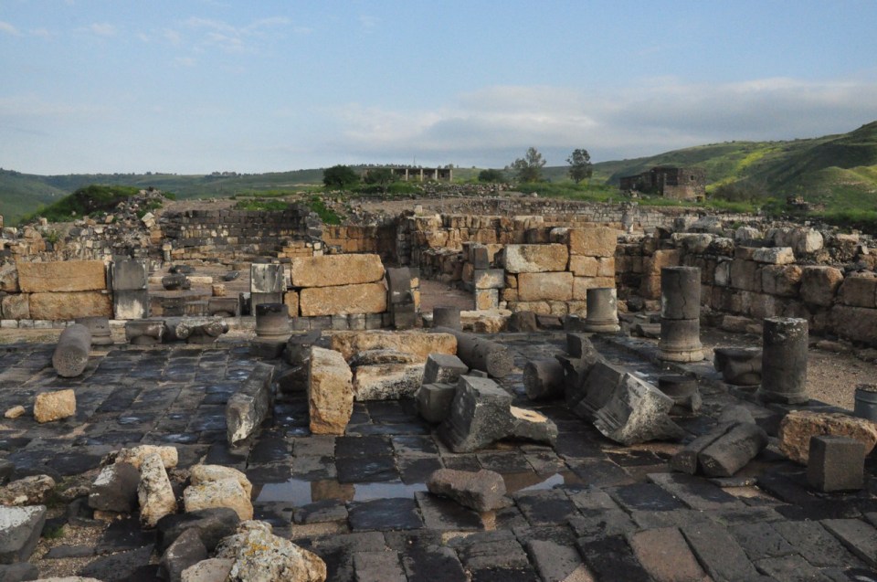
I invite you to join us on this adventure, 12 days of touring in Israel, where we’ll cover the famous sites like Megiddo and Hazor and uncover some of the less well-known gems like Sussita-Hippos, one of the Decapolis cities overlooking the Sea of Galilee that was destroyed in the earthquake of 749CE and never rebuilt.

Sussita excavation

We’ll start by going back 6500 years to the Chalcolithic period and tour up on the Golan Heights to learn about burial at that time. We’ll see dolmens, the megalithic tombs consisting of a flat rock resting on two vertical rocks that mark a grave. We’ll hike to the cultic site of Rujm el Hiri – is it a site that is connected to the calendar or to burial? At Ein Gedi we’ll see the ruins of a Chalcolithic temple. We’ll see artifacts at the Israel museum, examples of clay ossuaries and fine bronze castings of ritual objects.

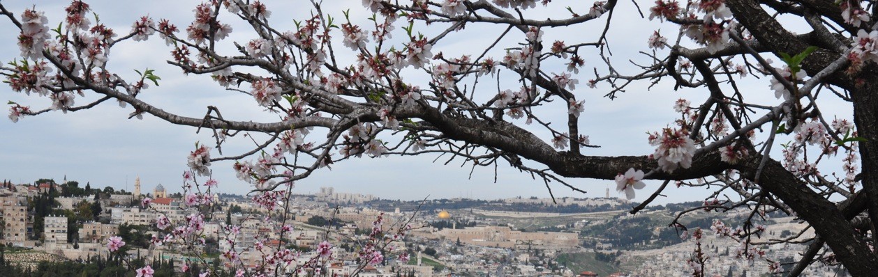
We’ll follow in the path of the Kings from 1000BCE to 586BCE by traveling from Dan where a piece of a basalt victory stella in Aramaic was found mentioning the kings of Israel and the house of David. We will explore the City of David, the walled Jebusite city on the ridge between the Kidron and Tyropean valleys. We’ll walk through Hezekiah’s tunnel that brought the water of the Gihon spring to the Siloam pool inside the walls. From there we will follow in the steps of pilgrims to the Temple mount. Part of the 650m distance will be in Jerusalem’s drainage channel until we come out right under Robinson’s Arch. We’ll see the Broad wall, the remains of an 8 meter high wall that protected Jerusalem from the north in the time of the Kings.

Khirbet Qeiyafa

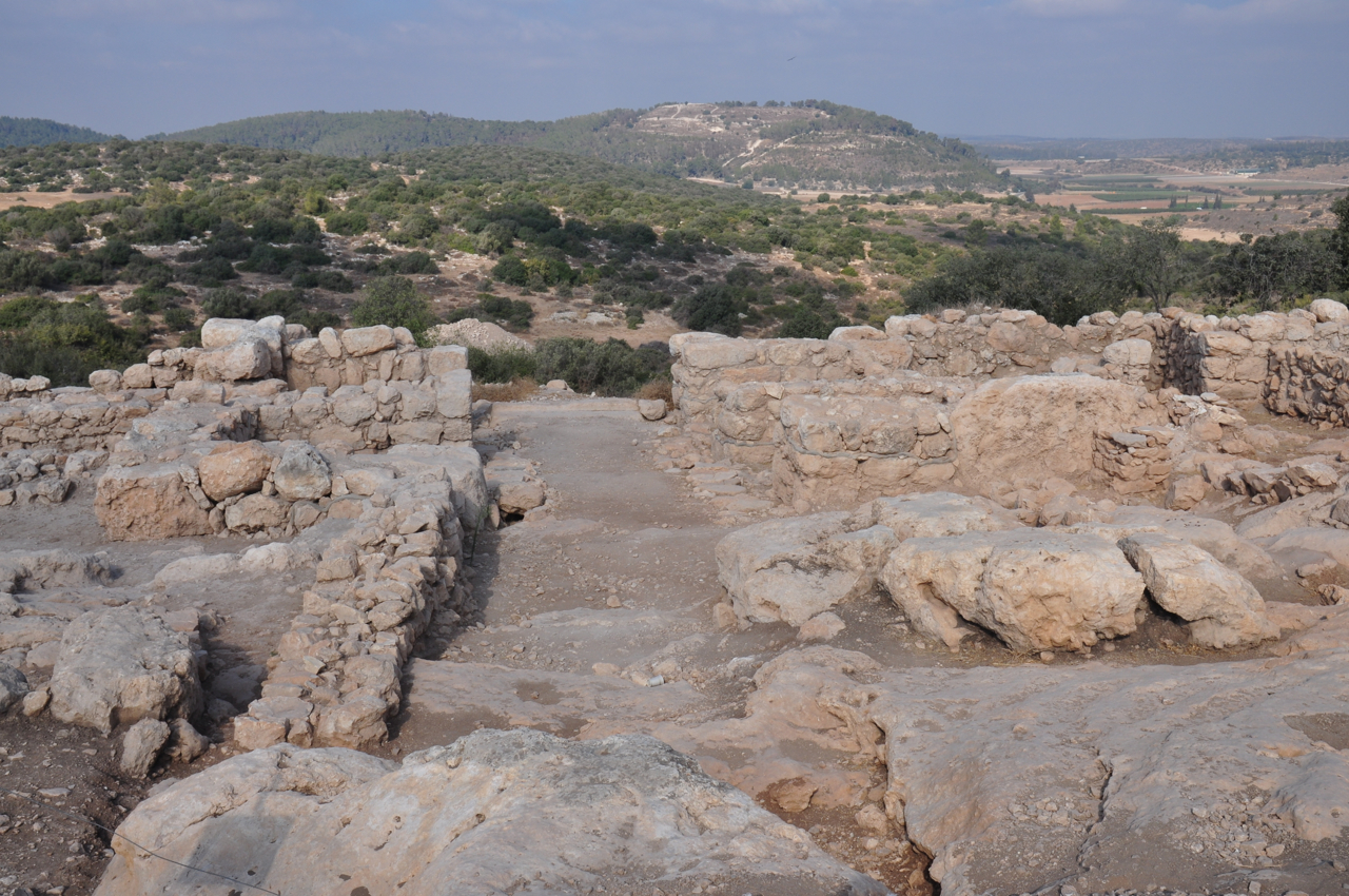
We’ll explore the walled Judean city of Khirbet Qeiyafa, with two gates and hence identified as Shaarayim, situated on the border of Judea facing the Phillistines.

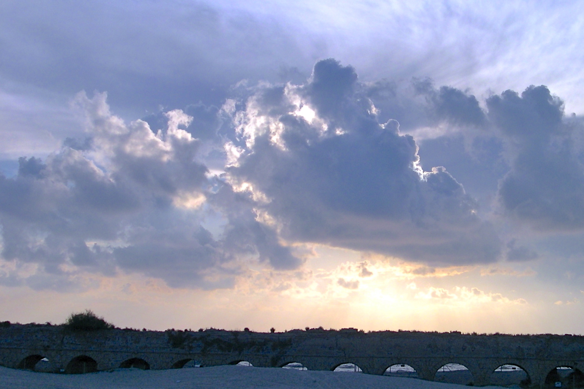
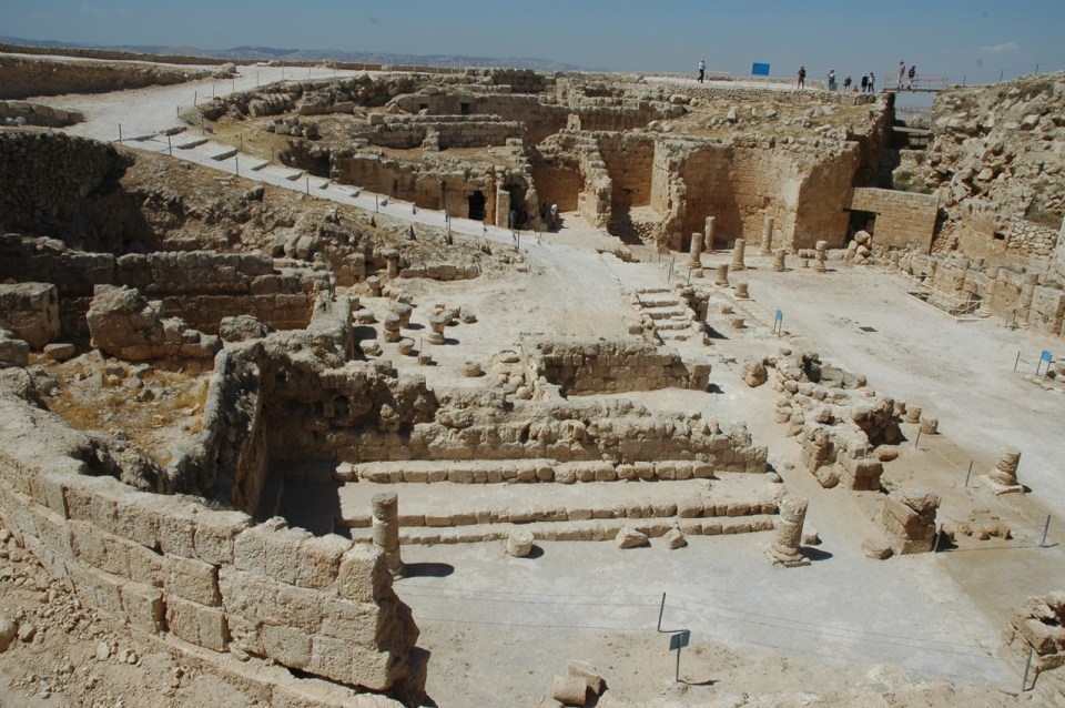
We’ll learn about the Second Temple Period, specifically the time of the Hasmoneans and King Herod who ruled under the auspices of the Romans. We’ll check out Herod’s impressive building projects. At Caesarea, we have the temple to Augustus, the protected harbor, the palace as well as a theater and a hippodrome later used as an amphitheater. At Sebaste there is another temple to Augustus. Josephus writes that Herod built a third temple at Banias. It’s unclear whether the temple was at Banias or nearby, perhaps at Omrit. We’ll visit Herod’s palaces at Masada, the Western palace and the 3 tier hanging palace on the northern end of the site. We’ll explore the palace and administrative complex at Lower Herodium and the palace/fortress on the top of a manmade mountain where the base of a mausoleum was discovered by Prof. Ehud Netzer in 2007.

Herodium Palace:fortress

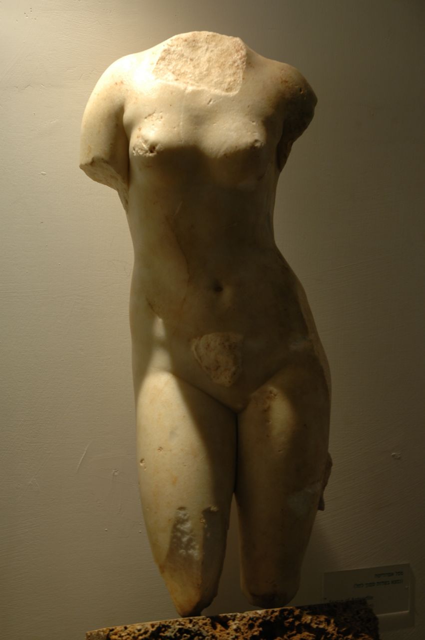
We’ll visit the newly opened exhibit at the Israel museum Herod the Great: The King’s Final Journey, artifacts from Herodium on display for the first time. We’ll also visit the Second Temple period model that displays Jerusalem at its peak just before its destruction at the hand of the Romans. We’ll visit the Shrine of the Book that houses the Dead Sea scrolls and other artifacts and combine that with the archaeological site of Qumran by the Dead Sea where the scrolls were found.

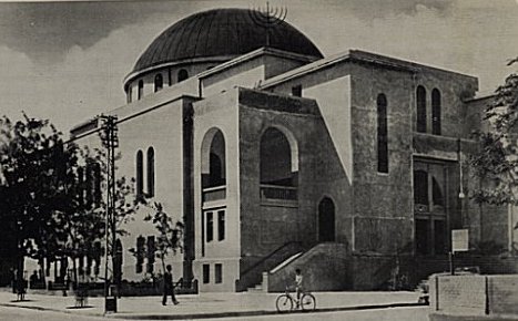
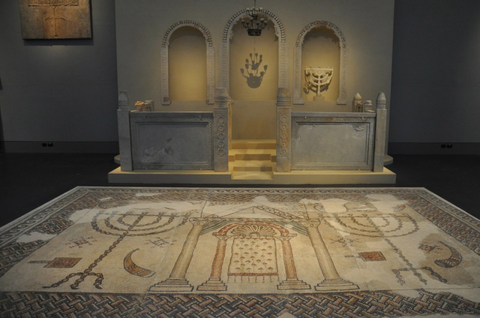
We’ll focus on the architecture of sacred space and check out various churches, in the basilica and martyrium form from the Byzantine period (4th to 7th century) and synagogues from the same period. We’ll see some amazing mosaics by visiting the  museum at the Inn of Good Samaritan, the archaeological sites of Sepphoris/Tzippori, and the synagogue at Beit Alfa. We’ll visit sites off the beaten path like the Kathisma church on the way to Bethlehem and Samaritan site on Mount Gerizim.

Synagogue mosaic floor at Israel Museum

Besides the Western wall, Judaism’s holy site, we will visit the Church of the Holy Sepulcher, the holiest site to Christianity and go up onto the Haram el-Sharif to see the Dome of the Rock and the Al Aqsa mosque, the third holiest site to Islam.

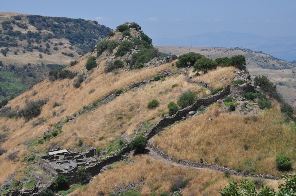
We’ll travel around the Sea of Galilee stopping at sites important to Christianity like Kursi, Capernaum and Magdala. We’ll even go up to the Golan Heights to the Jewish city of Gamla, the Masada of the north.

Gamla

For anyone who enjoys taking photographs, there will be plenty of opportunities and as an special incentive to join the tour, participants will be able to submit their best photographs from the tour to a special Pinterest site and will have a chance to win up to $1000. for the “best photo”.

If you’re interested in participating in an archaeological tour of the Holy Land, contact  me.

Photo of the Week – Aqueduct to Caesarea

When visiting the archaeological site at Caesarea don’t miss the lovely beach just north of the site with the aqueduct. The aqueduct was built by King Herod to bring water from the Shuni spring, south of Mount Carmel, about 10km to the northeast to the city. In the second century, to provide additional water, a second aqueduct was built alongside the first by the 10th legion under the Emperor Hadrian that brought water from Tanninim (Crocodiles) river. The aqueduct continued to supply water to Caesarea for 1200 years.

Aquaduct to CaesareaYou can click on the image for a larger view (which may take some time to load depending on your Internet connection). Please share this post with your friends by clicking on the icons at the end of this message.

The technical details – the photo was taken with a Nikon point and shoot camera in May (ISO 100, 11mm, F8.8 at 1/218 sec).

For more information about the archaeological site of Caesarea see my post at https://israeltours.wordpress.com/2011/01/03/caesarea-maritima-herods-promontory-palace/

Photographs on this website are © Shmuel Browns (unless marked otherwise) – if you are interested in purchasing one of my photos or using one of my photos for your own project please contact me.

Where is Magidovitch Street?

Yehuda Leib Magidovitch was born in Uman, Ukraine in 1861, studied at the Odessa Academy and immigrated to Tel Aviv in 1919. From 1920-23 he worked as the chief engineer of the city of Tel Aviv. He then started his own company and for the next 20 years, as architect and contractor was instrumental in developing the city of Tel Aviv. A sampling of his buildings stands on Rothschild Blvd., along Allenby, Herzl and Lilienblum. I’ve shared a live Google map showing the locations at Magidovitch Tel Aviv.

Magidovitch TA

One of his buildings, the most opulent in early 1920s Tel Aviv was known as ‘The Casino.’ Not a gambling house, the Casino Galei-Aviv cafe-restaurant on the beach close to the port was constructed to boost the fledgling nightlife of the new city. It lasted about a dozen years and was destroyed by order of the municipality in 1939.

The Casino Galei-Aviv at Tel-Aviv photographed in 1932

Magidovitch built Levin House, at 46 Rothschild Blvd. in 1924 by as an urban mansion, in the style of 19th century Italian summer houses with neo-classical details. Terraces of greenery set the house apart from the street. Conservation of the building was done as part of a 22-story office high-rise. In order to build a 7-floor underground parking garage under the house it had to be disconnected from its original foundations and a new one incorporating the garage had to be built, an unprecedented engineering feat.

Levin House

Magidovitch built a house on Nahalat Binyamin St. for the Bachar brothers. Today, in keeping with Tel Aviv planning policy, you can see a new 30 floor office tower going up at 22 Rothschild Blvd., that will connect to Bachar House via a glass atrium.

Aviv project-Bachar House

From Google Streetview

At 16 Herzl St. is Fsag Fnsk, the first commercial shopping center under one roof, built by Magidovitch in 1925 with an elevator and his trademark metal dome.

From Google Streetview

From Google Streetview

At the corner of Yavne and Montefiore, what was the Ismailov hotel built in 1925, similar to the Ben Nahum hotel in design, is being renovated to become another boutique hotel.

Ismailov hotel  Ben Nahum hotel

The Nordau hotel is a classic Magidovitch with a silver domed tower.

Nordau hotel

Magidovitch’s House of Pillars was undergoing renovations but that seems to have stopped.

House of Pillars

TA Kiosk 3Magidovitch designed the Kol Yehuda synagogue at 5 Lilienblum St. for the Jewish community from Aden in 1934. “The façade of this unassuming building does not give away its inner monumental grandeur. The building is indicative of Magidovich`s virtuosic architectural abilities, having created within it an elegant and rhythmic space by means of a network of exposed construction beams.”

Next to the synagogue is a classic Magidovitch building with his signature corner tower covered with a sheet metal roof. Beside it, on the corner of Lilienblum and Rishonim streets, is the third Tel Aviv kiosk.

From Google Streetview

From Google Streetview

Magidovitch also built the Great Synagogue at 118 Allenby St. In the 1970s the outside of the building was renovated with the addition of arches but this is what it used to look like.

Tel_Aviv_Great_Synagogue

Although most of Magidovitch’s building were in the eclectic style, in the 30s, he also built in the popular Bauhaus style. Two examples are the Esther Cinema, now the Cinema hotel on 1 Zamenoff and a residential building at 90 Rothschild Blvd.

90 Rothschild

From Google Streetview

In all, Magidovitch built some 500 buildings in Tel Aviv over a period of 40 years. There is no street named after him, his many buildings are his monument.

Tel Aviv Historical Walking Tour

Between 1887 and 1896 Jewish immigrants from Europe from the First Aliya settled north of Jaffa building the Neve Tzedek neighborhood which was the beginning of modern-day Tel Aviv. In 1906, on the initiative of Akiva Arye Weiss a group of Jews from the Second Aliya and residents of Jaffa got together to plan another neighborhood. To circumvent the Turkish prohibition on Jewish land acquisition, Jacobus Kann, a Dutch citizen and banker, helped to finance the purchase and registered it in his name. Kann perished during World War II in the Nazi concentration camp of Theresienstadt. In the spring of 1909 sixty-six Jewish families took possession of building parcels by lottery and erected the first buildings among the sand dunes, vineyards, and orchards in Kerem Djebali along the coast north of Jaffa. There they established a “garden suburb” called Ahuzat Bayit (“Homestead”) which was shortly thereafter renamed Tel Aviv.

Building parcel lottery 1909 photo by Soskin

Avraham Soskin, on his most famous iconic photograph:

“One day, it was in 1909, I was roaming with the camera in one hand and the tripod on my other arm, on my way from a walk through the sand dunes of what is today Tel Aviv to Jaffa. Where the Herzliah Gymnasium once stood I saw a group of people who had assembled for a housing plot lottery. Although I was the only photographer in the area, the organizers hadn’t seen fit to invite me, and it was only by chance that this historic event was immortalized for the next generations.”

The name Tel Aviv is from Sokolow’s translation of the title of Theodor Herzl’s Altneuland (“Old New Land”) based on the name of a Mesopotamian site mentioned in Ezekiel 3:15: “Then I came to them of the captivity at Tel Abib, that lived by the river Chebar”. It embraced the idea of a renaissance in the ancient Jewish homeland. Aviv is Hebrew for “spring”, symbolizing renewal, and Tel is a mound made up of the accumulation of layers of civilization built one over the other symbolizing the ancient.

First kiosk & water tower 1910 photo by Soskin

First kiosk renovated, corner of Herzl

Walking along one of the first streets of Tel Aviv, leafy Rothschild Boulevard (did you know that the street was originally named Ha’am Street?), is like visiting a historical museum that lines both sides of the street. We start our tour at the corner of Rothschild and Herzl Street [another idea for a tour: the stories behind street names, the people and events important in the history of Israel] where you can savor the espresso at Tel Aviv’s first ‘kiosk’ (the second kiosk is also on Rothschild at the corner of Nahalat Binyamin; can you find the third kiosk?). The Eliavsons, one of the 66 founding families built their house on the southwest corner of Rothschild and Herzl in 1909; in the 1930s a 4-story Bauhaus building was built there which a few years ago became the home of the Institut Français.

From Google Streetview

Weiss built his house at 2 Herzl Street and at the end of the street stood the Gymnasium Herzliya until is was demolished in 1962 to make way for the Shalom Meir Tower. It seems ironic that this landmark lives on as the logo of the Society for Preservation of Israel Heritage Sites. Weiss  continued with many other private initiatives — he built the first cinema (Eden) and the first post office in Tel Aviv and founded the Diamond Club which became the Israel Diamond Exchange.

From Google Streetview

Meir and Zina Dizengoff were assigned plot 43, the precise location where the group was standing in Soskin’s photo, today 16 Rothschild Blvd. Dizengoff was the first mayor of Tel Aviv and did much to develop the city. The residence is best known as the site of the signing of Israel’s Declaration of Independence on May 14th, 1948; now it’s a museum with exhibits on the history of Tel Aviv-Jaffa. You can listen to the historic recording of Ben-Gurion declaring the State of Israel at http://www.youtube.com/watch?v=6ZDSBF5xtoo&feature=related.

Google Streetview

In 1919 Yehuda Magidovich arrived in Israel and soon became the city’s chief engineer, his office was in the first city hall in the old water tower on Rothschild Boulevard. Afterwards he became one of Israel’s most prolific architects building 500 buildings in Tel Aviv, a number of them along Rothschild Blvd. The first public building designed by Magidovich in 1921 was the first luxury hotel in Tel Aviv (called at various times the Ben Nahum Hotel and the Ginosar Pension). Today you can see the newly renovated building (on the corner of Allenby Street) with its Magidovich signature tower. Historic buildings often owe their existence to adjacent office towers, part of Tel Aviv’s preservation and development policy — the city agrees to increase the height of the building if the developer agrees to renovate and preserve a historic building in the complex.

Related articles

Temple at Omrit—Herod or Philip

Visitors to Caesarea may have noticed the podium where Herod built a Roman temple to Augustus. We know about it from the writings of the Jewish Roman historian Josephus:

“Directly opposite the harbor entrance, upon a high platform, stood the temple of Caesar, remarkable for its beauty and its great size.”

In the 6th century a martyrium was built in its place and in time the site was occupied by a mosque, a widespread practice when one group supplants another. In Sebaste, the Greek equivalent to Augusta, Herod built a Roman temple to the emperor in fact, part of a marble statue of the emperor was uncovered in excavations of the site. We know about the temple from Josephus:

“… in the center of the new town [Herod] erected a vast shrine with precincts dedicated to Caesar 300 yards in length. The town he called Sebaste…”

Josephus continues and reports on a third temple built to Augustus but this time he is less clear exactly where it is located:

“When, later on, through Caesar’s bounty he received additional territory, Herod there too dedicated to him a temple of white marble near the sources of the Jordan, at a place called Paneion. At this spot a mountain rears its summit to an immense height aloft; at the base of the cliff is an opening into an overgrown cavern” (The Jewish War)

“When he [Herod] returned home after escorting Caesar to the sea, he erected to him a very beautiful temple of white stone in the territory of Zenodorus, near the place called Paneion. In the mountains here there is a beautiful cave, and below it the earth slopes steeply to a precipitous and inaccessible depth, which is filled with still water, while above it there is a very high mountain. Below the cave rise the sources of the river Jordan. It was this most celebrated place that Herod further adorned with the temple which he consecrated to Caesar” (Antiquities of the Jews)

If you follow Josephus’ account then there is little doubt that he’s writing about Banias, near the Cave of Pan. There are few remains there so it is hard to ascertain if the structure was a Roman temple. The majority opinion is that the remains of the building in front of the cave is the temple and based on archaeological evidence, an Augustan-period lamp embedded in the concrete interior of one of the building’s side walls, the building was constructed in the later first century BCE. Professor Netzer holds a minority opinion that the temple was to the left (west) of the cave on a prominent terrace because of the remains of a structure with opus reticulatum (a technique sent from Rome to Judea after the visit of Marcus Agrippa in 15BCE) walls, a Herod signature since the only other two examples are at Herod’s winter palace at Jericho and a circular wall uncovered north of Damascus gate that Netzer claims encloses Herod’s family tomb; some pottery remains could also be dated to the time of Herod. Last week I visited the archaeological site Omrit about 4 kilometers southwest of Banias. The site was first exposed by a brush fire in the summer of 1998 and excavations have been ongoing for ten years. Just as we crossed the stream to enter the fenced area of the site we came across a tangle of blackberries, ripe and delicious. I always try to add tastes when I’m guiding. In Roman times Omrit stood just south of the Scythopolis-Damascus road, a main route. Excavations uncovered a prostyle-tetrastyle temple measuring 25.22 meters by 13.16 meters with stairs leading up to four columns in front of the temple. The height is estimated to be 22 meters. The podium is a perfectly drafted, polished, mortarless structure made of ashlars—a signature of Herod’s grand building style. The temple’s plan reflects the type of Augusteum for celebrating the imperial cult that was common in the period. Similar temples were found at Pula, in Croatia, at Nimes, in the south of France and Pompei, in Italy; however, there were also variations in the model. Based on pottery and coins found the temple has been dated to the end of the 1st century BC. In a second phase, it was enlarged to a peripteral plan with 26 columns probably by one of the Agrippas or by Emperor Trajan at the end of the 1st century CE. The temple was destroyed by the earthquake of 363CE and a small chapel was built of stones in secondary usage at the beginning of the Byzantine period.

Aphrodite

Besides the architectural elements of the temple, bases, column drums, Corinthian capitals , architraves, friezes and cornices which constitue the bulk of the major finds, fragments of statuary and inscriptions were also recovered, one which may make  reference to Aphrodite.

A marble statue was found in the fields at the foot of nearby Tel Dan (on display at the Ussishkin museum) which may have stood in the temple at Omrit. The facade of the temple is similar to what is seen on coins minted by Herod Philip – the question is whether these coins depict Herod’s temple to Augustus or a later impressive temple built by his son to mark the edge of his new city of Caesarea Philippi.

Probably very few people have visited this site although it is in the middle of the country, on the edge of the Yatir Forest in the northern Negev, the largest planted forest in Israel. You can click on the image for a larger view (which may take some time to load depending on your Internet connection). Please share this post with your friends by clicking on the icons at the end of this message.

The photo was taken at Khirbet Anim – olive trees with the ruins of a 4thC synagogue in the background. The technical details – the photo was taken with a Nikon D90 DSLR camera on January 7 (ISO 200, 18mm, F10 at 1/400 sec).

For a closer view of the ruins of the synagogue see my post at https://israeltours.wordpress.com/2009/03/22/yatir-forest/

Photographs on this website are © Shmuel Browns (unless marked otherwise) – if you are interested in purchasing one of my photos or using one of my photos for your own project please contact me.