Yearly Archives: 2011

A Morning on Mount Scopus

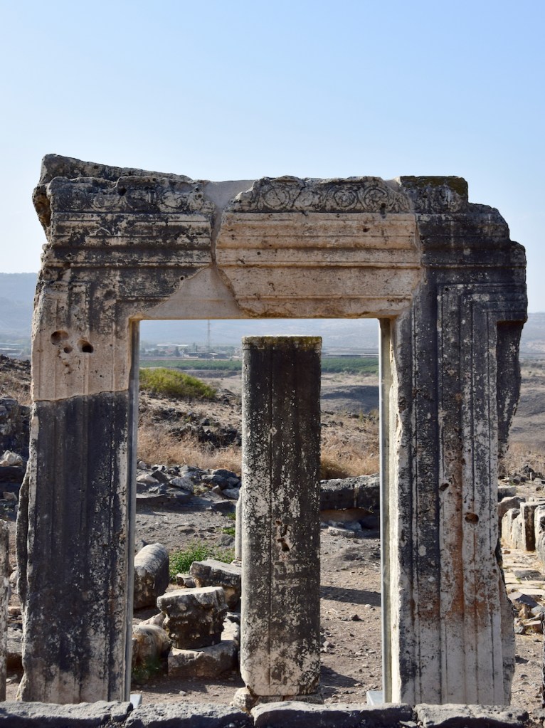
Construction of the campus of the Hebrew University began in 1918 on land purchased from the Gray Hill estate. The dedication ceremony was held in 1925 in the presence of many dignitaries, including Lord Balfour, Viscount Allenby, Sir Herbert Samuel, Chief Rabbi Abraham Isaac Hacohen Kook, the poet Haim Nahman Bialik, Ahad Ha’am, Dr. Chaim Weizmann and many others.

A design for the university campus by Sir Patrick Geddes positioned the university buildings on the slopes of Mount Scopus, below a domed, hexagonal Great Hall recalling the Star of David, as a counterpoint to the octagonal Dome of the Rock in the Old City. This plan was never implemented, but Geddes designed the university library, today the Faculty of Law building. The master plan for the campus was taken over by German Jewish architect Erich Mendelsohn in 1935. Mendelsohn greatly influenced the local Jerusalem International Style (Bauhaus).

Notice the living sculpture outside of the Sinatra building that commemorates the nine students killed by a bomb left in the university cafeteria in July 2002, a tree growing out of the ground at an angle, by Israeli sculptor, Ran Morin. The Tilted Tree signifies humankind’s ability to withstand even the most disruptive shocks and to continue to grow upwards.

Prof. Sukenik and his colleagues, including Prof. Nahman Avigad, had planned to open a museum on Mount Scopus in 1948 to display items related to the history of the Jewish people in ancient times. Among the artifacts are ceiling tiles from the ancient synagogue* discovered in 1932 in the city of Dura Europos, located in the desert above the banks of the Euphrates in Syria. Sukenik had been invited by the Yale University team to visit the site (in Syria) and join in the publication of the findings. He was given 3 ceiling tiles that he brought back to Israel. The outbreak of the War of Independence with the result that Scopus was isolated within Jordanian-occupied territory made the opening of the museum impossible.


Sixty-three years later, these painted clay tiles and other artifacts have been put on display, including some half dozen ossuaries, mosaics, clay vessels, etc. from excavations in Israel by members of the Archaeology department. The modest museum is open to the public.

Walk through the botanical gardens organized by Alexander Eig, head of the Botany Department, based on the flora of the Land of Israel planted in 1931 to some caves with Second Temple period tombs. It was here that they found some half dozen ossuaries (the ones displayed on site are replicas, the originals are in the museum) including one with a 4 line inscription in Greek and Hebrew:

[In this ossuary are] the bones of [the family of] Nicanor of Alexandria who made the doors
Nicanor  Alexa

Nicanor is mention in the Babylonian Talmud in Yoma 38a, the donor of the two bronze doors for the Temple. The original ossuary is at the British museum in London.

In 1940s, Pinsker and Ussishkin, early leaders of the Zionist movement, were buried in one of the caves.

Went back to the Jerusalem War Cemetery on Mount Scopus and found the graves of Jewish soldiers who served in the British army during WWI and fought and died here. In addition, I noticed two gravestones of Turkish soldiers.


Visited the memorial at Givat HaTachmoshet to see the model of Jerusalem and how the city was divided in the ceasefire agreement of Nov 30, 1948 signed by Dayan (Israel) and el-Tell (Jordan). Article VIII of the 1949 Armistice Agreements signed by Israel and Jordan in April 1949 called for a resumption of “the normal functioning of the cultural and humanitarian institutions on Mount Scopus and free access thereto; free access to the Holy Places and cultural institutions and use of the cemetery on the Mount of Olives; resumption of operation of the Latrun pumping station; provision of electricity for the Old City; and resumption of operation of the railroad to Jerusalem.” Jordan did not abide to the agreement. There is a movie with original army footage that relates the events that divided the city in 1948 and shows how Israel recaptured the area from Jordan in 1967 and reunited the city.


http://art-history.concordia.ca/cujah/issue03/3-the-significance-of-the-dura-europos-synagogue.htm

Miriam… Caiaphas Ossuary

The Israel Exploration Journal (Vol. 61) recently published an article by Zissu and Goren which summarizes the importance of and confirms the genuineness of a decorated ossuary bearing an engraved inscription. The Israel Antiquities Authority Unit for the Prevention of Antiquities Robbery acquired the ossuary three years ago from antiquity robbers who had plundered a Jewish tomb from the Second Temple period. Although the provenance of the ossuary is unknown investigations have led the IAA to determine that the ossuary came from a burial cave in the area of the Elah Valley.

The front of the ossuary that was found is decorated with a stylized floral motif above which is a long Aramaic inscription engraved in Jewish script:

מרים ברת ישוע בר קיפא כהן דמעזיה דבית עמרי

‘Miriam Daughter of Yeshua Son of Caiaphas, Priest[s] of Ma’aziah from Beth ’Imri’
or, an alternative reading
Miriam, Daughter of Yeshua Bar Qayafa, Priest of (the course of) Ma’aziah of the House of ‘Omri

In the conclusion of their study Zissu and Goren write, “the prime importance of the inscription lies in the reference to the ancestry of the deceased – Miriam daughter of Yeshua – of the Caiaphas family, indicating the connection to the family of the Ma’aziah course of priests of Beth ’Imri”. Caiaphas is the name of Yeshua’s father, and Miriam‘s grandfather.

Ma’aziah is the last of the twenty four priestly courses (service shifts) that served in the Temple in Jerusalem (the list of courses was formulated during King David’s reign and appears in I Chronicles 24:18). This is the first reference to the Maʽaziah course in an epigraphic find from the Second Temple period. For the first time we learn from an inscription that the Caiaphas family was related to the Ma’aziah course.

The ending “from Beth ’Imri” can be interpreted two ways:

  1. The first possibility is that Beth ’Imri is the name of a priestly family – the sons of ’Immer (Ezra 2: 36-37; Nehemiah 7:39-42) whose descendents include members of the Maʽaziah course.
  2. The second possibility is that Beth ’Imri is the place of origin of the deceased or of her entire family. The name of the ancient settlement was probably preserved in the name Beit ’Ummar, a village in the northern Hebron Hills. In that village and in nearby Khirbet Kufin, remains of a Jewish settlement were identified from the Second Temple period and the time of the Bar Kokhba Revolt. It is possible that the village of Kufin preserves the name of the Caiaphas family.

Since the ossuary in question was not found in a controlled archaeological excavation and because of the importance of its inscription, it was subjected to microscopic examinations using an environmental scanning electron microscope/energy dispersive spectrometer (ESEM/EDS), the purpose of which was to evaluate its authenticity. The patina covering the sides was checked, with emphasis on the patina covering the inscription. The examinations determined that the inscription is genuine and ancient.

Discovering Sussita

To the east of the Sea of Galilee across from Kibbutz Ein Gev is a road off the main highway <92> that passes beside a field of banana plants and winds its way onto the Golan plateau just south of Afik. About halfway, to the left of the road is a hill and on its summit (350 meters above the lake) the remains of the Byzantine city of Sussita (known as Hippos in its earlier Hellenistic incarnation).

With General Pompey’s conquest of Sussita in 63BCE it became one of the cities of the Decapolis, a group of ten cities on the eastern frontier of the Roman empire, grouped together because of their language, culture, location, and political status (each had a certain degree of autonomy and self-rule, for example, Sussita was allowed to mint its own coinage with a symbol of a horse). The Decapolis cities were centers of Greek and Roman culture in a region that was otherwise Semitic (Nabatean, Aramean, and/or Jewish). According to Josephus, Hippos had a mixed population of Christians, pagans and Jews. Of the ten cities, eight are in Jordan and two, Bet Shean and Sussita are in present day Israel.

The earliest survey and excavations, date back to the work done in the late 19th century by Gottlieb Schumacher (the German Templer railway engineer) and that of archeologist Claire Epstein in the 1950s. The University of Haifa (in conjunction with Concordia University of Minnesota and the Polish Academy of Sciences) will be excavating for their 12th season this summer.

Sussita is a remarkable archaeological site and yet is virtually unknown and unvisited; a guide will help you discover little known places and explain them. It is quite different from other cities, for example, most of the building and the street paving stones are of black basalt (rather than white limestone), the main Roman street that runs for a total length of about 500 meters like a spine across the top of the site is not the usual Cardo but actually the Decumanus.

As you walk up the path towards the site the first thing you come to is the east gate. It had a tower on each side, one round and one square – a unique feature (most towers are the same). The round tower is well built of accurately cut basalt stones laid without the use of mortar. The square tower is poorly formed and preserved, and seems to have been repaired with cement at a later stage.

Just inside the gate you can see two interlocking stone rings part of an ingenious water system built by the Romans.

Originally Sussita collected its water from rainfall that was stored in a large underground vaulted cistern 9 meters deep at the western end of the city; smaller cisterns have been uncovered under other buildings. When this was insufficient for the needs of the growing city the Romans built an aqueduct starting from the waterfall in Nahal El-Al (btw this is a great hike) about 25 kilometers away. The problem was how to get it across the valley and up into the city. The Romans engineered a pipe made up of interlocking stone rings, made airtight with caulking, in which the water flowed down into the valley and then was drawn up into the city by siphonic action (like sucking a hose to siphon gas from your tank into a container) – the first time in this region.

On the left side is the South-East Church, also called the Cathedral,  the largest and most magnificent of the eight churches uncovered in Sussita. It was excavated by Claire Epstein, as a rescue dig during the years 1951-1955 when the IDF fortified the hill against clashes with the Syrian army. Like at Beit Shean, the columns have been toppled over (like a row of wine bottles on a table covered by a tablecloth when the cloth is yanked), each one parallel to its neighbor, by the earthquake of 749CE .

Continuing along the Decumanus, one arrives at the forum on the south (left) side and opposite it, the Hellenistic (third century BCE) compound on the north side. At one end of the forum, there appears to have been a triumphal arch, marking the crossroads with the Cardo (the “heart”). Next to the arch is a monumental building (dated to the third century CE) which may have been a nymphaeum, the major water distribution point, but as no pipes or basins were found here, it could also have been part of an open-air shrine.

On the south side of the Northwest Church are two rectangular pools, the walls are plastered and there are steps leading down to the bottom. They look like they could be ritual baths (mikve) but actually these basins were used to collect grape juice. Next to the basins is a large area, the treading floor, where the grapes were placed and crushed by the feet of the workers in order to extract their juice. Besides  three wine presses in the area there is also an oil press and storage area for agriculture products used by the priests and monks.

In 2009 archaeologists identified the Roman public structure to the west of the forum that had puzzled them – an Odeon (in Greek, to sing), a roofed mini-theater with about 600 seats used for musical shows and poetry reading, the first to be discovered in Israel. One of the most recent discoveries at Herodium was a small Roman theater and loggia on the other side of the main staircase, across from the tomb area. It would be interesting to compare these two theaters.

Although we know that Jews were a minority living in the city so far no synagogue has been found. An eagle-carved lintel, typical of a synagogue (perhaps originally from a synagogue and re-used), was found on the west side of the hill, but it turned out to be another church, the Southwest Church (read the post about the Byzantine church recently uncovered at Hirbet Midras that scholars thought was a synagogue because of the lintel).

Sussita and Bet Shean, both cities of the Decapolis;  small theaters, synagogues and churches, aquaducts at Sussita and Herodium; earthquakes that levelled cities until archaeologists re-discovered them – there is much to experience with a guide.


You can read more about the excavations at their website http://hippos.haifa.ac.il/

Gamla – Nature, Archaeology and History

Gamla is both a nature reserve and archaeological site making it a great place to visit. We started with an easy hike, through a field of dolmens, prehistoric megalith tombs erected in the early Middle Bronze period about 2200BCE. A dolmen is made up of three large basalt stones, one lying on two other stones standing vertically. The hike takes us across a wooden bridge to the other side of Nahal Gamla for a view of the waterfall, at 51m the highest in Israel.

Gamla Waterfall

Take the trail past a Byzantine town to the Raptor lookout – the nahal is home to a large nesting population of Griffon vultures (that Israel has successfully resettled there) who did a fly past for us over the valley, it’s an incredible sight to see them gliding on the thermals.

The ancient city is situated on a steep hill (a horst like Masada) shaped like a camel’s hump, from which it derives its name (gamal means ‘camel’ in Hebrew). Jews inhabited it from the last quarter of the 2nd century BCE, and it was annexed to the Hasmonean state under Alexander Jannaeus in about 81BCE. Josephus Flavius, commander of the Galilee during the Jewish Revolt against Rome fortified Gamla as the main stronghold on the Golan. It’s fascinating to compare Gamla, a city and one of the first to stand against Vespasian’s legions with Masada, a fortress and the last to fall to the Romans.

Josephus provides a detailed description of the Roman siege and destruction of Gamla (like at Masada). Vespasian and his son Titus led the X Fretensis, XV Apollinaris and V Macedonica legions against Gamla, built a siege ramp in an attempt to take the city but were repulsed by the defenders. Only on the second attempt did the Romans succeed in breaching the wall at three different locations and invading the city. There they engaged the Jewish defenders in hand-to-hand combat up the steep hill. Fighting in the cramped streets from an inferior position, the Roman soldiers climbed onto the roofs that subsequently collapsed under the heavy weight, killing many soldiers and forcing a Roman retreat. The legionnaires re-entered the town a few days later, eventually beating Jewish resistance and completing the capture of Gamla.

According to Josephus, some 4,000 inhabitants were slaughtered, while 5,000, trying to escape down the steep northern slope, were either trampled to death or fell or threw themselves into the ravine (perhaps exaggerated by Josephus, the number of inhabitants has been estimated at less than 4,000 – at Masada 960 lost their lives).

Abandoned after its destruction, Gamla lay in ruins for almost 2000 years and was only identified in 1968 by Itzhaki Gal who was doing an archaeological survey of sites in the Golan after the Six Day War. It was excavated by Shemaryahu Gutmann (who did the original survey at Masada and who excavated there with Yigal Yadin) and Danny Syon for 14 seasons from 1976. The excavations uncovered 7.5 dunam, about 5% of the site, revealing a typical Jewish city.

The Gamla excavations revealed widespread evidence of the battle, about 100 catapult bolts, 1600 arrowheads and 2000 ballista stones, made from local basalt, 200 artifacts of Roman army equipment, quantities unsurpassed anywhere in the Roman Empire. Most were collected near the wall, placing the heavy fighting in the vicinity of the wall and the Roman siege engines to the northeast of the town.

Only one human jawbone was found during the exploration of Gamla, raising a question about what happened to the bodies of the Jewish defenders (like Masada). A tentative answer is suggested by archaeologist Danny Syon – he suggests that the dead would have been buried at nearby mass graves that have yet to be found (as at Yodfat).

One of the most interesting finds is the remains of a typical “Galilean” style synagogue inside the city walls, with rows of columns, tiers of side benches, heart-shaped corner pillars and an alcove for Torah scrolls in the northwest corner. A mikveh (ritual bath) was found nearby. Interesting to compare this to the synagogue found at Masada. The synagogue is thought to date from the late 1st century BCE making it one of the oldest synagogues in the world.

Also found were six coins minted at Gamla during the Revolt, with the inscription “For the redemption of Holy Jerusalem” in a mixture of paleo-Hebrew and Aramaic that shows that the defenders of Gamla saw their fight against the Romans as no less than a struggle for national independence.

The Golan Archaeological Museum in nearby Katzrin displays artifacts from Gamla and other sites on the Golan and a moving film about Gamla – definitely worth a visit.

Springs in Jerusalem Hills

Around Jerusalem there are some special hikes that let you combine nature, history and archaeology. Two that I’ve already written about are Nahal Katlav and Shaar HaGai. Before heading out pick up some artisan bread, cheese, wine, hummus (you can find zatar growing wild) and salads for a picnic, drive into the hills, hike the trail and enjoy. In Psalms it says

הַמְשַׁלֵּחַ מַעְיָנִים בַּנְּחָלִים בֵּין הָרִים יְהַלֵּכוּן God sends the springs into the valleys, between the mountains. (Psalms 104:10)

A hike to a maayan, a natural spring where water finds its way out of the limestone hillside, is a great outing for the whole family. At some point someone cut into the bedrock to make a pool, perfect for a dip on a hot summer day. There is even a trail, Shvil HaMayaanot, from just before Even Sapir that goes by a number of springs and pools. Drive out to the Jerusalem Biblical Zoo near Malcha (itself a fun destination for the whole family) and park the car at the farthest parking lot, a road with a blue trail marker continues west to 2 springs (it’s also possible to drive it but then it won’t be a hike).  To your right the hill above the trail is called Rekhes Lavan (White Ridge) because of the kirton (chalk, a soft kind of limestone) and the valley below to the left with the train tracks is Nahal Refaim (Valley of Ghosts). After following the winding road you will come to a small parking area, a green Parks sign and steps on your right. Climb the stairs to Ein Lavan that fills 2 pools, a shallow one for smaller children or for cooling your feet and a deeper one, about 1.5 meters, great for swimming. After your picnic follow the spring back towards it source to find a burial cave from the Second Temple period. The second spring, Ein Itamar (also known as Ein Balad), is farther and more challenging to find. Our youngest son, AdirChai, who is the family expert on maayanot told me about it.
 

From Ein Lavan descend the steps and continue along the road. At the fork stay right, you will see that the blue trail joins the black. The road becomes paved again, there is a gravel path that forks to the left (don’t take it, follow the black trail). When the road turns right and is climbing there’s a dirt path to the left that leads down (marked with a blue trail marker), follow it until it turns sharply to the left. Look for the ruins of a stone building, the pool is below it. If you need a guide contact me.

Mount Arbel

Rising majestically above the western shore of the Sea of Galilee (in Hebrew, Kinneret) are two sheer limestone and dolomite cliffs, facing each other. The Arbel stream flows in the valley between them past Migdal (the home town of Mary Magdalene). Part of a national park and nature reserve, it’s a great place to hike.

The higher mountain is Mount Arbel, 181 meters above sea level but since the Kinneret is the lowest freshwater lake in the world at 209 meters below sea level Arbel is actually 390 meters above the valley and lake below. The second mountain, north of the stream, is Mount Nitay (98 meters above sea level) but this part of the reserve is closed to visitors to protect the flora and fauna. Looking down over the cliff it is easy to forget that you are standing on a broad plateau and not flying over the valley.

As early as the Hasmonean period there was a town Arbel that overlooked the ancient road from Galilee to the town on the Kinneret. The sage Nittai of Arbela, one of the Tanaim is recorded in Mishna Avot 1,7 where he advises “Keep far from an evil neighbor and do not associate with the wicked and do not lose belief in retribution”. Josephus mentions Arbel when he describes the battle in 37BCE between Herod and Jewish rebels who barricaded themselves in the caves in the cliff. Because the access to the caves was by extremely narrow paths, Herod had soldiers lowered over the cliff in baskets to reach the caves. In the early first century CE, Jesus of Nazareth performed miracles at the foot of the Arbel, moving between Migdal and Capernaum with his followers.

Outside the park, closer to Moshav Arbel are the remains of an ancient synagogue from the 4th century . It was first discovered in 1852 by the explorer and scholar Edward Robinson (who also recognized Herodium, Ein Gedi and Masada and after whom the arch at the the southern end of the Western Wall is named). Situated in the center of the village, it was built from large limestone blocks, in contrast to the other buildings which were of black basalt common to the region.

Drawing of Arbel synagogue by Leen Ritmeyer

The synagogue’s facade faced east which was rare for Galilean synagogues. The entranceway was cut out of a single large stone – three quarters of the frame remain in situ and was reconstructed in 1990.  The synagogue consisted of a main hall with three rows of columns topped by Corinthian capitals in the shape of a “U” that supported a second-story gallery. The hall was lined with stone benches and the floor was about 1.5 m lower than the threshold alluding to Psalm 130 “Out of the depths have I called you O Lord”.

The building seems to have been destroyed and rebuilt in the 6th century. At this time the orientation was changed – a doorway in the northern wall, a round niche in the southern wall facing Jerusalem for the Torah scroll and a platform for Torah reading were added. This synagogue was apparently destroyed by a fire in 749CE, conceivably resulting from the devastating earthquake that destroyed Bet Shean, Zippori, Sussita and other sites.

Related articles