Tag Archives: Dead Sea

Mount Sodom

Mount Sodom

South of Masada along highway 90 there is a hike up Mount Sodom, a hill that is made up almost entirely of halite or rock salt. It is 226 meters above the Dead Sea with some great views (and photography opportunities) but still 170 meters below sea level. Don’t miss the rock formation that has separated from the cliff face due to weathering. It is known as Lot’s wife, a reference to the Biblical story of the destruction of Sodom and Gomorrah and how Lot’s wife looked back as they left and was turned into a pillar of salt. Interestingly there are other rock outcrops that are called Lot’s wife in other parts of the world, check Wikipedia for some fascinating accounts like a basalt pillar, a deserted, volcanic island in the Philipines Sea, at the southernmost tip of the Izu archipelago in Japan.

Lot's wife as a pillar of salt, © 2009 Shmuel Browns

Dead Sea pools

The Dead Sea

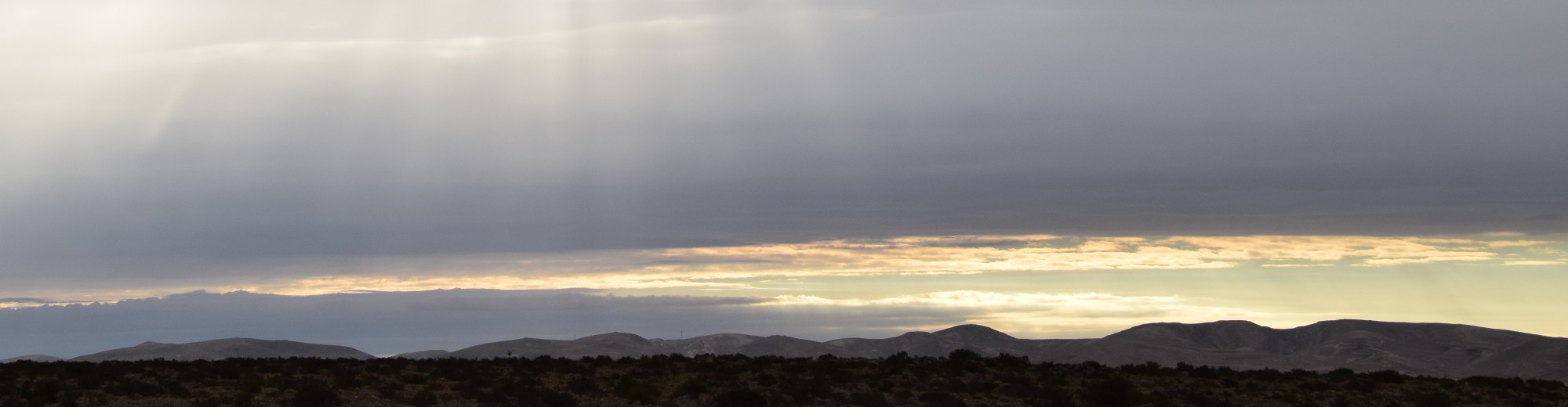
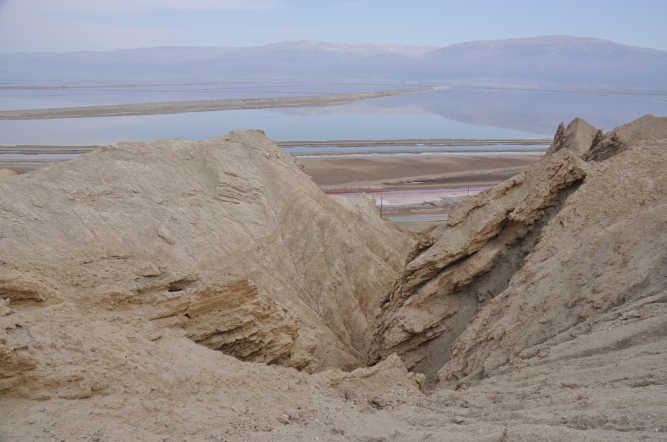
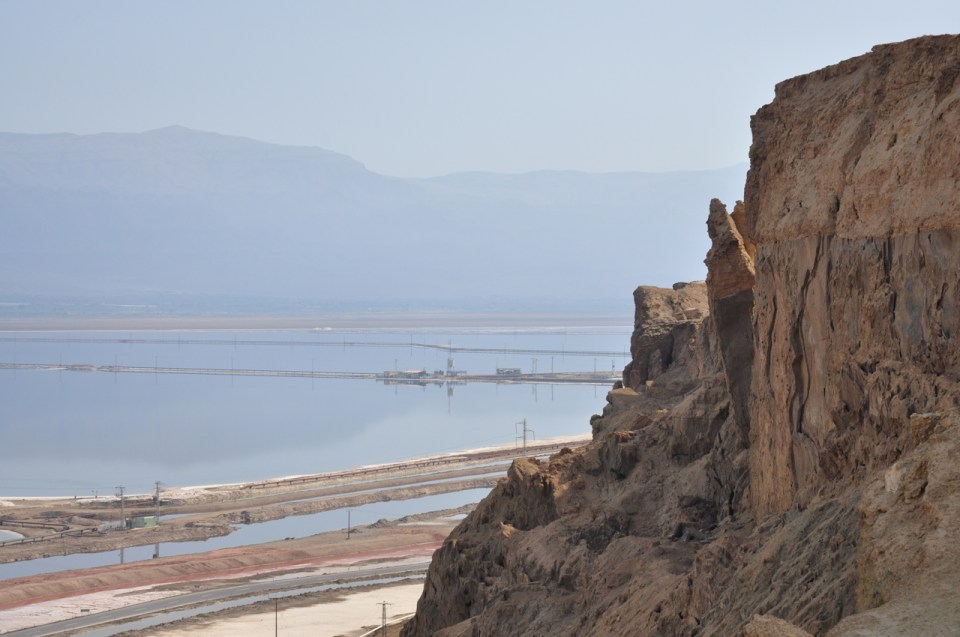
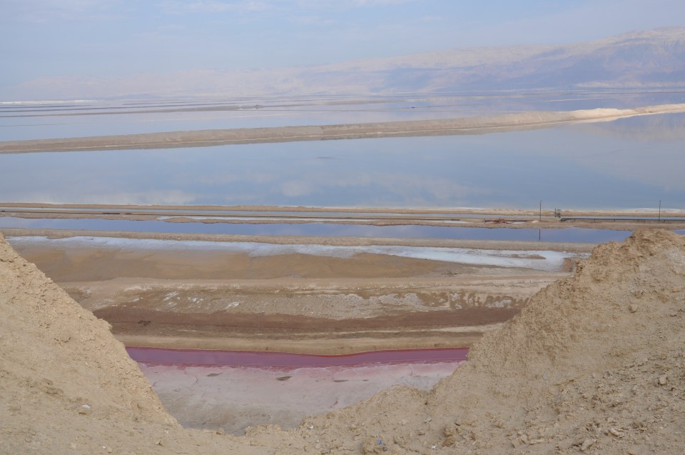
Driving on highway 90 from Jerusalem down to the Dead Sea takes half an hour as you descend from more than 700 meters above sea level to 400 meters below sea level. The Dead Sea is situated at the lowest point on earth, in the Great Rift valley that runs from Turkey in the north to Mozambique in the south, in the crack in the earth’s crust created when Asia and Africa were torn apart five million years ago. Originally it was an ancient larger sea connected to the Mediterranean when water flowed across the Jezreel valley and Jordan River to fill the rift. Although it has no outlet, evaporation in the hot Judean desert reaches 25 mm per day in the summer so in four days it loses the equivalent of the annual rainfall. When the amount of water flowing into the Dead Sea from the Jordan River was equal to the amount lost to evaporation, 1.2 billion cubic meters, the level stayed in equilibrium. Today the Dead Sea is receding at the alarming rate of one meter a year as Israel and Jordan divert the waters flowing into it. The sea is still 1100 meters deep at the northern end so it isn’t going to disappear tomorrow but it is a serious problem that needs to be addressed.

Hilton, Dead Sea

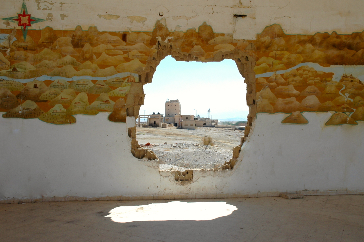
At Lido junction at the northern end of the Dead Sea I often stop to show people the replica of a Crusader map painted on the curved walls of what was a fancy Jordanian restaurant on the shores of the Dead Sea. The artwork was done in March 1973 by Kohavi, who served like me as a reserve soldier at the nearby “Hilton” hotel, now an Israeli army base. Here you can see the trickle that is the Jordan River today flowing into the Dead Sea.Jordan River flowing into Dead Sea

Continuing south along highway 90 we’ll pass some private beaches on your left where you can float in the salty water of the Dead Sea and cover yourself in mineral rich mud. The mud contains magnesium, potassium, sodium, bromide and calcium, all beneficial to our skin; in fact, as the mud dries it even draws out toxins from your skin.

On your right we’ll pass Qumran where the Dead Sea scrolls were discovered in the nearby caves. At that time, Qumran was a land terminal, you couldn’t continue southward except by boat. The Dead Sea was an important transportation route because even heavily-laden barges would float easily (the Madaba mosaic map shows 2 such boats carrying salt and grain). On your left is En Feshka (also called Einot Tsukim). Excavations were carried out here in 1958 by de Vaux (when he was excavating Qumran) and in 2001 by Hirshfeld. The concensus is that this was a farm that prepared balsam perfume. Today it is a nature reserve, 1500 dunam of which has restricted access and can only be visited with an authorized guide like me.

Just before we reach En Feshka look up on the cliffs to your right for the PEF markings, 2 black horizontal lines drawn in 1900 and 1927 by members of the Palestine Exploration Fund and the letters PEF in red. To help you understand how much the Dead Sea has receded these lines were painted from a boat floating on the Dead Sea in the 1900s.

East of the main highway (on your left) we’ll see a few sinkholes and more across from Ein Gedi. As the Dead Sea recedes fresh water from runoff dissolves the salt in the newly uncovered salt-laden earth creating an empty cavern. When the top crust of earth collapses a sinkhole is formed. More than a 1000 sinkholes have appeared on the Israeli and Jordanian coasts of the Dead Sea in the past 15 years. The holes fill up with water and the naturally occurring minerals create pools of orange, yellow, green and indigo with borders of encrusted salt, incredible to see. I’ve taken a series of photographs of sinkholes that you can see on my Flickr site http://www.flickr.com/photos/27944012@N06/sets/72157621040678204/

Sinkholes at Dead Sea © Shmuel Browns

Israel with kids

Israel is a great place to visit with kids. The country is small but varied. One day you can be bumping along in a jeep on the Golan Heights with a view into Syria and hear the stories of Israel’s capture of the area during the Six Day War in 1967. The next day you can be riding on a camel across the sands in the Negev, sleeping in a Beduin tent or under the stars. On the Mediterranean coast, in Akko there is a Crusader fortress that was buried in sand by Al Jazar in order to build his citadel that we can explore. At Masada there is a Herodian fortress in the desert later used by Zealots in the Great Revolt against the Romans. There is an opportunity to climb through caves more than two thousand years old, an experience out of “Raiders of the Lost Ark”. In Jerusalem you can walk around the Old City on the ramparts from the time of Suleiman the Magnificent, walk on paving stones that go back to Roman times and even the Second Temple period or walk underground along the length of the Western Wall.

Check out this article by Nancy Better in the May 17th edition of the New York Times, Taking the Kids – In Israel, With a Whiff of Adventure.

All the sites mentioned in the NY Times article can be incorporated into your personalized tour. There are less expensive accommodations for those on a tighter budget.

Dead Sea: Hiking Nahal Zohar

Friends have told me that they’ve already had snow and that it’s bitter cold in Ottawa, Canada (where I grew up) but here in Israel the weather is fantastic, sunny and in the 70s. It’s great weather to go hiking and yesterday I hiked Nahal Zohar. Since it is at the southern end of the Dead Sea it takes longer to drive there from Jerusalem, about 2 hours, than the hike I posted 2 weeks ago, starting at Qumran. The hike took us 5 hours at a leisurely pace including a stop for lunch.

The hike can be walked in either direction – this time we did it from the lookout on the Sodom-Arava Road to the Dead Sea, you come out of the wadi near the hotels at Ein Boqeq.

View of Nahal Zohar and where we started our hike

View of Nahal Zohar and where we started our hike

Nahal Zohar was used as early as Israelite times 7th C BCE and during Roman-Byzantine times as a way to carry products from the Dead Sea: salt, asphalt, afarsimon perfume and dates to ports on the Mediterranean coast, Gaza and Ashkelon. In order to safeguard the way and collect the appropriate custom taxes there were forts, the remains of which can be seen today.

Remains of Byzantine fortress in Nahal Zohar with water system

Remains of Byzantine fortress in Nahal Zohar with water system

canyon-pool

Pool in rock, Nahal Rom

From Nahal Zohar we switched into Nahal Yizrakh and then Nahal Rom, the last part of the hike through a very lovely canyon with Acacia trees and pools of water.

Dead Sea: Hiking and Qumran

For a great day trip from Jerusalem visit the archaeological site at Qumran in the Judean desert. It takes just ½ hour by car to travel the 42 km from Jerusalem and descend the 1170 meters to the northern shore of the Dead Sea. Another option is to take a jeep ride across the desert to the site. Qumran is where scrolls written on parchment were discovered in a cave by Beduin shepherds. Take a guided tour of the site to learn who lived at Qumran, how they were able to live in such an isolated place in the desert without a natural source of water and how they supported themselves.

The settlement at Qumran is named after the wadi (stream bed) that during the winter rainy season brings flood waters via channels to the pools and cisterns dug at Qumran. There is a nice hike in Wadi Qumran where you climb up to the top of the cliffs, along the plateau with great views of the Dead Sea and descend at Ein Feshka – the whole trek takes about 4 hours and can be done by families.

Hiking at Qumran

Hiking up above Wadi Qumran and the Dead Sea.

Hiking Qumran cliffs

Hiking the cliffs above Wadi Qumran with Sumsum.

Complete your day back in Jerusalem by visiting the Shrine of the Book at the Israel Museum to see the Dead Sea Scrolls and other artifacts discovered at Qumran. As your guide I will point out the conceptual design of the building by Kresler and Bartok, described as “a milestone in the history of world architecture”. The combination of experiencing the Qumran site and the very special artifacts discovered there on display at the museum is the key to understanding this historical period.

Dead Sea – Lowest Place on Earth

From Jerusalem (elevation of 750 meters above sea level) it is about a half hour drive, on routes <1> and <90> down to the northernmost end of the Dead Sea (elevation 420 meters below sea level), the lowest place on earth. As the highway continues along the western shore of the Dead Sea you will pass Qumran, Ein Gedi, Masada, Ein Boqeq and the Dead Sea Works. There are numerous places along the route to take photos of the Dead Sea and the mountains that rise above it. In one day I took almost 150 photographs, filling all 3 of the CompactFlash cards (digital film) that I had with me, more photos than I have ever taken in one day.

It is very hot in the Judean desert so a stop for a dip at the springs at Ein Gedi is delightful. While enjoying the cool water pool in Nahal David, a family asked if I would take a photo of them under the falls – little did they know that they were getting someone who was so practised. With a little patience you will be able to observe the wildlife that lives in the reserve: hyrax, ibex, tristram grackle and red dragonfly.

If you drive along the Dead Sea in the late afternoon you will be able to watch the setting sun as it paints the blue-green sea different colors of pink and purple. This photo is at Ein Boqeq – only as I was focussing on my composition in the viewfinder did I notice the full moon rising over the mountains of Moab.
Moonrise over Dead Sea at sunset
From there it is a short drive south to the Dead Sea Works, these are a series of photos of the industrial complex as night fell.
Full moon over Dead Sea Works
Nightfall at Dead Sea Works
Dead Sea Works lit up at night

I would be happy to arrange a tour and guide you if you want to focus on Israel through a camera lens.

In the last 3 years I’ve taken more than 4000 photographs in Israel. In July I am going to Kathmandu, in the foothills of the Himalayas, the highest place on earth–I am looking forward to an exhibit of my photos “From the Lowest Place on Earth” that will be on show there in August. To view the photos click here.