Category Archives: Nature

Nimrod, Golan

The alarm clock went off at 5am Sunday morning. We were to drive our 2 sons, Amitai and AdirChai and his friend Ariel, from Jerusalem to the Hermon to hike the Golan Trail. We had 2 days to explore the area.

Day 1: Nimrod
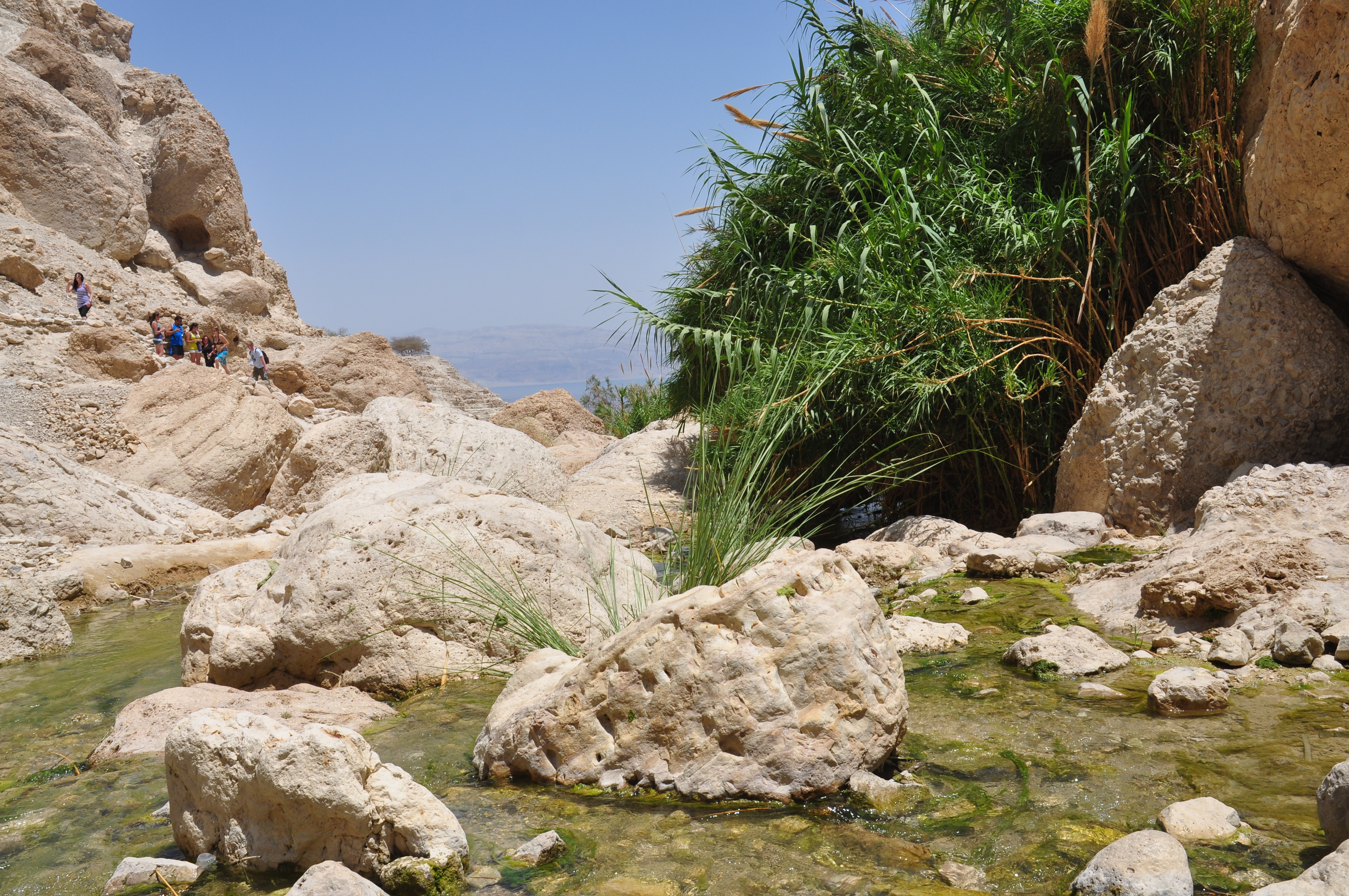
After seeing the boys off, we drove to Nimrod, just 5 families on the southern slope of the Hermon and at 1110 meters above sea level, the highest settlement in Israel.  There is a great view of Birkat Ram to the south-east and the Nimrod fortress to the west. As you enter, there’s a blue boxy concrete building, a gallery of paintings by Diego Goldfarb and next to it a restaurant (not kosher) called the Witch and the Milkman. They carry artisan cheeses from the HaNoked Dairy and give tastes. We bought two cheeses, a hard Tome style (French) goat cheese treated with red wine and a Manchego like (Spanish) sheep’s cheese treated with Chardonnay to go with the crackers I had made (I think I’m the only tour guide who bakes homemade organic whole wheat crackers to share with my clients).

DSC_0124

From there we drove 8 km to the Nimrod fortress off of highway <989>, part of the Parks Authority with an entrance fee of 20 NIS per person.  The fortress controlled one of the main roads that ran from Tyre to Damascus. It was built around 1229 by the Ayyubid ruler Al-Aziz Uthman, nephew of Salah ad-Din. Later additions by the Mameluk sultan Baybars in 1260 (actually his second in command Bilik) are commemorated by a large, beautifully carved inscription in Arabic.

DSC_0071.JPG

Also found was a stone relief of a very cute looking lion, the symbol of Baybars.

DSC_0128

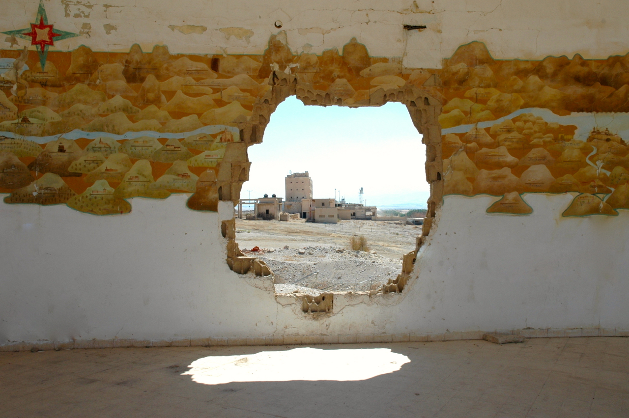
The fortress is the largest in Israel and includes a large water cistern and a donjon (keep), surrounded by a moat, probably the two most important things against a siege.

There are 2 incredible things about this fortress that I experienced when I visited it for the first time on the guide course:

  1. I took this photo of the arch above the entrance to the northwest tower where a number of stones have slipped due to an earthquake in 1759 and are hanging suspended to this day.
    DSC_0075.JPG
  2. Nearby is the vaulted stairway  of the secret tunnel. I noticed that it was quite damp and in looking up I saw stalactites growing from the ceiling and I understood that since the fortress is built of limestone from the Hermon (as opposed to the basalt of the Golan) the water seeping through is dissolving the limestone blocks just like in a natural cave.
    DSC_0142

Hiking Nahal Yehudia

Day 2: Hiking Nahal Yehudia
After a breakfast of fruit and homemade granola we drove to Nahal Yehudia off highway <87>. The hike is listed as appropriate for good hikers who can swim as there are a couple of places where you have to climb down the rock face with the help of handholds or a ladder into a deep pool that you have to swim across. The trail is one of eleven listed in the Park’s brochure on the Yehudia Forest Reserve, including Nahal Zavitan, the Meshushim (hexagonal basalt pillars) pool and Gamla which includes the archaeological remains of the Jewish town that fought against Vespasian at the start of the Jewish Revolt in 66CE and Griffon vultures that can be seen flying overhead. There is parking, bathrooms, drinking water, a snack bar and information center (the park warden we spoke to was very helpful); the entrance fee was 20 NIS per person. Note that you must start out on the trail by noon.

DSC_0161

The hike starts above the wadi, walking through a deserted Syrian village built on the remains of an earlier Jewish one of basalt field stones from the Roman-Byzantine period. Remains of a wall have led archaeologists to suggest that Yehudia is Soganey, one of the three fortresses (the other two are Gamla and Sele’ukya) in the Golan built by Josephus at the time of the Roman Revolt. You walk on a path strewn with basalt, by pasture land where you may see cattle grazing.

DSC_0171

Then you walk down into the wadi to the Yehudia Falls and the first pool, good for a cool dip especially if it’s a hot day.

DSC_0177

At this point we changed out of our hiking boots and into water sandals as there are places where you walk in the water. Continuing along the wadi you get to the first descent. U-shaped handholds have been attached to the rock to help you get down about 4 meters. This is just your warm up. The trail brings you to a cliff where you descend 9 meters by metal ladder into a pool. There is no place to stand, you step off the bottom rung of the ladder and swim across to the other side of the pool.

DSC_0184

The challenge is what to do to keep your gear dry (and in this day and age with cell phones, cameras, car keys with electronic locks, etc. we have stuff that won’t work if it gets wet). We used the double garbage bag technique but also saw a group float their packs across on a small inflatable boat, you can rig up a rope and omega your pack across or probably safest, pack in professional waterproof bags used for kayaking.

After traversing the pool you come to another descent, this time about 4 meters with only handholds. At the bottom you have the option of swimming or walking across the pool as it isn’t that deep. Be careful as it is slippery walking on the rocks. The water can be quite cold so it’s great that there is a place in the sun to sit on some large rocks and have a snack.

DSC_0182

Using the 2 large plastic bags that we had brought for our packs, we picked up a bunch of garbage that we carried out with us. We continued along the wadi, sometimes walking on the rocks, sometimes in the water. At the well marked junction you can leave the red trail to take the green back to the Syrian village or continue  along the wadi a bit further to one last pool and waterfall. Then we backtracked and took the green trail up out of the wadi, back to the Syrian village and the trail head. It was just the middle of November but there were already cyclamen and narcissus in bloom.

You can view a fuller set of photographs from this Golan trip on Flickr at http://www.flickr.com/photos/27944012@N06/sets/72157622790431204/

The Dead Sea

Driving on highway 90 from Jerusalem down to the Dead Sea takes half an hour as you descend from more than 700 meters above sea level to 400 meters below sea level. The Dead Sea is situated at the lowest point on earth, in the Great Rift valley that runs from Turkey in the north to Mozambique in the south, in the crack in the earth’s crust created when Asia and Africa were torn apart five million years ago. Originally it was an ancient larger sea connected to the Mediterranean when water flowed across the Jezreel valley and Jordan River to fill the rift. Although it has no outlet, evaporation in the hot Judean desert reaches 25 mm per day in the summer so in four days it loses the equivalent of the annual rainfall. When the amount of water flowing into the Dead Sea from the Jordan River was equal to the amount lost to evaporation, 1.2 billion cubic meters, the level stayed in equilibrium. Today the Dead Sea is receding at the alarming rate of one meter a year as Israel and Jordan divert the waters flowing into it. The sea is still 1100 meters deep at the northern end so it isn’t going to disappear tomorrow but it is a serious problem that needs to be addressed.

Hilton, Dead Sea

At Lido junction at the northern end of the Dead Sea I often stop to show people the replica of a Crusader map painted on the curved walls of what was a fancy Jordanian restaurant on the shores of the Dead Sea. The artwork was done in March 1973 by Kohavi, who served like me as a reserve soldier at the nearby “Hilton” hotel, now an Israeli army base. Here you can see the trickle that is the Jordan River today flowing into the Dead Sea.Jordan River flowing into Dead Sea

Continuing south along highway 90 we’ll pass some private beaches on your left where you can float in the salty water of the Dead Sea and cover yourself in mineral rich mud. The mud contains magnesium, potassium, sodium, bromide and calcium, all beneficial to our skin; in fact, as the mud dries it even draws out toxins from your skin.

On your right we’ll pass Qumran where the Dead Sea scrolls were discovered in the nearby caves. At that time, Qumran was a land terminal, you couldn’t continue southward except by boat. The Dead Sea was an important transportation route because even heavily-laden barges would float easily (the Madaba mosaic map shows 2 such boats carrying salt and grain). On your left is En Feshka (also called Einot Tsukim). Excavations were carried out here in 1958 by de Vaux (when he was excavating Qumran) and in 2001 by Hirshfeld. The concensus is that this was a farm that prepared balsam perfume. Today it is a nature reserve, 1500 dunam of which has restricted access and can only be visited with an authorized guide like me.

Just before we reach En Feshka look up on the cliffs to your right for the PEF markings, 2 black horizontal lines drawn in 1900 and 1927 by members of the Palestine Exploration Fund and the letters PEF in red. To help you understand how much the Dead Sea has receded these lines were painted from a boat floating on the Dead Sea in the 1900s.

East of the main highway (on your left) we’ll see a few sinkholes and more across from Ein Gedi. As the Dead Sea recedes fresh water from runoff dissolves the salt in the newly uncovered salt-laden earth creating an empty cavern. When the top crust of earth collapses a sinkhole is formed. More than a 1000 sinkholes have appeared on the Israeli and Jordanian coasts of the Dead Sea in the past 15 years. The holes fill up with water and the naturally occurring minerals create pools of orange, yellow, green and indigo with borders of encrusted salt, incredible to see. I’ve taken a series of photographs of sinkholes that you can see on my Flickr site http://www.flickr.com/photos/27944012@N06/sets/72157621040678204/

Sinkholes at Dead Sea © Shmuel Browns

Negev desert

The Negev desert, shaped like a 4700 square mile inverted triangle in the south of Israel, makes up more than half of the country’s land area. I can arrange to make a visit to the Negev part of your itinerary, you have to experience the desert to understand its importance.

Geographically the Negev can be divided into 5 areas: the northern, western and central Negev, the high plateau and the Arava Valley. This article focuses on the high plateau area, Ramat HaNegev (Negev Heights). The plateau stands between 370 metres and 520 metres above sea level and has extreme temperatures in summer and winter and significant differences in temperature between day and night. Even though the area gets only 100 mm of rainfall per year and the soil is poor and quite salty, Israel is successfully growing olives, pomegranates, pistachios and grapes for wine.

DSC_0042

Here are some places to add to your itinerary as you explore Ramat HaNegev.

  • Kibbutz Revivim is growing 5 varieties of olives using brackish water and selling the olives and olive oil in an upmarket boutique dedicated to their products in Tel Aviv.

DSC_0017

  • Park Golda includes a lake and picnic tables to eat your lunch or for an unforgettable desert experience, try Beduin hospitality in a black goat’s hair tent followed by a camel ride.

IMG_0931

  • The Large Makhtesh is one of 3 craters in the region, a unique formation to the Negev, where the inside of a mountain is eroded by water, leaving the outer shell.
  • Visit the tzrif on Kibbutz Sde Boker to get a glimpse of how Ben-Gurion and Paula lived. The Ben-Gurion Institute, a research facility for the study and the dissemination of his writings, offers visitors a multi-media program about the man and his vision.
  • You can visit a string of family farms along route <40> for wine and cheese tasting and even sleep over in one of their cabins under the desert stars. On farms that are growing grapes and making wine, the vines have been planted on the same 1500 year old terraces that were prepared by the Nabateans and take advantage of runoff from the winter rains. These farms are also a symbol of Israel’s pioneering spirit in the 21st century, composting their waste, recycling their grey water and generating electricity using solar photovoltaic panels.

DSC_0033

  • Hike into the canyon at the Ein Avdat National Park with springs, pools and waterfalls, an oasis in the desert or from the Roman bath house (below Avdat) supplied with water drawn from a well tunneled 70 meters through bedrock hike north along the Israel Trail to the Ein Eikev spring that flows year round.
  • Visit the remains of the Nabatean city of Avdat which was probably the regional capital. Located at the crossroads that join Petra in Trans-Jordan to Eilat and to Gaza, Avdat controlled the passage of the caravans from India and Arabia. Conquered in 106 CE by the Roman Emperor Trajan, it lost its importance when a road was built between Eilat and Damascus. Avdat adjusted by adopting agriculture, particularly the production of wine, as its means of subsistence. Numerous terraced farms and water channels were built throughout the region in order to collect enough run-off from winter rains to support agriculture in the hyper arid zone of the Negev. At least five wine presses dated to the Byzantine period have been found at the site showing us how important wine-making was in this region. In the Byzantine period (5th and 6th century) a citadel and a monastery with two churches were built on the acropolis of Avdat on the ruins of earlier pagan temples. The town was totally destroyed by a local earthquake in the early seventh century and was never reinhabited.

Ein Gedi

Ein Gedi-waterfalls and pools

Ein Gedi (literally Spring of the Goats, refers to Nubian Ibex that come to the spring to drink) is an oasis in the Judean desert along the western shore of the Dead Sea. Here are two hikes (each about 5 km) in the Ein Gedi reserve that are perfect for families, Nahal David and Nahal Arugot.
On entering the reserve follow the marked the path and after about 15 minutes of easy walking we’ll reach the first waterfall, Mapal Shulamit that cascades 30 meters down the rock to a pool below. After a refreshing dip we’ll continue to a fork in the trail, we’ll take the steeper one on the right (the other path would take us back to the entrance) to the Shulamit spring and from there above the wadi to the Dudim cave. Retracing our steps we’ll continue to the Ein Gedi spring and beside it the flour mill. From there we can walk to the ruins of the Chalcolithic temple (3500 BCE), one of the oldest remains of human settlement in the Judean desert. We’ll descend through a cranny along a dry canyon to discover a 50 meter high waterfall and a great view of Nahal David and the Dead Sea beyond.

Ein Gedi-Nahal DavidAccording to the Roman historian Pliny the Elder the area of Ein Gedi was settled during the Second Temple period by a Jewish ascetic sect called the Essenes. The archaeological evidence uncovered by Hirschfeld suggests that they lived   near the spring where he found more than 20 tiny stone cells and two pools, one for irrigation and one a miqve or ritual bath. Pottery shards date it to the first century BCE.

The second hike starts from Tel Goren along the Nahal Arugot river bed past acacia trees and salvadora to a large pool used for irrigation of crops like balsam; the pool was filled by a channel that brought runoff from the wadi. Continuing we will pass reeds, maidenhead ferns, willow and poplar; we may see a rare orchid called Ben Horesh. A little farther the wadi narrows to a steep walled canyon at whose end is a waterfall and pool.
Excavations at Tel Goren by Mazar of the Hebrew University in  the 1960s show that the site was settled in the Israelite period and functioned as a royal estate for growing dates of the now extinct Judean palm Phoenix dactylifera, considered uniquely medicinal. Balsam was grown for the production of perfume (in Hebrew, afarsimon).
The Romans were interested in the production of balsam perfume; Mark Anthony confiscated the groves from Herod and gave them to Cleopatra. After their deaths, Herod was able to lease them back. During the Great Revolt, the Jews uprooted the groves so they would not fall into the hands of the Romans.
Excavations have revealed a small Jewish village and a synagogue from the 4th century with a beautiful mosaic floor. Written in Hebrew and Aramaic,  inscriptions list the signs of the zodaic and months of the year (later displayed graphically in mosaic floors in synagogues in Bet Alpha and Tiberius) and the expression “Peace unto Israel” (also found in the ancient synagogue in Jericho) and a dire warning at the end: “whoever reveals the secret of the town to the Gentiles – He whose eyes range through the whole earth and who sees hiddens things, He will set his face on that man and on his seed and will uproot him from under the heavens.” The secret seems to be the production of perfume from balsam.

En Feshka pondThe other natural source of fresh water in the Judean desert is Ein Feshka 30 km to the north of Ein Gedi. The lowest nature reserve in the world consists of 3 parts of which one is closed to visitors except research scientists who are studying the desert. The public part includes a small archaeological site from the Second Temple period and pools of fresh water, picnic tables and facilities for the enjoyment of visitors. The closed reserve is 1500 dunams (370 acres) that can only be visited with an authorized guide like me. It’s incredible to find a large freshwater pond with fish, shaded by trees in the middle of the desert next to the Dead Sea.

Judean palm

The scientific name of the Judean palm Phoenix dactylifera refers to its remarkable ability to grow again and even fruit after near death due to drought.

The Judean palm was endemic to Israel. It is the one referred to when the palm tree is mentioned in the Bible and Koran and appears in Roman writing, referring to its medicinal properties, and is pictured on various coins. This would imply as well that the lulav or palm frond used for the Four Species (Arba’at HaMinim) on the festival of Sukkot (Tabernacles) would be the branches of the Judean palm. Looking at the barren landscape of the Judean desert it is hard to imagine this area covered by palm forests.

Along Dead Sea

The Judean palm, like the balsam plant that used to grow around Ein Gedi and Jericho, became extinct sometime after the Romans, around 500 CE. Today there are palm groves along the Dead Sea shore but these were all imported from the date groves of California or varieties smuggled to Israel from Iraq, Morocco and Egypt in the 1950s.

In mid 1960s, during the archaeological excavations of King Herod’s palace on Masada, Ehud Netzer who was the architect  working with Yigal Yadin found some dry date pits in a clay jar. He passed them along to botanical archaeologist Mordechai Kislev at Bar Ilan where they sat in a lab drawer for more than 40 years. Then in 2004 the seeds were rediscovered by Dr Sarah Sallon of the Natural Medicine Research Center who passed them to Dr Elaine Solloway at the NMRC cultivation site on Kibbutz Ketura to try to germinate them. A small specimen of pit was checked and independent carbon dating at University of Zurich dated the seeds dated between 155 BCE to 64 CE.

First Solloway soaked the seeds in hot water to make them once again able to absorb liquids. Then she soaked them in a solution of nutrients followed by an enzymatic fertilizer made from seaweed. On the auspicious date of the 15th of the Jewish month of Shvat, the Jewish new year of trees, the date pits were planted.

Amazingly, one of the seeds sprouted. It is now about 40 months old, 1.2 meters high with a half dozen leaves. As of February 2020, the palm, named Methuselah had reached 3.5 metres (11 ft).

Date palms are dioecious, meaning that they are either male or female. Researchers are hoping for a female palm which would bear fruit.

Phoenix dactylifera growing after 2000 years at Kibbutz Ketura; photo from March 2022.


UPDATE: An article in the Jerusalem Post reports that the Judean palm (grown from the 2000 year old seed from Masada) that has been growing in a greenhouse at Kibbutz Ketura is now 2.5 meters tall and in a ceremony on Thursday, Tu Bishvat (the Jewish New Year of trees) was transplanted to Israeli soil.

The palm bloomed in April 2011, just past it’s 5th birthday – it’s male.

UPDATE: As of 2019, thirty-two Judean date palm seeds from sites near the Dead Sea have been planted and six saplings (Adam, Jonah, Uriel, Boaz, Judith, and Hannah; 4 males and 2 females) have survived. As of February 2020, Adam was 1.5 meters high; both Adam and Jonah have produced flowers. As of June 2021, dates have grown from the pollination of Hannah, one of the female specimens, by Methuselah.

Researchers at the Arava Institute for Environmental Studies at Kibbutz Ketura plan to grow dates resurrected from seeds found at archaeological sites in the Judaean Desert and Masada in large quantities using tissue culture, and then establish them in commercial plantations.

Other Readings
  • Frankincense comes home for Christmas (blogs.timesofisrael.com) – Soloway has successfully grown frankincense from seed at Kibbutz Ketura, another native plant extinct here for over 1500 years.
  • Afarsimon (Commiphora gileadensis) or balsam used to grow along the shore of the Dead Sea and the perfume made from the plant was very expensive and in high demand during the Roman period. By the 6th century after the destruction of the Jewish temple and exile the industry had disappeared. Rumor has it that some wild afarsimon plants were smuggled from Saudi Arabia and had been planted at the Jerusalem Botanical garden even though the weather is too cold. Fortunately, Elaine Soloway got some of the plants and grew them in the desert climate at Ketura and from there they were planted at Guy Ehrlich’s Balm of Gilead Farm at Almog junction along with frankincense and myrrh.