Category Archives: Archaeology

Roman Amphitheaters in Israel

An amphitheater is an open-air venue, oval or circular in shape, used for entertainment, performances, and sports (think sports stadium today, not to be confused with a Roman theater which is semicircular). The term derives from the ancient Greek ἀμφιθέατρον (amphitheatron), from ἀμφί (amphi), meaning “on both sides” or “around” and θέατρον (théātron), meaning “place for viewing”.

Originally built from the Imperial era 27 BCE on throughout the Roman Empire, the remains of at least 230 amphitheaters have been found. The largest amphitheater ever is the Colosseum or Coliseum, also known as the Flavian Amphitheater in Rome, just east of the Roman Forum and is considered one of the greatest works of Roman architecture and engineering. Construction of the Colosseum began under the rule of the Emperor Vespasian in around 70 CE and was completed in 80 CE under his son and heir Titus, funded by the treasures taken from the Jewish Temple when the Romans destroyed Jerusalem. Like many Roman building projects, for example, aqueducts and bridges, it has stone masonry cladding on a concrete core. It is estimated that the Colosseum could seat more than 50,000 spectators. The 43.3 meter dome of the Pantheon was also formed of unreinforced concrete.

In Israel you can visit 3 amphitheaters left behind by the Romans.

  1. At Caesarea-Maritima Herod built a hippodrome for chariot races on the sea coast beside his Promontory Palace. In the 2nd century, the hippodrome was shortened to form an amphitheater. Built of kurkar stones I estimate that it held about 4000 spectators. Below is a view of the eastern side with the VIP seating area.Hippodrome VIP seats
  2. Fresco at amphitheater
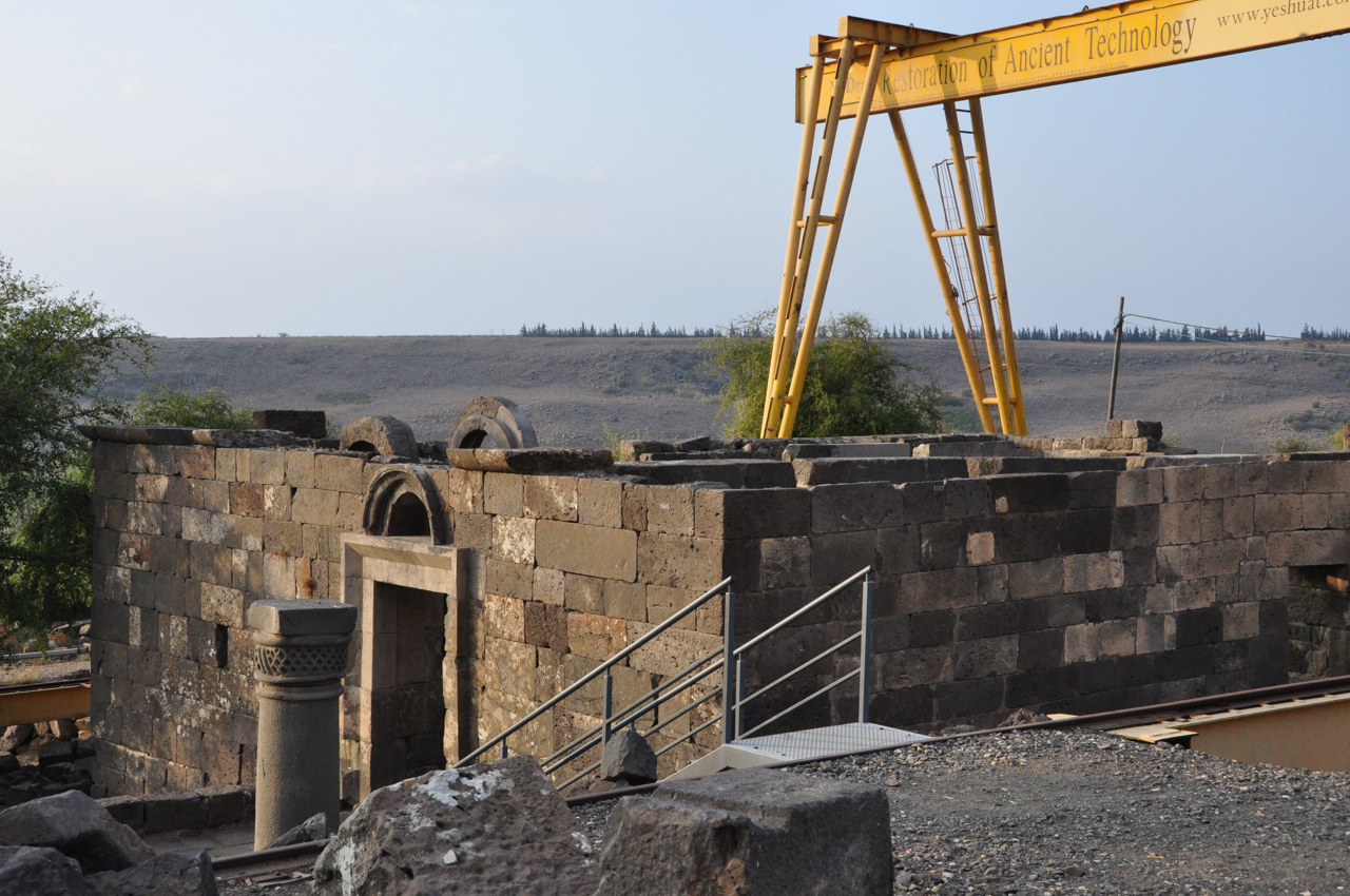
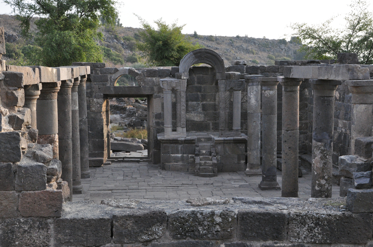
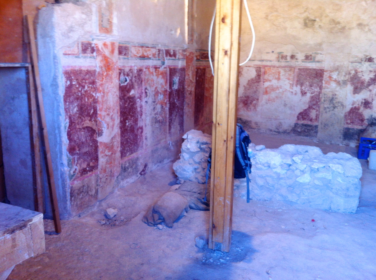
On the northwestern outskirts of Beit Guvrin, called Eleutheropolis, in the 2nd century the Romans built an amphitheater [
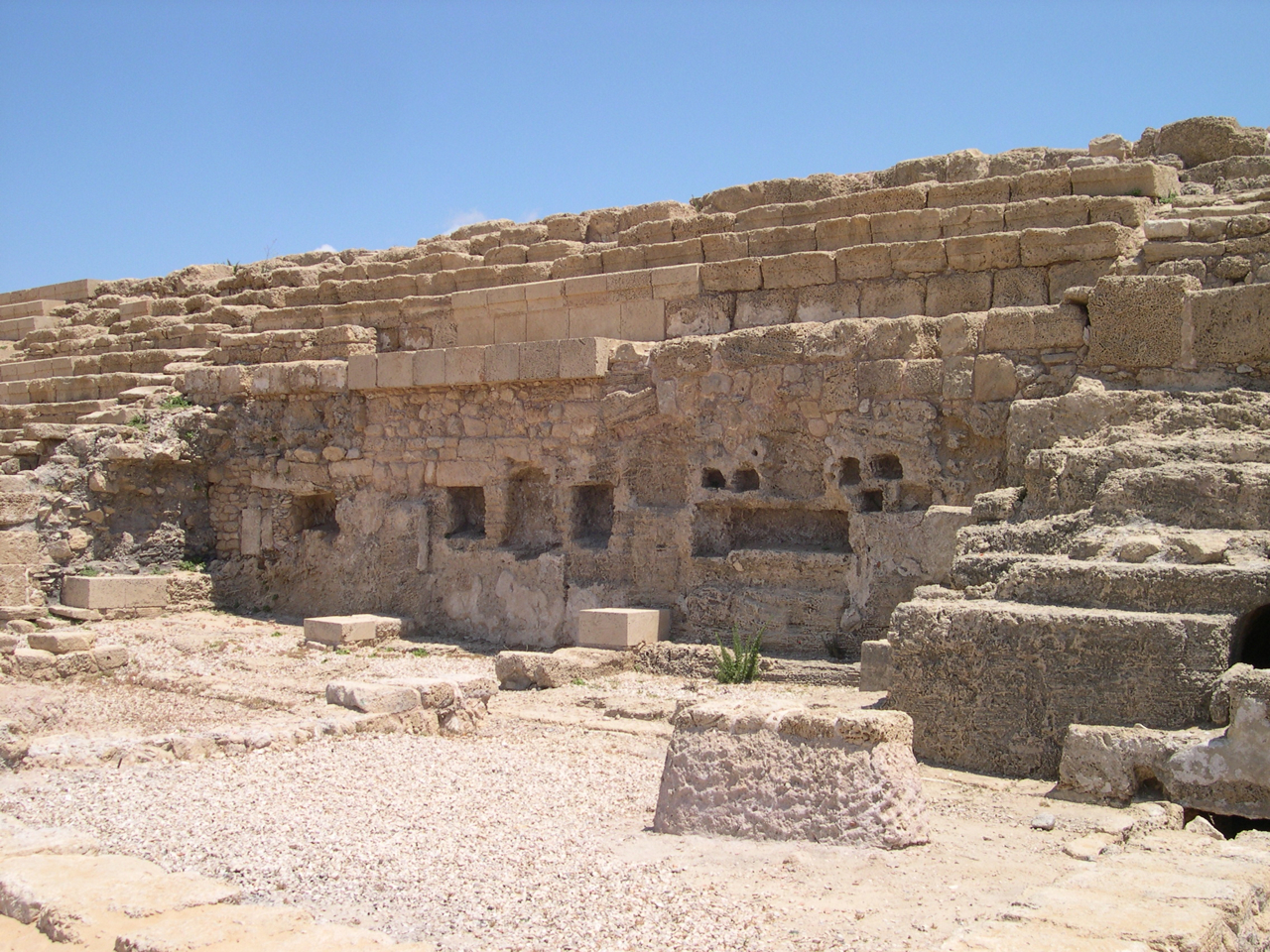
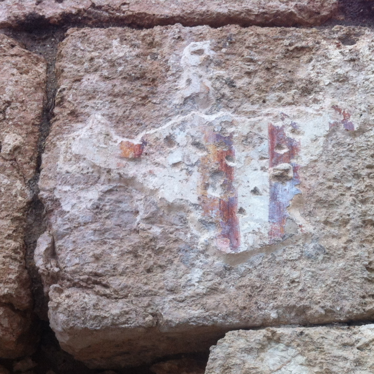
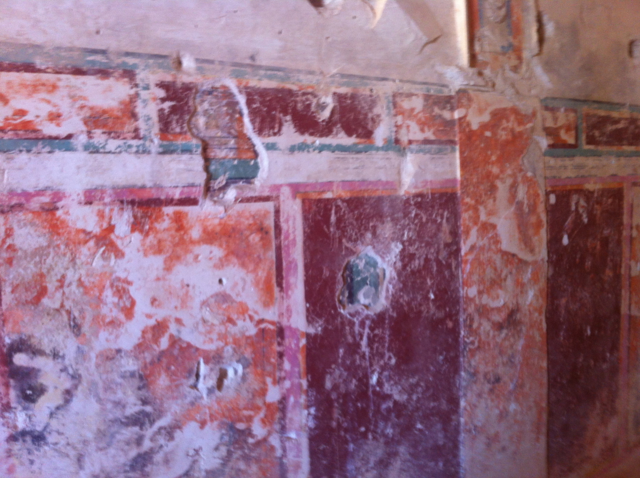
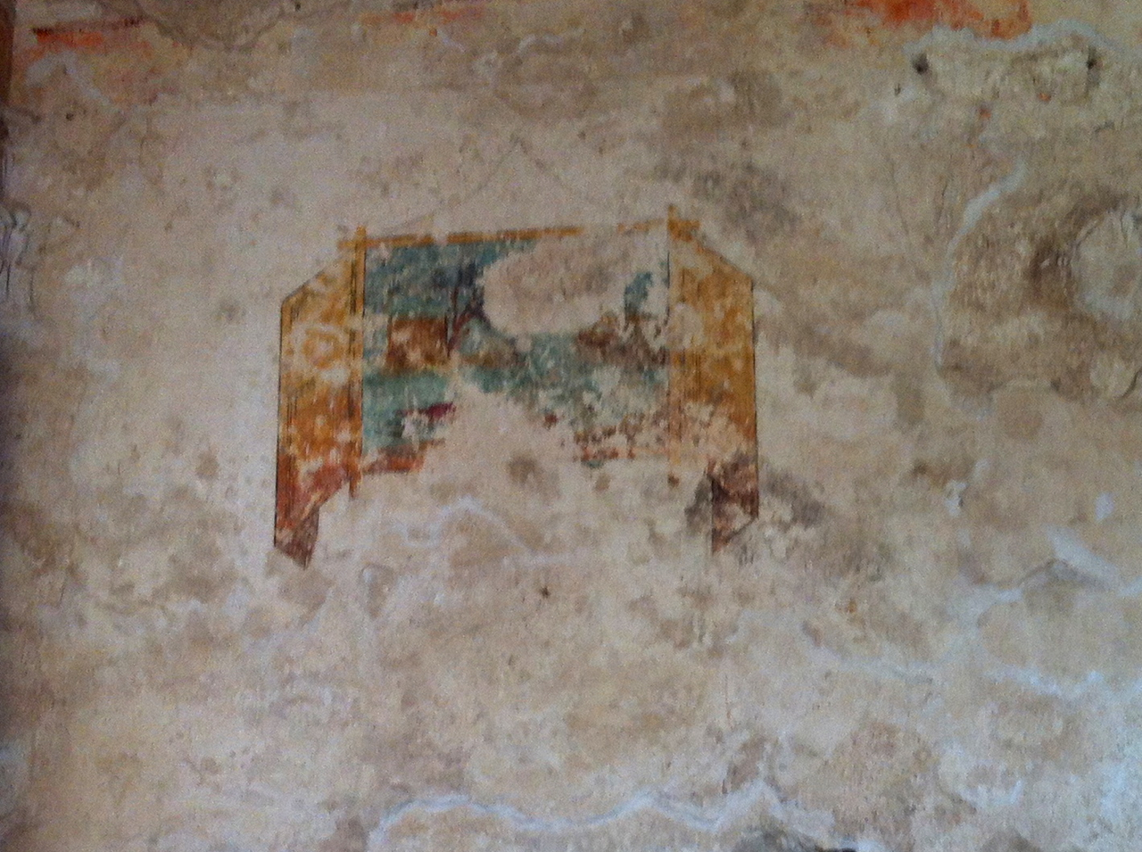
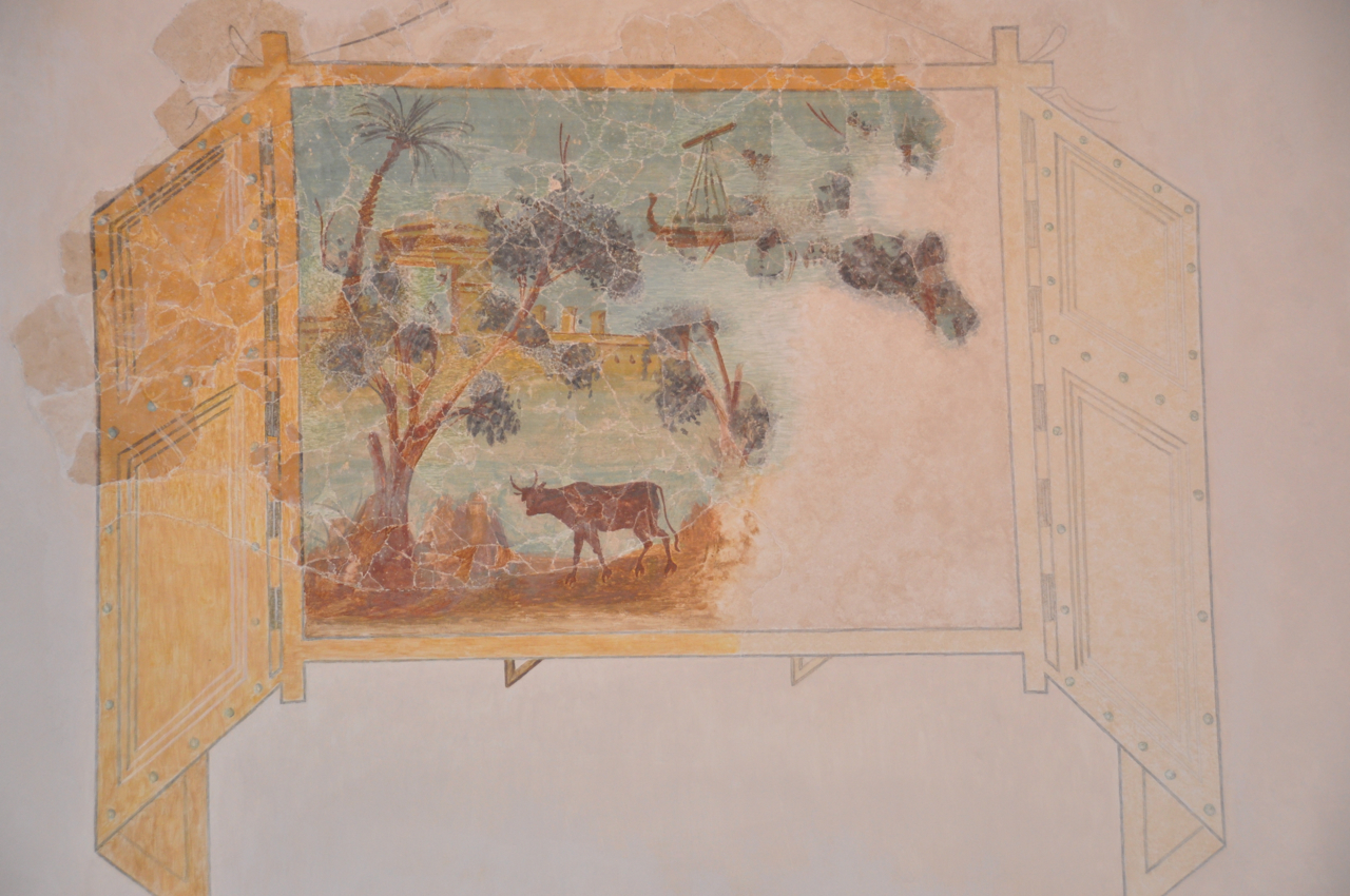
31.6082°N 34.8939°E] for Roman troops stationed in the region after the suppression of the Bar Kochba revolt. It had a walled arena of packed earth, with subterranean galleries. The arena was decorated with frescoes and surrounded by a series of connected barrel vaults, which formed a long, circular corridor that supported the stone seats above it. Click on the image for a larger view.Amphi Pano BG
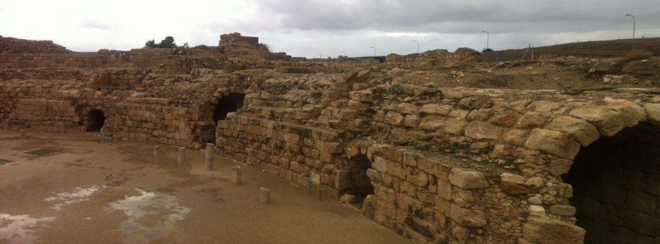
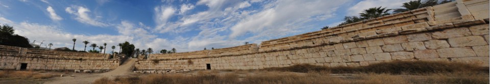
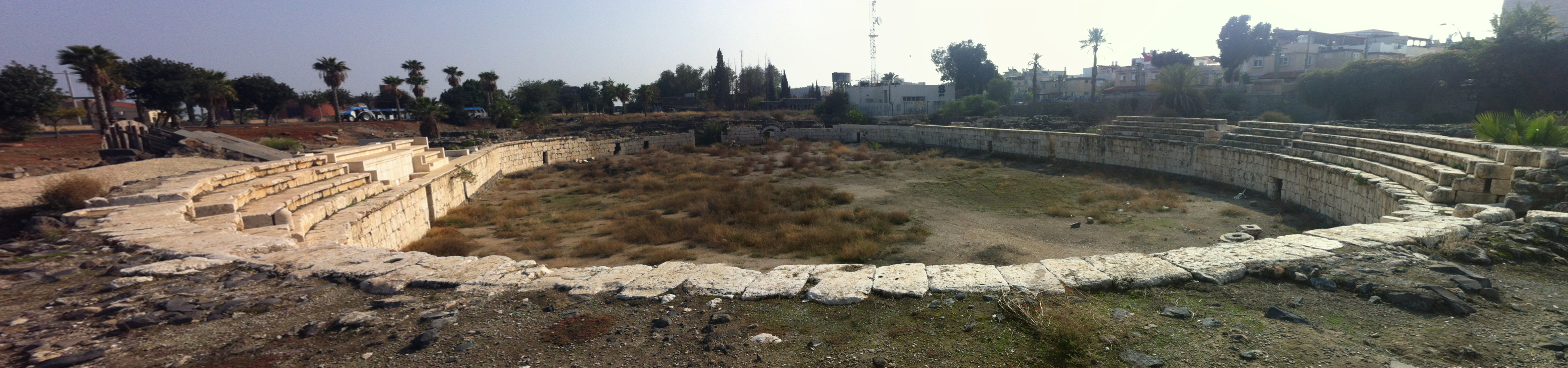
  3. South of the Roman civic center at Beit Shean, the Romans built an amphitheater [32.498508°N 35.501446°E] on the western part of an existing hippodrome of which very little is known. The structure was an oval, 102 x 67 meters, of limestone blocks on a foundation of basalt. There were 10-12 rows of seats that would have held 5000-7000 spectators. Below is a panorama of the amphitheater at Beit Shean. I took 3 photos standing inside the amphitheater and 3 outside on the edge  and stitched them together using Photoshop. Click on the images for a larger view.Amphitheater Panorama Beit SheanBeit Shean amphitheater

Gladiatorial munera began to disappear from public life during the 3rd century, due to economic pressure, philosophical disapproval and opposition by the increasingly predominant new religion of Christianity. Spectacles involving animals, venationes, became costlier and rarer until in the 6th century they ended. Today all that is left are the remains of the structures.

Nahal Prat or Wadi Qelt

Nahal Prat (nahal: נחל=stream bed) or Wadi Qelt (wadi: وادي‎=valley) flows from west to east across the northern Judean Desert, from near Jerusalem to Jericho, a distance of 28 km, from 770 meters above sea level to where it flows into the Jordan River at 395 m below sea level. Hiking trails follow the stream bed, which has water all year around fed by three springs, En Prat, En Mabu’a and En Qelt. My blog post about Wadi Qelt and the St. George Monastery is one of my most popular so I want to tell you about another destination in the area, the Nahal Prat nature reserve. Take highway 1 from Jerusalem towards the Dead Sea and then a left onto road 437 towards Ramallah. Turn right to the Jewish settlement of Anatot (the Levite city mentioned in Jeremiah 1:1), now called Almon (from Joshua 21:18).

Tomb ibn Taymiyya

Ruins of the Jewish Iron age village, time of Kings is at the turning, with the 13th century Arab tomb of Sheikh Ibn Taymiyya (תָקִי אל-דין אבו אל-עבאס אחמד בן עבד אל-חלים בן עבד אל סָלאם בן תימיה אל-חָרַאנִי) on the hill. Drive through Almon to the entrance of the reserve and descend the winding road to a parking lot.

Ein Prat

I took these photographs of En Prat, the valley formed by the steep limestone cliffs and the pools within the reserve.

Fallen Rocks Ein Prat

The remnants of settlements, monasteries and palaces are scattered along the stream, as are signs of stream-based cultivation. A number of aqueducts were found along the stream, the earliest of which dates to the Hasmonean period, used to channel water to the winter palaces near Jericho. These channels continued to be used through the Roman, Byzantine and early Arab periods. This enabled the growing of fruit trees like fig, pomegranate, date and citrus.

Ruins of a later water-operated flour mill can be seen on the ascent to the Faran Monastery, originally founded by the monk Haritoun in the 3rd century, believed to be the first monastery in the Judean Desert. This area, in the desert and not far from the holy city of Jerusalem, with many natural caves, springs and abandoned Second Temple period fortresses, attracted monks seeking seclusion.

Today, for the same reasons, the area is a popular recreation site to hike, picnic and swim in the natural pools.

Pine Ein Prat

Tamat Pool


Golan Heights Tour

The Golan Heights, Israel’s mountainous north-eastern region, is one of the most beautiful areas of the country. In the Golan, rather than desert, we have streams and waterfalls. There are also numerous archeological sites and ancient synagogues dating back to the Roman and Byzantine periods, evidence of flourishing Jewish communities in the area going back 2000 years. The remains of 25 synagogues from the period between the Great Revolt in 66 and the Islamic conquest in 636, when organized Jewish settlement on the Golan came to an end, have been discovered – 6 have been excavated.

The Golan was settled in the modern period beginning in 1886 when Jews from Tzfat and Tiberias settled there. The Bnei Yehuda society of Tzfat purchased a plot of land in the village of Ramataniya in central Golan (4 km north-west of the present day religious moshav of Keshet) and named their settlement “Golan BeBashan” and settled there for about a year.

In 1887, they purchased lands between the modern day Bnei Yehuda and Kibbutz Ein Gev. This community survived until 1920, when two of its last members were murdered in the anti-Jewish riots which erupted in the spring of that year. In 1891, Baron Rothschild purchased approximately 18,000 acres of land about 15 km east of Ramat Hamagshimim, in what is now Syria. First Aliyah (1881-1903) immigrants established five small communities on this land, but were forced to leave by the Turks in 1898. The lands continued to be farmed until 1947 by the Palestine Colonization Association and the Israel Colonization Association, when they were seized by the Syrian army. Most of the Golan Heights were included within Mandatory Palestine when the Mandate was formally granted in 1922, but Britain ceded the area to France in the Franco-British Agreement of 7 March 1923. Consequently, the Golan Heights became part of Syria after the termination of the French mandate in 1944.

During the 1948-49 War of Independence  the Syrians army attacked the adjacent Jewish areas and managed to advance beyond the international border. After the war, the Syrians built extensive fortifications on the Heights, which were used for shelling of civilian targets in Israel. 140 Israelis were killed and many more were injured in these attacks between 1949 and 1967, and particularly in the spring of 1957. Because of this pounding, Israel Defense Forces captured the Golan Heights during the Six-Day war.

Gamla view

On a recent tour of the Golan I took clients to the archaeological park with ruins of the ancient Jewish city of Gamla to see the Second Temple period synagogue, hiked through dolmens to a 50 meter waterfall and from a panoramic lookout with a view of the Sea of Galilee watched the Griffon vultures soar through the canyon.

Griffon vulture, Gamla

From there we visited Um el-Kanatir (Arabic for Mother of the Arches) an impressive set of standing ruins of a Jewish village from the Byzantine era to see the ongoing reconstruction of the synagogue there. The ruins of a very large synagogue of local basalt stone were found, destroyed by the earthquake of 749 CE. I hadn’t visited in a year and there has been a lot of progress in the reconstruction of the synagogue, the walls extend to ceiling height now and the bima has been set in place (the work has now been completed).

Um el Kanatir synagogue

Um el Kanatir synagogue interior

Katzrin is also well worth a visit. The Talmudic Village lets us explore the 4th century CE village of Katzrin which includes a 6th century synagogue (built on an earlier more modest one) similar to the one at Um el Kanatir. The nearby Archaeological Museum displays artifacts uncovered on the Golan. One fascinating find is an 1,800-year-old door lintel carved of basalt with a Hebrew inscription “this is the beit midrash (study house) of Rabbi Eliezer HaKapar” that was  discovered in the village of Daburiye, situated near a steep ravine with a pair of spectacular waterfalls. We know of the tanna (70-200 CE) Eliezer HaKapar, whose name refers to his work, making wine from the fruit of the caper. There is a discussion in the Talmud about wearing new shoes on the Sabbath: What are new shoes? Shoes that have not “walked” a certain distance, the distance between the synagogue at Katzrin and the beit midrash of Rabbi Eliezer KaKapar.

The Golan Heights Winery which changed the world’s impression of Israeli wines and placed Israel firmly on the international wine map or one of a number of smaller wineries is definitely worth a visit if you are into wine. One of my favorites is the Pelter winery on Kibbutz Ein Zivan where you can have a tour and learn how Tal Pelter produces a sparkling white wine in the traditional way, as well as an unwooded Chardonnay and a Gewurztraminer described as “Sweet peach, liche, melon, citrus on a lively acidic background” and taste the wine along with the artisan goat cheeses that Tal’s spouse/partner makes.

Hamat Gader is the site of natural hot mineral springs with temperatures reaching 50 °C (122 °F) and includes a 2000 seat Roman theatre built in the 3rd century CE and a large synagogue from the 5th century CE.

A Look into Loggia at Herodium

At the Herod exhibit at the Israel museum there is a room that is a reconstruction of the loggia, the VIP box from the Herodium theater with its colorful panels on the lower part of the wall and above on light-colored plaster, unique paintings in secco, trompe de l’oeil views through an open window. Secco is a technique that requires less artisan skill and used when time is short as in the approaching visit of Marcus Aggripa in 15 BCE. In secco paint is applied on top of dry plaster whereas in fresco the paint is added while the plaster is still wet. The fresco technique requires skilled craftsmen who have to work applying small areas of plaster, smoothing it and then adding the mineral pigments.

Loggia at museum

The loggia at Herodium is not accessible to the public, room is enclosed by a wooden structure and a team of conservators are working to protect the delicate secco painting. Last week while guiding at Herodium I found the door open and was able to look in for a moment. Hence the photos below were taken in a rush, using my iPhone – since few images of the loggia have been shared I offer them for viewing here.

Loggia at Herodium

Two things struck me: 1) Through holes in the plaster you can see that the lower panels have two layers of paint and plaster implying that the walls were redecorated, probably for Marcus Aggripa’s visit. In talking to Dudi Mevorah, curator at the Israel museum, the outer layer is not fresco but a covering done in secco.

Loggia frescoes

2) There are delicate paintings still on the upper section of the wall that are being conserved in place. The painting on display in the museum exhibit is a painstaking reconstruction of thousand of tiny pieces of paint found on the floor of the loggia by museum staff. You can view it at https://israeltours.files.wordpress.com/2013/02/secco-loggia.jpg

Secco wall painting

Israel Roundup

Israel Antiquities Authority Archives Digitized

The Israel Antiquities Authority (IAA) is working on publishing a database of their archives, many of whose documents are suffering from disintegration because of poor paper quality and poor storage facilities in the past. The documents include 19th century letters on excavations at the City of David, plans for the restoration of the Church of the Holy Sepulchre after the earthquake of 1927, and the extensive archives of the Rockefeller Museum. Most of the documents are in English (they will receive Hebrew annotation). http://iaa-archives.org.il/

Sifting Excavated Material from Temple Mount

I took clients, a father and 2 children, to the Temple Mount Sifting Project in Emek Tsurim, just below Mount Scopus and everyone really enjoyed it. For those not familiar with the project, it is under the direction of Prof. Gaby Barkai and since 2005 has been working on the massive amount of material (400 truck loads) that was removed from the Temple Mount illegally, after the unsupervised excavation of the entrance to the underground Marwani mosque, in the area of Solomon’s stables. The material was rescued from where it was dumped in the Kidron Valley. It is being steadily sorted and sifted by staff with the help of visitors. You start with an interesting presentation on the history of the Temple Mount, through the Israelite, Second Temple, Roman, Byzantine, Islamic and Crusader periods, followed by hands-on wet-sifting of buckets of raw material for artifacts which you sort into six categories: pottery, worked stone, metal, bone, glass and mosaic tesserae.

Excavations by Institute of Galilean Archaeology

An American-Israeli archeological team unearthed remains of the Jewish village of Sichin at the northern edge of the Tzippori National Park. The town was mentioned by Jewish historian, Josephus, as one of the first Jewish communities in the Galilee during the Second Temple period and later, in the time of the Talmud, as a village of Jewish potters near Tzippori. The excavations revealed the first evidence of the existence of a magnificent synagogue.

Dr. Mordehai Aviam from the Institute for Galilean Archeology, Kinneret College, said:

“It was a great surprise for us, the excavators, to discover seven stone molds for preparing decorated clay oil lamps. One of the lamp fragments manufactured at the site is decorated with a menorah (candelabra) with lulav (ceremonial palm fronds) next to it. According to the clay vessels finds, it seems that the settlement was abandoned in the fourth century CE, apparently after the earthquake which occurred in 363, or possibly as a result of the Gallus revolt which took place in 351, which was centered at Tzippori. The excavations will continue for the coming years, and will try to unearth the synagogue, manufacturing equipment and residential buildings.”

In other news, a joint Israeli-Japanese team uncovered, in the ruins of a Second Temple period Jewish farm-house being excavated in the Nahal Tabor nature reserve, a Canaanite cultic standing stone (like ones at Hazor or Gezer) in secondary usage as part of a door frame. The Canaanite temple, where this object would have originally stood, has not yet been found.

Nimrod Fortress

A second stone, with part of a relief of a lion, symbol of Mamluk Sultan Baybars was uncovered at Nimrod by the Parks Authority (INPA). This relief is approximately 1.1 meters long, 0.7 meters high and 0.6 meters wide (25% larger than the first lion discovered 15 years ago in an excavation by Hartal), with some parts of the lion still intact and visible, though lacking its head, mane and front legs.

Nimrod Lion 2

Photo: INPA

Baybar's Lion, Nimrod Fortress

First Station, at Jerusalem’s original railway station built in 1892, terminus of the Jaffa-Jerusalem Railway, is advertised as the meeting place of food and culture. What we can say is it’s bopping.

FirstStation

One starting point is the visitors center where you can get information, book a Segway or electric bicycle tour and buy souvenirs. There is a Re:bar, frozen yoghurt and shakes, a Vaniglia ice cream, kiosk selling draught beer and snacks and a market building with cheese, produce, wine, pizza, chocolates, etc. There are 4 restaurants, 2 kosher and 2 not, an interesting balance of religion and marketing. The Miznon and Fresh are dairy kosher cafe restaurants; Landwers café and Adom restaurant and wine bar, not kosher, open Shabbat. Events this month include an Eco Sukkah competition and Seventy Faces photography exhibit, part of the Jerusalem Biennale. Check it out. For complete listing see http://www.firststation.co.il/en/

Gedaliah at Mizpa

Today is the Jewish Fast of Gedaliah in which we remember the assassination in the town of Mizpa, in about 582 BCE, of the Babylonian appointed Jewish governor of Judah. Gedaliah son of Ahikam son of Shafan and many of his followers were murdered by ten men led by Ishmael son of Nethaniah of the Davidic line with the connivance of the Ammonite king (Jeremiah 41:1-3). There are two candidates for Mizpa, Nebi Samuel and Tell en-Nasbeh. See Todd Bolen’s very interesting post about why Nebi Samuel is not Mizpa.

Archaeological excavations at Tell en-Nasbeh go back to 1926; see Zorn for more recent analysis of the site. Uncovered was a monumental inner and outer gate complex from Iron Age II. The city plan, which is characteristic of many other Israelite settlements, like Khirbet Qeiyafa, follows basically a ring-road arrangement: a town wall often with houses or other structures built up against it in a casemate manner. At least six spacious four-room houses have been identified as well as what may be remains of a Babylonian residence. Epigraphic finds include inscribed ostraca, in cuneiform and one with a Mesopotamian name written in Hebrew characters, weights, scarabs, a cylinder seal, and eighty-seven LMLK seal impressions.

The prize was the seal of Jaazaniah, which possibly belonged to the officer of the same name who reported to Gedaliah at Mizpa (II Kings 25:23). This seal has the image of a cock in a fighting stance, one of the earliest representations of this bird ever recovered.
Jaazaniah onyx seal found at Tell en-Nasbeh with (modern) impression, Center for Online Jewish Studies

A clay bulla (seal impression) was found in the City of David that has the name Shafan.
Gmaryahu ben Shafan seal

A bulla with the name “Gedaliah who is over the house” was found at Lachish.
Gedaliah seal, Lachish