Photo of the Week – Tumulus in Negev

In a hike in the Negev, in the area of Mount Arkov (across the road from Avdat) to see the rock drawings and tulips in bloom, I took this photo of a tumulus, a mound of stones raised over a grave. The tumulus and rock drawings or petroglyphs may be from early hunter-gatherers, dated to the fourth millennium BCE.

Tumulus NegevYou can click on the image for a larger view (which may take some time to load depending on your Internet connection). Please share this post with your friends by clicking on the icons at the end of this message.

The technical details – the photo was taken with a Nikon D90 DSLR and 18-200mm lens in November (ISO 200, 36mm, F11 at 1/500 sec).

Photographs on this website are © Shmuel Browns (unless marked otherwise) – if you are interested in purchasing one of my photos or using one of my photos for your own project please contact me.

Nebi Samuel

Nebi Samuel Overlooking the ancient route from Beit Horon to Jerusalem (today highway <436>) is a tree-covered, limestone mountain (885 meters high) that gets its name from the Hebrew prophet Samuel who according to Judaism, Christianity and Islam is buried there. Another tradition, supported by archaeological evidence, is that this site is Mizpeh, where Samuel anointed Saul, the first King of Israel and where King Solomon made a thousand burnt offerings at the high-place of Gibeon – the biblical city of Gibeon is only 1.5 km north of the site, today the Palestinian village of el-Jib, behind the separation wall. Excavations, still ongoing, have uncovered the remains of settlements from both the First Temple (7th century BCE) and Second Temple (Hasmonean) periods.

Nebi Samuel, Second Temple

According to the Biblical text I Samuel 25:1 it says that “Samuel died and all Israel gathered and lamented him and buried him in his home(town) in Ramah”. If this site is Mizpeh, then there would be a problem. In the Byzantine period (6th century), Christian tradition said that the prophet’s bones were relocated here and a monastery was built at the site to honor Samuel. In 1099, during the First Crusade, the Crusaders saw Jerusalem for the first time from here and named the mountain, Mons Gaudi (Mountain of Joy). There is still a great view of Jerusalem but of course a much different view than what the Crusaders saw. As part of the fortress that they built there in the 12th century, was a Romanesque style church over the burial cave and a hostel for Christian pilgrims on their way to Jerusalem. When the Crusaders were defeated by the Arabs under Salah a-Din in 1187 the fortifications were destroyed. In the 14th century the Mamelukes converted the church to a mosque. The building and minaret we see today is neither Mameluke nor Ottoman (though the lovely inscription over the door is) but rebuilt by the British after WWI – in the heavy fighting between the Turks and British and aerial bombardment by the British for the strategic hill damaged the building. Jewish armies fought here, from forces led by Judah the Maccabi against the Seleucid-Greeks in 165 BCE to the Harel Brigade who failed to capture the mountain during the War of Independence (1948) but were successful in the Six-Day War (1967).

Preparation of moat

On the western side you can see a section of the moat that was never completed, the large blocks of limestone stand detached ready to be quarried. The path continues past a small Muslim cemetery through an orchard of old olive and fig trees to a spring, named for Hannah, Samuel’s mother, that flows out of a cave in the bedrock.

Hannah's Spring

Photo of the Week – Geomorphology

Geomorphology is the is the scientific study of landforms and the processes that shape them. My teacher, Menahem Marcus called it פיסול הנוף, the sculpting of the landscape by surface processes that comprise the action of water, wind, ice, fire, and living things on the surface of the Earth. This photo of a natural pool in Wadi Qelt, itself a stream bed sculpted by the action of water, has been sculpted into an interesting shape.

Wadi Qelt poolYou can click on the image for a larger view (which may take some time to load depending on your Internet connection). Please share this post with your friends by clicking on the icons at the end of this message.

The technical details – the photo was taken with a Nikon point and shoot camera in October (ISO 100, 8mm, F2.8 at 1/50 sec).

Photographs on this website are © Shmuel Browns (unless marked otherwise) – if you are interested in purchasing one of my photos or using one of my photos for your own project please contact me.

Photo of the Week – Look over Jordan

The Great Rift valley is a unique geographical formation, a crack in the earth’s crust that runs approximately 6000 km from Mozambique to northern Syria. The section from the Dead Sea to the Sea of Galilee is called the Jordan Rift valley and separates Israel from Jordan. This photo was shot in the late afternoon, looking east towards the mountains of Jordan, biblically the mountains of Moab and Edom.

Look over Jordan

The technical details – the photo was taken with a Nikon D90 DSLR and 18-200mm lens in February (ISO 200, 70mm, F10 at 1/320 sec).

Photographs on this website are © Shmuel Browns (unless marked otherwise) – if you are interested in purchasing one of my photos or using one of my photos for your own project please contact me.

Israel Roundup

ARTIFAX magazine and The Book & The Spade radio program have published the Top Ten Discoveries in Biblical Archaeology in 2012. At #3 is a First Temple period cistern with a 250 cubic meter capacity that was discovered by chance during the ongoing clearing of the drainage channel near Robinson’s arch. Press release at http://www.antiquities.org.il/article_Item_eng.asp?sec_id=25&subj_id=240&id=1958&module_id=#as

Photo credit: Courtesy of the Israel Antiquities Authority/Vladimir Naykhin

Photo credit: Courtesy of the Israel Antiquities Authority/Vladimir Naykhin

Found while sifting material from City of David, at #4 is a fiscal bulla, a clay seal impression with three lines of script, related to the taxing of shipments at the time of King Hezekiah, the earliest mention of Bethelehem. Found while sifting material from drainage channel near Robinson’s arch, at #5 a personal seal with the name Matanyahu inscribed on it dated to the end of the First Temple period, see https://israeltours.wordpress.com/2012/05/03/first-temple-period-seal/

Jewish National Fund (JNF) has published a map of Israel with 110 “great old” trees marked. One example, #91, a Common Oak, called the “Lone Tree” symbolizing the Gush Etzion bloc south of Jerusalem that has a height of 10 meters, trunk circumference of 3.5 meters and is estimated to be 500 years old. I do a tour that includes the moving audio-visual presentation on the history of the Gush at Kibbutz Kfar Etzion, gourmet lunch at Gavna in the forest with a view all the way to the Mediterranean and a tour of the Lone Tree microbrewery.

Lone Oak

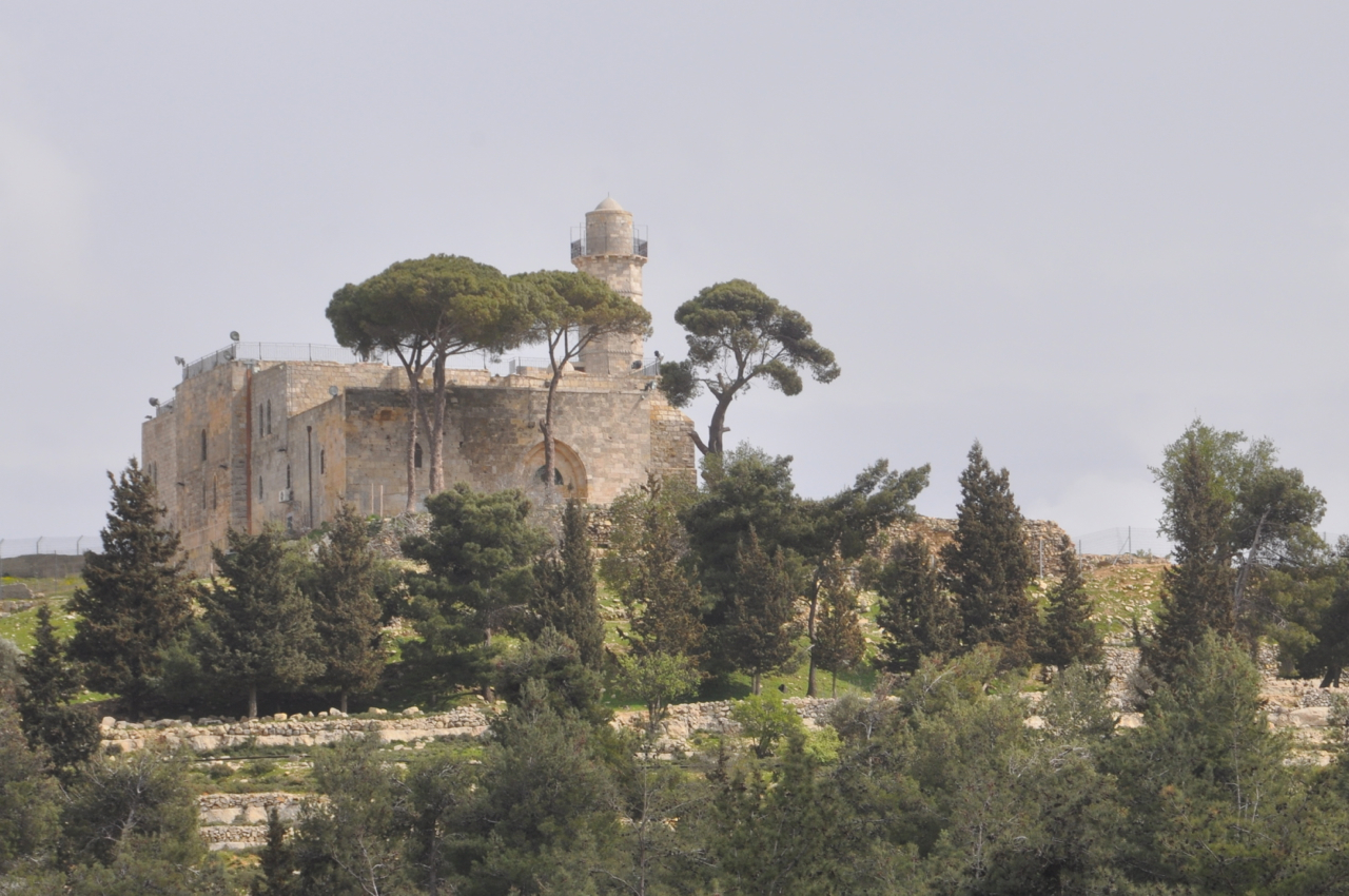
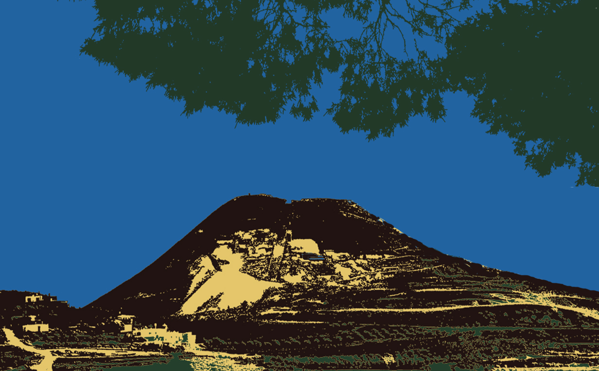
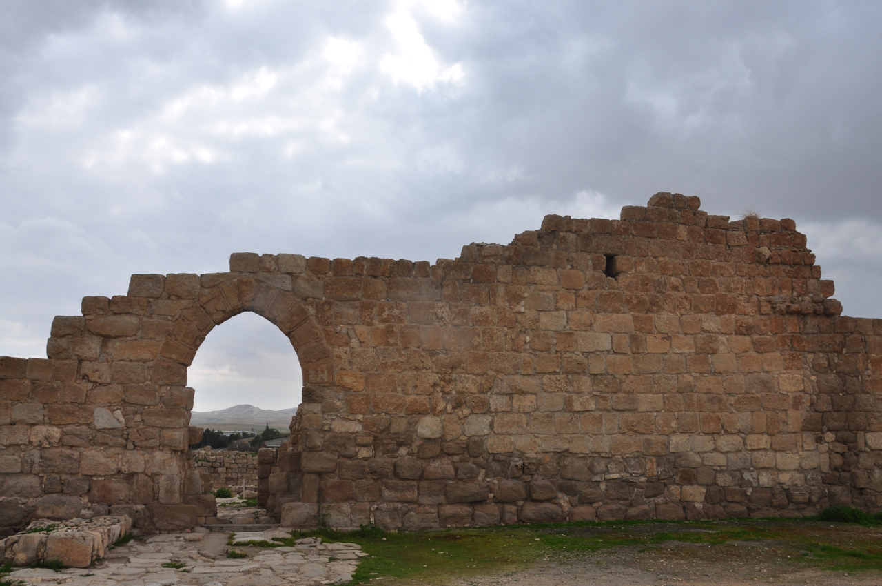
Herod the Great: The King’s Final Journey exhibit at the Israel Museum is an exceptional opportunity to encounter the material opus of Herod the Great – his architecture and aesthetics, and the work of his chief archaeologist, Professor Ehud Netzer. Evidence of Herod, the meaning, struggles, and accomplishments of his life beckon beyond the exhibit halls, to the sites where he fought, ruled, dreamed, and built – Herodium, Masada, CyprosSebasteCaesarea, Banias and Omrit

Herodium-4colourFor those who will be in Israel, I am leading in-depth full-day tours of Herodium and the Israel Museum’s Herod exhibit, for details see https://israeltours.wordpress.com/herod-the-great-tour

For those who will not be able to visit Israel, I posted a few articles with photos of the exhibit.
Here are the links to check for photos:

The Israel museum has published a 277 page hardcover catalog of the exhibit. You can order a copy by sending an email to shop at imj.org.il
ARIEL has released volume 201-200 Art and Architecture in Jerusalem and Israel in the Second Temple Period (in Hebrew) in memory of Prof. Ehud Netzer.

From the pantry at Herod’s palace-fortress at Masada, amphorae – large clay jars that held imported delicacies – attest to the luxury and sophistication of Herod’s palate: apples, honey, fine wine, and garum, a savory Roman fish sauce. One amphora bears an inscription of Herod’s name in Latin and Greek. For more about garum, https://israeltours.wordpress.com/2010/11/25/food-discoveries-masada-garum/

Film documentary: Volunteers with military experience, many from America, came to Israel around 1947 to help the fledgling Jewish state. Their acronym, Mahal (MH”L}, stands for מתנדבי חוץ לארץ. The 3 large Hebrew letters, מח’’לֹ, stand as a monument at Sha’ar Hagai, on the road to Jerusalem. Playmount Productions has released a sample from their upcoming documentary Above and Beyond: The Birth of the Israeli Air Force.

Emek Habacha project: Estimated at €250 million to install 50 130 meter tall (height of the Azrielli Towers in Tel Aviv) wind turbines able to produce 120 megawatts has received approval. These will replace the 10 wind turbines that produce 6 megawatts at Tel Asania. I blogged about the old wind turbines in May 2011 at https://israeltours.wordpress.com/2011/05/02/wind-turbines-on-golan-trail/

Euthemius, Judean Desert Monastery

The history of the third monastery of Euthemius, which bears his name, illustrates the history of Christian monasticism in the Judean desert. Young monks were drawn to the holy Euthemius and the monastery became the most important and central among the Byzantine monasteries in the 5th century CE.

Northern wall Euthemius

Euthemius came to the Holy Land as a pilgrim in 406 from Armenia and stayed at the laura of Faran, founded by the monk Chariton at Wadi Qelt. A laura is a cluster of caves or cells where monks live in seclusion and meditation. They gathered centrally once a week, generally on Sunday, for prayer. After five years, he and a fellow hermit, Theoktistus, moved to a cave on the cliffs of Nahal Og. With additional monks attracted to Euthemius, the site became the first coenobium in the Judean desert. A coenobium is a communal monastery where the monks live together with a strict daily schedule of work and prayer, a walled complex that consists of living quarters, refectory and church.

Inside Euthemius monasteryTo continue in solitude, Euthemius and a fellow hermit, left the monastery and moved to the ruins of Masada. In 428 CE he returned to the monastery of Theoktistus but preferring solitude went to live in a cave to the west of the monastery off the main Jericho-Jerusalem road. When other monks joined him, it grew into a laura. In 475, after a full life, Euthemius died at the age of 97.  After his death, the laura became a coenobium and a crypt was built in the center of the monastery around the same cave where the monastery had begun and his bones re-interred there. Pilgrims came to visit the monastery to pay their respects to Euthemius and a tradition arose to pour wine down a chute to the crypt which poured over his bones – the wine was collected as a keepsake.

By the end of the fifth century many important monasteries were established, including Mar Saba, Martyrius, Gerasimus and St. George – all of which can be visited on a tour of monasteries in the northern Judean desert, also called the desert of Jerusalem because of its proximity to Jerusalem and Bethlehem.

Unlike most Christian sites, the monastery was not damaged by the Islamic conquest of 638. However, it was severely damaged in the 659 earthquake – the ruins of the church that we see today are from after the earthquake, the mosaic floor is from the Byzantine period.

Mosaic floorThe monasteries in the Judean desert were frequently attacked during the Islamic period and in 809 the monastery was plundered and destroyed in the 12th century. The main arched gate on the northern wall and the eastern wall and the opus sectile floor in the church are from the Crusader period.

Crusader opus sectileThe other important aspect of the Judean desert monasteries are their water systems, for little rainfall falls in the region and water had to be accumulated or it would be impossible to live there. Four tremendous cisterns were discovered in the monastery. You can enter the largest one (12 meters by 18 meters and 12 meters deep that would hold 3000 cubic meters) which is outside the eastern wall. Channels bring water from runoff to a collecting pool and then to the covered cistern.

Large cistern Euthemius