Tag Archives: Judean desert

Hiking Nahal Og

This is a real gem of a hike. Nahal Og is less than a half hour from Jerusalem in the Judean desert. It’s picturesque in a rugged, desert kind of way so it’s a good opportunity for taking photographs of the scenery and of course your family/group.

You might find that parts of the hike are challenging but this is a hike that is doable by parents and kids. There are three places where metal rungs have been hammered into the rock to give you hand and foot holds to help you traverse the steep rock faces. In the winter months there will be parts of the trail that have filled with water that you will have to cross.

The trail is a loop so you end back where you parked your car and in fact, you can do the trail in either direction, depending on whether you want to ascend or descend the rungs. Most people find that climbing up the rungs is easier than going down. The hike itself should take you about two hours.


To fill out your day combine the hike with one of the many other attractions in the area, the mosaics at the Inn of the Good Samaritan, St George’s monastery in Wadi Qelt, the archaeological site at Qumran, a float in the Dead Sea.

Hiking Nahal Dragot

Driving along the shore of the Dead Sea on our way to Masada and Ein Gedi, I usually point out the cutoff to Nahal Dragot – there are some great hikes here if you are up to the challenge. In fact, Nahal Darga as it is also called, is a kind of test for Israelis.

Nahal Dragot

From the center at Metzukei Dragot, there is an unpaved road (if you were to continue north you could go as far as Herodium), take the turn to a lookout point with a great view of the canyon, the deepest part of Nahal Darga and a hint of what awaits.

IMG_1055

Returning to the main road and continuing westward we come to the start of the black trail. From there it is a short hike to the Murabat Caves, 3 caves, side by side on the northern cliff. It was here that letters signed Bar Kosiba were found, evidence that the mythical leader of the Bar Kochba Revolt against the Romans in 132-135CE did in fact exist.

Letter of Shimeon bar Kosiba to Yehonathan, son of Be’ayan:
Peace! My order is that whatever Elisha tells you, do to him and help him and those with him. Be well.

From here it’s about a 150 m. descent to the start of the canyon. It will take 4-6 hours (4 km) to hike this part of the narrow canyon with more than 50 meter high walls, dry waterfalls and pools of water in natural craters (note there are places you will have to swim across). At the end of the hike the wadi widens and crosses highway <90> about 1½ km from the Mezuke Dragot cutoff, estimate that to complete the hike will take a full day. There are metal D-shaped rings hammered into the rock in places to help you on the descents but it’s probably also worth having at least 20m. of rope. A guide is recommended.


Amitai in Nahal Darga, photos AdirChai Haberman-Browns, used with permission.

You should also read this article http://www.jpost.com/Travel/AroundIsrael/Article.aspx?id=135713

Tour of Herodium and Herod’s Tomb

herodium mountain top palace fortress panorama

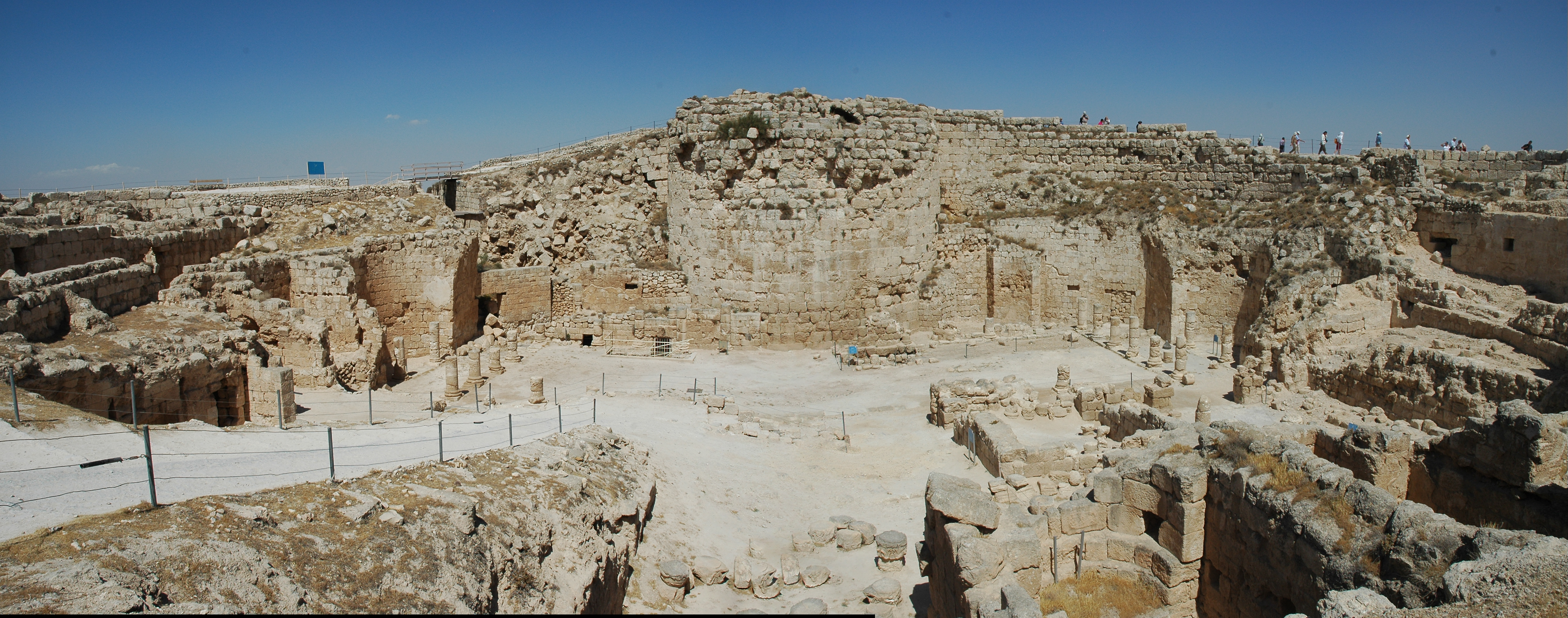
Panoramic view looking down into Herod’s palace-fortress

A guided tour of an archaeological site like Herodium can be a unique birthday present for a friend or family member. It was a hot and sunny day but there was a cool breeze on the mountaintop and you could understand one reason why Herod would have chosen this site.

When I guide Herodium I often start in the Old City to show people the remains of the buildings at the Wohl museum and the stones of the walls and streets from the Herodion period along the western wall below Robinson’s Arch. Also, the Herodion stones forming the base of the tower at the Roman Gate are impressive. Seeing examples of Herod’s architecture help people know what to look for when we get to Herodium.

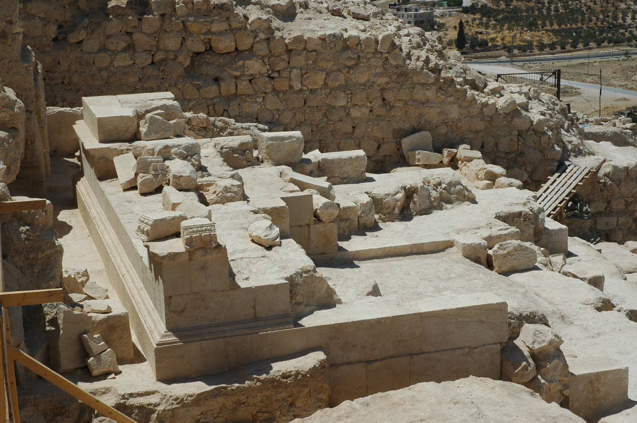
Last summer, I participated for a few days in the latest excavations that Ehud Netzer is leading on the eastern side of the mountain, excavating the tomb area. We were working on the pool and besides many pottery shards we found some catapult stones (size of snowballs, not to be confused with the larger ones rolled down from the walls by the Jewish rebels) and some coins from the Great Revolt.

Excavations are continuing and they’ve excavated a much larger area now. More of the base of the mausoleum is now exposed. Additional stone architectural details of a very high quality can be seen. These are not of the local soft limestone but a more royal stone, called meleke, that would have been quarried some distance away and brought here. Netzer thinks that the base supported a nefesh or monument, cylindrical in shape, something like Yad Avshalom in the Kidron Valley.

Tomb area at Herodium
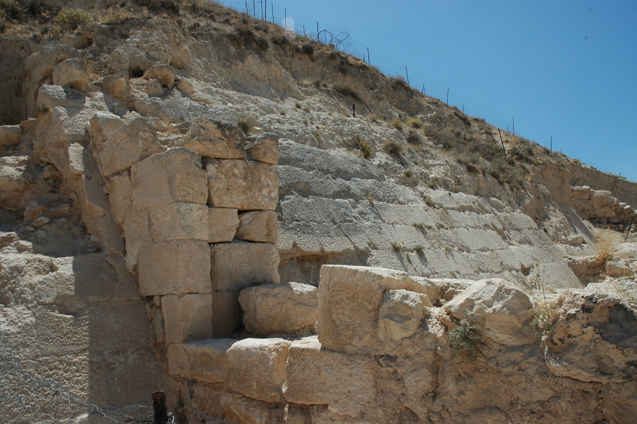
The latest findings are changing our understanding of Herodium. For example, it seems that the earth that was piled up around the mountain palace/fortress is not from the time of Herod but later. Originally, there was a glacis, a sloping wall, that circumvented the mountain.

Glacis at Herodium

Also, the archaeological evidence suggests that the staircase that is described by Josephus “and provided an easy ascent by two hundred steps of the purest white marble” was built later, that originally there was a “snake path” like at Masada. Archaeologists are left with some interesting unanswered questions: When was it done, why and by whom?

I’ve uploaded additional photographs of Herodium to Flickr at http://www.flickr.com/photos/27944012@N06/sets/72157615671440473/