Category Archives: Wildflowers

Sternbergia on my mind

At this time of year I can’t help noticing that the season is changing, we’re on the cusp from Israel’s hot and dry summer to cooler weather and autumn rains (I have even had to start wearing socks). Plants also notice this change. One small flowering plant, with bright yellow flowers (Sternbergia clusiana, חלמונית, from the same Hebrew root as egg yolk) has also noticed the change and pushes a small shoot up through the dry earth and using all its pent up energy blooms. If you know where to go you can see them. One place is the nahal, a dry stream bed, just down from Maale Rehavam, a small Jewish village established in 2001 on land belonging to Nokdim (another settlement in the Gush Etzion area of the West Bank) tucked behind Herodium.

Though Sternbergia looks like crocus they belong to the daffodil family, and are not related to the saffron and crocus that bloom after the first rains. If you are interested in hiking to see and/or photograph wildflowers in Israel I would be happy to take you.

Khirbet Hanut Mosaic Vandalized

When you hire me as your guide I can take you places and show you things you probably won’t find on your own. Out of Jerusalem along highway 375 is the shell of a small stone building where the floor is covered with sand.

The site is from the Byzantine period, the ruins of a monastery with a mosaic floor including an inscription in Greek dated to 563CE. To see it, all you have to do is sweep aside the sand covering the mosaic – a simple way to protect it.

Image

Unfortunately, because the location is accessible somebody took advantage and two days ago badly damaged the mosaic. According to the report in YNet Israel Antiquities Authority staff collected 23 bags full of the scattered stone cubes (tesserae) from the mosaic. I had even driven by the site on two different days last week on my way to photograph a field covered with thousands of red poppies and had thought to stop and take photographs but didn’t.

So these photographs are from a few years ago and I post them here so there is a record and you can see parts of the mosaic. It is terrible when something like this happens.

Good news. The site has been repaired and here are some photographs.

Khirbet Hanut is not far from Khirbet Midras where the stunning mosaics uncovered in a Byzantine church were vandalized just over a year ago. I posted photographs of those mosaics in my article Khirbet Midras Mosaics.

Hiking Nahal Mikhmas

On Monday we drove out of Jerusalem on highway 437 past Pisgat Zeev to get to the starting point of our hike in the northern Judean desert. On the way, about 5km north of Jerusalem on the left along the watershed ridge at 839m above sea level is Gibeah (of Saul) or Givat Shaul usually pointed out as the location, Tel el-Ful, where King Hussein of Jordan began construction of his Royal Palace in the 1960s.

The site has a number of important Biblical/historical references:

• The Concubine of Gibeah, and the ensuing Battle of Gibeah between the Israelite tribes against Benjamin (Judges 19-21)

• Israel’s first king, Saul, reigned from Gibeah for 38 years (1 Samuel 8-31)

• Prophetic mention during the period of the Divided Kingdom (Hosea 5:8, 9:9, 10:9; Isaiah 10:29)

• The encampment of the 10th Roman Legion in their assault on Jerusalem in 70CE (Josephus, War of the Jews)

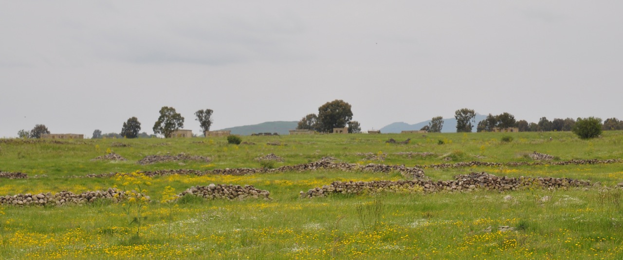
Just before we arrived at our destination on the right we passed another site, Qubur Bani Israel (Tombs of Children of Israel), 4 large narrow rectangular walled structures measuring 15 by 3 meters which rise from a rocky plateau overlooking Wadi Qelt. The megaliths still have two or three rows of gigantic, rough-hewn stones carefully in place. The name refers to the site being an ancient Jewish burial ground in the territory of Benjamin; archaeologists estimate the date as 2000BCE. A theory proposed by Noga Reuveni (who also established the biblical gardens of Neot Kedumim) is that in fact this site marks the tomb of Rachel who was buried “on the road to Efrat, now Bet Lehem (Bereishit 35:19)”. There is a city Farah settled near the spring Ein Farah that is mentioned among the cities of Binyamin (Joshua 18:23) and it is not unreasonable to posit that it was alternatively called Efrat (same Hebrew root). Since the city was in an area of wheat and barley, it was later renamed (like other cities) Bet Lehem. This also matches the description to Saul before his return home to Gibeah.

When you leave me today, you will meet two men near the tomb of Rachel in the territory of Benjamin (1 Sam. 10:2)

This should have been a clue that this was not going to be just a nature hike.

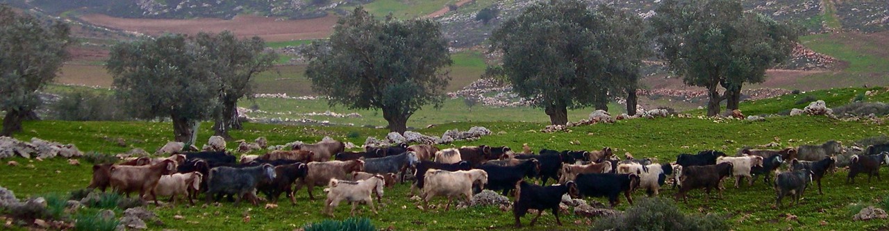
We started hiking from Geva Binyamin, also called Adam. Because the area is in Judea and Shomron/the West Bank we had to arrange clearance with the army and get the security officer to open the gate from the settlement. Geva Binyamin was founded in 1984 and in 2007 had a population of 3500 people. It sits between the Arab towns of Jabah and Mikhmus that recall the towns of Geva and Mikhmas mentioned in the Bible.

Open a TaNaKh and read 1 Samuel, chapters 13 and 14 for the account of the battle between King Saul and his son Jonathan against the Philistines. The Israelite forces are camped at Geva and the Philistines are on Mikhmas with the wadi separating them. Jonathan sneaks out of the camp at night and hidden by the deep walls of the canyon makes his way to the Philistine garrison… We were standing on the ridge reading the account of the battle, overlooking the area where it took place.

The black trail follows the ridge above Nahal Mikhmas. Hidden among a pile of rocks is the spring of Ein Suweinit. Many caves can be seen and we stopped at two of them, El-Jai is one of the largest in the Shomron.

From there we descended the steep cliff to the nahal, actually quite challenging because of the slippery rocks and mud.

Because of the rains we saw two flowers, the tiny purple Grape Hyacinth, in Hebrew, Kadan and bunches of white Desert Bulbs, Bezalziya.

Dark Grape Hyacinth (Muscari commutatum), also bulb, cluster of tiny flowers like jugs that hang upside down to protect the pollen from rain.

A rosette of grey-green leaves emerges before the flowers, 6 petals with a stamen on each, blooms for 5-6 weeks which is long for bulbs, grows among rocks to protect the bulbs from being dug up by porcupines and other animals.

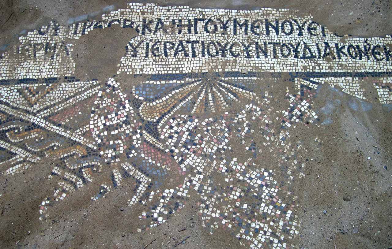
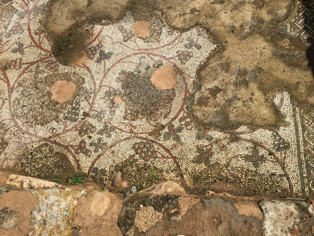
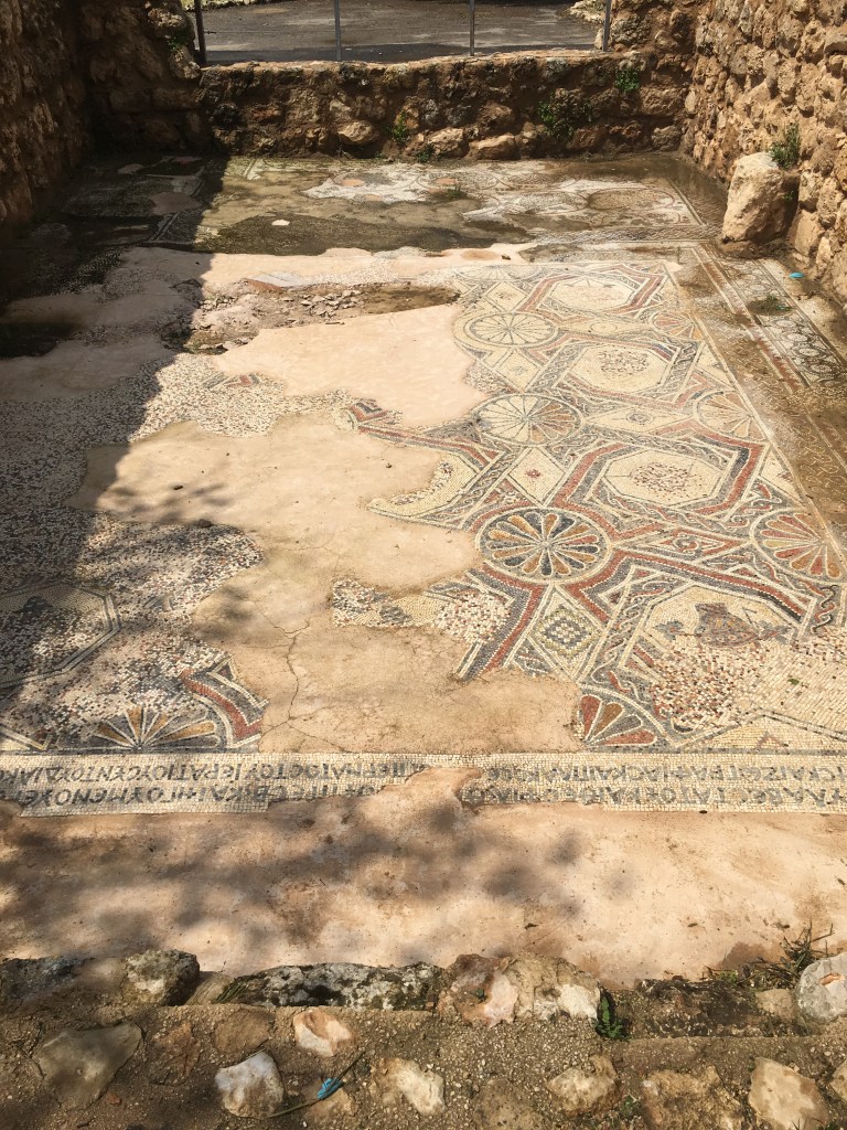
Where Nahal Mikhmas joins Wadi Qelt the trail changes to red and we followed it to the left/east to Ein Mabu’a/Ein Fawwar. This spring is an artesian or karstic fountain, which flows from a cave into a round concrete pool built by the British in the 1920s. Until the Six Day War, the water was pumped to East Jerusalem, but today it is no longer used. In the Second Temple period an aqueduct brought water to the fortress at Cypros and there is a mosaic floor from a Byzantine church. If mosaics interest you then visit the nearby museum at Inn of the Good Samaritan.

Wind Turbines on Golan Trail

Whenever I spend some time on the Golan I am struck by its quiet expansiveness (compared to other parts of Israel). This time over the Passover holiday it was especially beautiful, everything was so green and the fields were covered with early wheat and wildflowers, poppy, lupine, asphodel, daisy, mustard, clover and some I had never seen.


The Golan trail is a 130km trail that snakes along from Mount Hermon in the north at an altitude of 1500 meters above sea level to the Taufik spring above Hamat Gader. I went up to hike 3 days of the Golan Trail from Har Bental to Alonei HaBashan and from there to Faraj intersection. On the first day we could see the snow-capped Hermon to the north and the Sea of Galilee below us to the south.

Unfortunately the third day to Nahal Daliyot and Rujm el-Hiri was cancelled due to inclement weather. These couple of days hiking were the closing parenthesis of the 8 days I hiked from Eilat in March.

The Golan Trail goes by and then climbs a hill, the Bashan ridge on which 10 wind turbines, 30 meters high were installed in 1992. When I went by only 5 were working, producing about 3 megawatts of electricity that is used by the Mey Eden and Golan Heights winery and some 20,000 residents of the Golan in 32 settlements.

Plans have been in place for 150 new, larger wind turbines to be installed over an area of 140 square kilometers of the northern Golan that would cost about $500 million and produce 400 megawatts of electricity, enough to power the entire eastern Galilee. A company has been established to build a wind farm in the northern Golan, in the valley known as the Vale of Tears with investments in place amounting to some $120 million. The Golan has some of the strongest levels of wind energy in the entire region but there are problems. One is that such a large number of tall (80 meters high) wind turbines could be hazardous to the migratory birds that pass over the Golan in the thousands. Also, photovoltaic panels have become more efficient and less expensive. Individuals and companies can install the panels and the electric company buys the electricity generated at 4 times the current rate. So far, some 150 photovoltaic systems have been installed generating 7 megawatts of electricity with another 200 installations approved.

Golan landscape

Desert Wildflowers

If you are going to be in the south of Israel, there is a nice hike from the Timna valley through Nahal Mangan climbing onto the Milhan ridge; from there you can descend and camp at the Milhan well. This area gets less than 100mm of rain per year but in March we saw a lot of plants in bloom for a desert.

The Silon Kotzani (Zilla spinosa) is a perennial but only lives a couple of years dying from drought or flash floods. The plant grows into a sphere of stems and thorns that is typical of thorny plants in the desert. The peak of its flowering is March, afterwards it dries up. The small purple flowers are edible and have a mild cabbage taste. When dry the stems of the bush can be used as kindling to start your campfire.

The White Broom, Rotem HaMidbar (Retama raetam) was blossoming, bunches of small, delicate white flowers. This is the bush under which the prophet Elijah sat.

But he went a day’s journey into the wilderness, and came and sat down under a broom-bush. Kings I 19, 4

The Broomrape, Yahnuk HaMidbar (Cistanche tubulosa) is a parasite that grows on and gets its nourishment from the roots of other plants. There are no leaves, just a spike of yellow flowers.

Parosheet Galonit (Pulicaria desertorum) is a low-lying plant with yellow flowers that grows in desert areas. The leaves and flowers can be used to make tea, the plant has a pleasant scent.

Lotus HaMidbar, Desert Lotus (Lotus lanuginosus) is a low-lying perennial with small red flowers that grows in desert areas.

Fagonia Rakah (Fagonia mollis) is one of the typical and most widespread plants that grows in the desert.

For other posts about wildflowers click on “Wildflowers”  under Categories in the right hand column or https://israeltours.wordpress.com/category/wildflowers/

Jewish Hirbet Midras

About 45km south of Jerusalem in the Ella valley, where David fought Goliath, are the ruins of an ancient agricultural settlement beginning in Iron age II, Hirbet Midras. With the recent discovery of a Byzantine church thought to be the burial place of the prophet Zechariah* people may lose sight of the fact that the site also contained a large, important Jewish settlement that dates from the Second Temple period (3rd century BCE) until its destruction during the Bar Kokhba uprising.

The site is part of a JNF park and nature reserve covering about 5000 dunam with typical Mediterranean woodlands, Kermes oak, Atlantic pistachio, terebinth and buckthorn. When I visited there were pink cyclamen (rakafot רקפות), red anemones (kalaniot כלניות) and Common Asphodel in bloom. With the recent rains, hyssop (zatar) had come up.

There were also many clumps of mandrakes (dudaim) in bloom, the fruit, which is reported in the Bible to be an aphrodisiac, will be ready late summer, at the time of the wheat harvest.

וַיֵּלֶךְ רְאוּבֵן בִּימֵי קְצִיר-חִטִּים, וַיִּמְצָא דוּדָאִים בַּשָּׂדֶה, וַיָּבֵא אֹתָם, אֶל-לֵאָה אִמּוֹ; וַתֹּאמֶר רָחֵל, אֶל-לֵאָה, תְּנִי-נָא לִי, מִדּוּדָאֵי בְּנֵךְ

Reuven went out and found mandrakes in the field and brought them to his mother, Leah. Then Rachel said to Leah, “Give me, I pray thee, of your son’s mandrakes”.  Genesis 30:14

Among the remains at the site are various buildings, agricultural installations and an extensive complex of caves and tunnels, including a columbarium and tombs.

Cut out of the soft limestone is a bell cave with square and triangular niches carved in the walls that was used as a columbarium (dovecote). The pigeons were raised for food and the dung used as fertilizer. Other bell caves were used for storage and hiding during the Bar Kokhba revolt – a collection of chambers were quarried and connected to each other by tunnels. For those who like spelunking you can walk and crawl (about 20 minutes and you’ll need a flashlight and a map) from the bell cave through a circular maze of tunnels through some dozen chambers that takes you back to where you started.

At the top of the hill with a great view of the coastal plain is a stepped, pyramid-shaped structure of dressed stone, the only one of its kind in Israel. The base is about 10 meters and the present height is 3.5 meters but 3 rows of stones are missing bringing the original height to 5 meters. This structure is a nefesh or monument marking a Jewish burial cave.

There is a wall of dressed stones up the hill near the stepped pyramid and nearby part of a niche which leads scholars to identify the building as a 4th century synagogue.

On the way back down you will pass a system of subterranean burial chambers cut in the limestone. The original opening of the cave was from a square patio, the tomb opening was sealed by a large stone disc that rolled on a track in the rock.

Nearby on the western side of highway 38 is a site with Roman milestones from the third century CE, from the days of Marcus Aurelius, with inscriptions of one of the caesars names (Septimius Severus) and his achievements.


*According to Jewish and some Christian traditions the burial place of Zechariah, along with Hagai and Malachi, the last three Hebrew prophets who are believed to have lived during the 5th-6th centuries BCE is in a large catacomb on the Mount of Olives (31.783333°N 35.250833°E). Archaeological research shows that the complex dates from the 1st century BCE, when this style of tombs came into use for Jewish burial. Some Greek inscriptions discovered at the site suggest the cave was re-used to bury Christians during the 4th and 5th centuries CE.