Category Archives: Water

Agamon Hula Lake

I just guided a group in the north of Israel and can report that Agamon Lake received rave reviews. Matt, steering the 7-cycle that we rented, said “This is the greatest day in my life”. Aunt Ruth who had just come from the birding festival in Eilat helped us identify the many birds that we saw. Some of the younger at heart rode bicycles, the older people drove in an electric golf cart (all available for rental at the site).

Matt steering the 7-cycle, photo Steven Browns

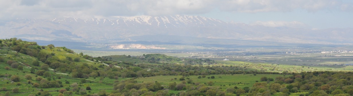
Agamon Lake is in the Hula Valley (עמק החולה‎, Emek HaHula) an agricultural area in northern Israel in the Syrian-African Rift Valley with abundant fresh water. The Hula is bordered on the east by the Golan Heights and to the west by the Naftali mountains rising 400 to 900 meters above sea level. Basalt hills about 200 meters above sea level formed during late Pleistocene volcanic activity along the southern side of the valley impede the Jordan River flowing into the Sea of Galilee, referred to as the basalt “plug” formed the historic Hula Lake about 20,000 years ago and the surrounding wetlands. It is an important route for birds migrating between Africa, Europe, and Asia.

The Hula Lake existed until the 1950s, a shallow, pear-shaped basin 5.3 kilometers long and 4.4 kilometers wide, extending over 12-14 km². It probably contained the richest diversity of aquatic life in the Middle East (south of Lake Amiq, Turkey which was drained at about the same time as the Hula). Based on research 260 species of insects, 95 crustaceans, 30 snails and clams, 21 fishes, 7 amphibians and reptiles, 131 birds and 3 mammals were noted.

Between 1951 and 1958 draining operations were carried out by the Jewish National Fund (JNF). The declared objectives of the Hula draining project were two-fold: the addition of arable land and the eradication of malaria; additional perceived benefits were more water (by reducing evaporation losses) and peat as fertilizer. Hula Lake was drained by deepening and widening of the Jordan River downstream and digging two peripheral canals diverting the Jordan at the north of the valley (to bypass the plug).

In response to environmental concerns a small (3.50 km²) area of recreated papyrus swampland in the southwest of the valley was set aside and in 1963 became Israel’s first nature reserve.

Unfortunately, what originally seemed like a good idea over time created severe agricultural and ecological problems due to peat sediment degradation: uncontrollable underground fires, formation of dangerous caverns within the peat, proliferation of field mice, release of nitrates and sulfates into the Kinneret, 119 animal species were lost to the region, 37 totally lost from Israel, many freshwater plant species became extinct. So from 1980 to 1994 under the auspices of the JNF a program for the Hula’s rehabilitation was inaugurated.

In 1994 a small area in the southern part of the Hula Valley, in the area that once served as the transition between the original Lake Hula and the surrounding swamps was reflooded to create Agamon HaHula (אגמון החולה‎, literally: “Little Hula Lake”).  It has an irregular shape, covering an area of 1 km², several smaller islands were created in the middle of the lake to provide protected nesting sites for birds. At least 120 species of birds have been recorded in or around the lake including large flocks of migratory pelicans, storks, cormorants, cranes, and other birds en route between Europe and Africa that spend days to weeks in the vicinity of Agamon HaHula. Also, new nesting colonies of various species such as herons and plovers have been established. As well, water buffalo and donkeys have been introduced and a small furry rodent called a nutria (also called a coypu), which was brought to Israel from South America for its fur, has made its home here.

You can check out the Agamon website at http://www.agamon-hula.co.il/

7-cycle, photo Steven Browns


Nahal Saar

Just 4 km from Nimrod fortress at the junction of highway <989> with <99> is the Saar waterfall and pool. This photo was taken in November before we had much rain so there was no waterfall – you can see that the pool is very quiet and serene. This is one of the places that I suggest to people who are interested in a tour focussed on photography.

DSC_0153

A couple of weeks later I was touring with a family to the Golan and we stopped at Saar Falls. With the rain the water was now cascading down the rocks in three waterfalls.

Nahal Saar is the divider between the basalt plateau of the Golan and the limestone Mount Hermon. The root of Hermon, hrm, is the same as the Arabic Haram indicating a holy, untouchable or sacred precinct (as in the Haram el-Sharif in Jerusalem).

4–Day Itinerary

I’m happy when people contact me looking for a multi-day itinerary based from Jerusalem. It’s definitely worth a few days if you have the time. I’d like to share one itinerary that I guided for clients a couple of weeks ago. Of course, this itinerary is just to give you the idea – when you hire me as your guide you get a personalized itinerary that matches your interests.

Day 1

  • We started with an overview of Jerusalem from the promenade at Armon HaNatziv, learned about the aquaduct that brought water to the city from Hasmonean times (100 BCE). From there we drove to Herodium for a comprehensive tour: the lower city (pool, Roman bath, monumental building, Byzantine church) outside the park and the palace/fortress on the manmade mountain top built by King Herod including the latest excavation by Netzer of the tomb and Roman theater discovered on the north-east side of the mountain.
  • Visit to Gush Etzion (Etzion Bloc) to learn about the history of the Gush and memorial to the defenders of Kibbutz Kfar Etzion in 1948. Lunch at a lovely restaurant called Gavna in the forest of Kibbutz Massuot Yitzhak with a view all the way to the coastal plain.
  • Visit to Hebron and the Cave of Machpela, that Abraham purchased to bury Sarah in which our forefathers and 3/4 mothers are buried. The building over the cave was built by Herod. Walk around the city to try to understand the current political reality.

Day 2

  • Walking tour of the Old City covering the 4 quarters, the 3 religions and 3000 years of history, including Herodian, Roman, Byzantine, Arab, Crusader periods. Views of the city from above and exploring underground. Tastes of the city for lunch.

Day 3

  • Visit the Israel museum to see the 2nd Temple model of Jerusalem. Tour of the Shrine of the Book, the unique architecture, the exhibits of artifacts from Qumran and the Dead Sea Scrolls.
  • Opportunity to stroll through the Sculpture garden.
  • Visit the City of David, the walled Jebusite city captured by King David in 1004BCE and made the capital of his kingdom. Learn about the extensive archaeology going on there and the politics. Possibility of walking through Hezekiah’s tunnel.

Day 4

  • Drive from Jerusalem to the Dead Sea and Judean desert, the lowest point on earth, only 42 km away but 1170 meters lower. Learn about the African Rift valley, water, shrinking of Dead Sea, sink-holes, flora and fauna.
  • Qumran where the Dead Sea Scrolls were discovered in passing.
  • At Ein Gedi, hike Nahal David to waterfalls and natural pools (it’s delightful to take a dip even in the winter months). Visit the ruins of the Jewish synagogue with mosaic floor.
  • Continue south to Masada, Hasmonean fortress in the desert extensively renovated by Herod, used by the Jewish rebels against the Roman and later by some Byzantine monks. Visit the new museum at Masada.

Nimrod, Golan

The alarm clock went off at 5am Sunday morning. We were to drive our 2 sons, Amitai and AdirChai and his friend Ariel, from Jerusalem to the Hermon to hike the Golan Trail. We had 2 days to explore the area.

Day 1: Nimrod
After seeing the boys off, we drove to Nimrod, just 5 families on the southern slope of the Hermon and at 1110 meters above sea level, the highest settlement in Israel.  There is a great view of Birkat Ram to the south-east and the Nimrod fortress to the west. As you enter, there’s a blue boxy concrete building, a gallery of paintings by Diego Goldfarb and next to it a restaurant (not kosher) called the Witch and the Milkman. They carry artisan cheeses from the HaNoked Dairy and give tastes. We bought two cheeses, a hard Tome style (French) goat cheese treated with red wine and a Manchego like (Spanish) sheep’s cheese treated with Chardonnay to go with the crackers I had made (I think I’m the only tour guide who bakes homemade organic whole wheat crackers to share with my clients).

DSC_0124

From there we drove 8 km to the Nimrod fortress off of highway <989>, part of the Parks Authority with an entrance fee of 20 NIS per person.  The fortress controlled one of the main roads that ran from Tyre to Damascus. It was built around 1229 by the Ayyubid ruler Al-Aziz Uthman, nephew of Salah ad-Din. Later additions by the Mameluk sultan Baybars in 1260 (actually his second in command Bilik) are commemorated by a large, beautifully carved inscription in Arabic.

DSC_0071.JPG

Also found was a stone relief of a very cute looking lion, the symbol of Baybars.

DSC_0128

The fortress is the largest in Israel and includes a large water cistern and a donjon (keep), surrounded by a moat, probably the two most important things against a siege.

There are 2 incredible things about this fortress that I experienced when I visited it for the first time on the guide course:

  1. I took this photo of the arch above the entrance to the northwest tower where a number of stones have slipped due to an earthquake in 1759 and are hanging suspended to this day.
    DSC_0075.JPG
  2. Nearby is the vaulted stairway  of the secret tunnel. I noticed that it was quite damp and in looking up I saw stalactites growing from the ceiling and I understood that since the fortress is built of limestone from the Hermon (as opposed to the basalt of the Golan) the water seeping through is dissolving the limestone blocks just like in a natural cave.
    DSC_0142

Hiking Nahal Yehudia

Day 2: Hiking Nahal Yehudia
After a breakfast of fruit and homemade granola we drove to Nahal Yehudia off highway <87>. The hike is listed as appropriate for good hikers who can swim as there are a couple of places where you have to climb down the rock face with the help of handholds or a ladder into a deep pool that you have to swim across. The trail is one of eleven listed in the Park’s brochure on the Yehudia Forest Reserve, including Nahal Zavitan, the Meshushim (hexagonal basalt pillars) pool and Gamla which includes the archaeological remains of the Jewish town that fought against Vespasian at the start of the Jewish Revolt in 66CE and Griffon vultures that can be seen flying overhead. There is parking, bathrooms, drinking water, a snack bar and information center (the park warden we spoke to was very helpful); the entrance fee was 20 NIS per person. Note that you must start out on the trail by noon.

DSC_0161

The hike starts above the wadi, walking through a deserted Syrian village built on the remains of an earlier Jewish one of basalt field stones from the Roman-Byzantine period. Remains of a wall have led archaeologists to suggest that Yehudia is Soganey, one of the three fortresses (the other two are Gamla and Sele’ukya) in the Golan built by Josephus at the time of the Roman Revolt. You walk on a path strewn with basalt, by pasture land where you may see cattle grazing.

DSC_0171

Then you walk down into the wadi to the Yehudia Falls and the first pool, good for a cool dip especially if it’s a hot day.

DSC_0177

At this point we changed out of our hiking boots and into water sandals as there are places where you walk in the water. Continuing along the wadi you get to the first descent. U-shaped handholds have been attached to the rock to help you get down about 4 meters. This is just your warm up. The trail brings you to a cliff where you descend 9 meters by metal ladder into a pool. There is no place to stand, you step off the bottom rung of the ladder and swim across to the other side of the pool.

DSC_0184

The challenge is what to do to keep your gear dry (and in this day and age with cell phones, cameras, car keys with electronic locks, etc. we have stuff that won’t work if it gets wet). We used the double garbage bag technique but also saw a group float their packs across on a small inflatable boat, you can rig up a rope and omega your pack across or probably safest, pack in professional waterproof bags used for kayaking.

After traversing the pool you come to another descent, this time about 4 meters with only handholds. At the bottom you have the option of swimming or walking across the pool as it isn’t that deep. Be careful as it is slippery walking on the rocks. The water can be quite cold so it’s great that there is a place in the sun to sit on some large rocks and have a snack.

DSC_0182

Using the 2 large plastic bags that we had brought for our packs, we picked up a bunch of garbage that we carried out with us. We continued along the wadi, sometimes walking on the rocks, sometimes in the water. At the well marked junction you can leave the red trail to take the green back to the Syrian village or continue  along the wadi a bit further to one last pool and waterfall. Then we backtracked and took the green trail up out of the wadi, back to the Syrian village and the trail head. It was just the middle of November but there were already cyclamen and narcissus in bloom.

You can view a fuller set of photographs from this Golan trip on Flickr at http://www.flickr.com/photos/27944012@N06/sets/72157622790431204/

The Dead Sea

Driving on highway 90 from Jerusalem down to the Dead Sea takes half an hour as you descend from more than 700 meters above sea level to 400 meters below sea level. The Dead Sea is situated at the lowest point on earth, in the Great Rift valley that runs from Turkey in the north to Mozambique in the south, in the crack in the earth’s crust created when Asia and Africa were torn apart five million years ago. Originally it was an ancient larger sea connected to the Mediterranean when water flowed across the Jezreel valley and Jordan River to fill the rift. Although it has no outlet, evaporation in the hot Judean desert reaches 25 mm per day in the summer so in four days it loses the equivalent of the annual rainfall. When the amount of water flowing into the Dead Sea from the Jordan River was equal to the amount lost to evaporation, 1.2 billion cubic meters, the level stayed in equilibrium. Today the Dead Sea is receding at the alarming rate of one meter a year as Israel and Jordan divert the waters flowing into it. The sea is still 1100 meters deep at the northern end so it isn’t going to disappear tomorrow but it is a serious problem that needs to be addressed.

Hilton, Dead Sea

At Lido junction at the northern end of the Dead Sea I often stop to show people the replica of a Crusader map painted on the curved walls of what was a fancy Jordanian restaurant on the shores of the Dead Sea. The artwork was done in March 1973 by Kohavi, who served like me as a reserve soldier at the nearby “Hilton” hotel, now an Israeli army base. Here you can see the trickle that is the Jordan River today flowing into the Dead Sea.Jordan River flowing into Dead Sea

Continuing south along highway 90 we’ll pass some private beaches on your left where you can float in the salty water of the Dead Sea and cover yourself in mineral rich mud. The mud contains magnesium, potassium, sodium, bromide and calcium, all beneficial to our skin; in fact, as the mud dries it even draws out toxins from your skin.

On your right we’ll pass Qumran where the Dead Sea scrolls were discovered in the nearby caves. At that time, Qumran was a land terminal, you couldn’t continue southward except by boat. The Dead Sea was an important transportation route because even heavily-laden barges would float easily (the Madaba mosaic map shows 2 such boats carrying salt and grain). On your left is En Feshka (also called Einot Tsukim). Excavations were carried out here in 1958 by de Vaux (when he was excavating Qumran) and in 2001 by Hirshfeld. The concensus is that this was a farm that prepared balsam perfume. Today it is a nature reserve, 1500 dunam of which has restricted access and can only be visited with an authorized guide like me.

Just before we reach En Feshka look up on the cliffs to your right for the PEF markings, 2 black horizontal lines drawn in 1900 and 1927 by members of the Palestine Exploration Fund and the letters PEF in red. To help you understand how much the Dead Sea has receded these lines were painted from a boat floating on the Dead Sea in the 1900s.

East of the main highway (on your left) we’ll see a few sinkholes and more across from Ein Gedi. As the Dead Sea recedes fresh water from runoff dissolves the salt in the newly uncovered salt-laden earth creating an empty cavern. When the top crust of earth collapses a sinkhole is formed. More than a 1000 sinkholes have appeared on the Israeli and Jordanian coasts of the Dead Sea in the past 15 years. The holes fill up with water and the naturally occurring minerals create pools of orange, yellow, green and indigo with borders of encrusted salt, incredible to see. I’ve taken a series of photographs of sinkholes that you can see on my Flickr site http://www.flickr.com/photos/27944012@N06/sets/72157621040678204/

Sinkholes at Dead Sea © Shmuel Browns