Author Archives: Shmuel Browns

Unknown's avatar

About Shmuel Browns

I am a tour guide, licensed by the Israel Ministry of Tourism. I do tours throughout Israel, personalized to your interests, time and budget.

Early Counterfeit Silver Coin

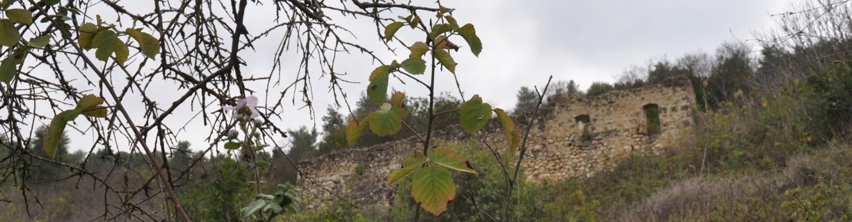
An extensive survey was conducted in preparation for the upcoming Israel-Germany joint excavation at Tel Azekah in the Elah valley this summer. During the survey, among the many pottery shards, a silver Athenian Tetradrachmon coin which was used as universal currency in the 5th and 4th centuries BCE (very much like the dollar or the euro today) was found.

Athenian Tetra Drachma coin, courtesy of IAA

The diameter of the coin is 23 mm, and it is fairly heavy for its size. One side of the coin depicts the profile of Athena, the patron goddess of Athens, and the other depicts an owl, the goddess’ symbol. On closer examination it turns out that the core of the coin is made of bronze which has been covered with silver in order to give the illusion that it is pure silver, in other words what we have here is an early example of a counterfeit coin!

The excavation is an exciting development because digging Azekah, a site that was a major Judahite fortress in the late 8th century, will provide us with new data and help advance new theories about the rise and fall of the Levantine territorial kingdoms of the Biblical Period. This has been the  focus of hot debate. How much archaeological and historical evidence do we have that Judah was a full blown state before the 9th century, in the time of King David and Solomon? See my article on the House of David Stele uncovered in the excavations at Tel Dan. More recent excavations by Garfinkel at Khirbet Qeiyafa has shed some light on this question, demonstrating the slow and gradual process of the monarchy and its expansion from the hill country of Jerusalem to the much more fertile lowlands. BTW, I do a great tour of Khirbet Qeiyafa, a Judean walled town identified as Biblical Shaarayim.

Finding a coin in an archaeological strata enables us to date that layer. If you’re interested in coins check out my post on other coins found in archaeological excavations.

The excavation at Tel Azekah begins July 15th. I’m going to check out working at the dig. Do you want to join me?

First Temple period Seal

First Temple period Seal

Courtesy of Israel Antiquities Authority.

A small stone seal at least 2,600 years old in Paleo-Hebrew script has been found in the continuing excavations of the main drainage channel along the western side of the Temple Mount in Jerusalem the Israel Antiquities Authority announced. The name on the seal is Matanyahu, meaning ”gift of God”, son of but only two letters survived – “Ho”. The seal was found in a structure that dates to the First Temple period – between the end of the 8th century BCE and 586 BCE. No more than two dozen seals this old have been found since excavations began in Jerusalem in the 1800s, according to archaeologist Eli Shukron.

The drainage channel runs from the City of David (you reach it by climbing the stairs from the Siloam pool), under the excavations in the Givati parking lot, under the current street and under the walls of the Old City to the Davidson archaeological park where you exit near Robinson’s Arch. Work is continuing on clearing the drainage channel and   my guess is that they have already passed the Western Wall plaza.

Check out my article on walking the drainage channel. The City of David and Davidson archaeological parks are great sites (there’s a combination ticket) and I’m happy to guide you there.

Model of Herod’s Tomb

I was at Herodium today and took the opportunity to photograph the new smaller than life-size model of Herod’s tomb which has been installed by the path that leads to the palace-fortress. The model was built from drawings by Prof. Ehud Netzer based on the base of the mausoleum uncovered and Netzer’s expertise as both an architect and archaeologist on the Herodian period. Netzer estimates the nefesh as 25 meters high, with a cube-shaped lower level with two rows of decorations below the roof line, a row of egg and dart pattern and below it a row of medallions and vertical bars. On top of this cube sits a cylindrical second level, a tholos with columns and a conical roof. The model shows Nabatean funerary urns in four places along the roof line and the peak of the cone. We found two pieces of stone carved in the egg and dart pattern a few years ago when I volunteered at the dig.

There is also a short video, currently only in Hebrew, that attempts to illustrate the account by Josephus of Herod’s death.

Archelaus omitted nothing of magnificence therein, but brought out all the royal ornaments to augment the pomp of the deceased. There was a bier all of gold, embroidered with precious stones, and a purple bed of various contexture, with the dead body upon it, covered with purple; and a diadem was put upon his head, and a crown of gold above it, and a secptre in his right hand; and near to the bier were Herod’s sons, and a multitude of his kindred; next to which came his guards, and the regiment of Thracians, the Germans. also and Gauls, all accounted as if they were going to war; but the rest of the army went foremost, armed, and following their captains and officers in a regular manner; after whom five hundred of his domestic servants and freed-men followed, with sweet spices in their hands: and the body was carried two hundred furlongs, to Herodium, where he had given order to be buried.

There were a half dozen people working at the tomb site. I noticed the remains of some additional structures that have been uncovered. Unfortunately, access to the tomb area is still closed.

Khirbet Hanut Mosaic Vandalized

When you hire me as your guide I can take you places and show you things you probably won’t find on your own. Out of Jerusalem along highway 375 is the shell of a small stone building where the floor is covered with sand.

The site is from the Byzantine period, the ruins of a monastery with a mosaic floor including an inscription in Greek dated to 563CE. To see it, all you have to do is sweep aside the sand covering the mosaic – a simple way to protect it.

Image

Unfortunately, because the location is accessible somebody took advantage and two days ago badly damaged the mosaic. According to the report in YNet Israel Antiquities Authority staff collected 23 bags full of the scattered stone cubes (tesserae) from the mosaic. I had even driven by the site on two different days last week on my way to photograph a field covered with thousands of red poppies and had thought to stop and take photographs but didn’t.

So these photographs are from a few years ago and I post them here so there is a record and you can see parts of the mosaic. It is terrible when something like this happens.

Good news. The site has been repaired and here are some photographs.

Khirbet Hanut is not far from Khirbet Midras where the stunning mosaics uncovered in a Byzantine church were vandalized just over a year ago. I posted photographs of those mosaics in my article Khirbet Midras Mosaics.

Lights over Egypt, Israel and Jordan from Space

Nasa’s EarthObservatory site is a great website about our Earth. After posting the photos about the changes in the Dead Sea I remembered another image of this region, the Nile delta in Egypt and neighboring Israel and Jordan taken at night from Space. You can see clearly based on the lit up areas where the major populations are situated. Israel is pretty brightly lit up suggesting that a) we use a lot of electricity for lights and/or b) the northern part of our small country is relatively densely populated.

From the EarthObservatory website:

The Nile River and its delta look like a brilliant, long-stemmed flower in this astronaut photograph of the southeastern Mediterranean Sea, as seen from the International Space Station. The Cairo metropolitan area forms a particularly bright base of the flower. The smaller cities and towns within the Nile Delta tend to be hard to see amidst the dense agricultural vegetation during the day. However, these settled areas and the connecting roads between them become clearly visible at night. Likewise, urbanized regions and infrastructure along the Nile River becomes apparent.

Another brightly lit region is visible along the eastern coastline of the Mediterranean—the Tel-Aviv metropolitan area in Israel (image right). To the east of Tel-Aviv lies Amman, Jordan. The two major water bodies that define the western and eastern coastlines of the Sinai Peninsula—the Gulf of Suez and the Gulf of Aqaba—are outlined by lights along their coastlines (image lower right).

Scattered blue-grey clouds cover the Mediterranean Sea and the Sinai, while much of northeastern Africa is cloud-free. A thin yellow-brown band tracing the Earth’s curvature at image top is airglow, a faint band of light emission that results from the interaction of atmospheric atoms and molecules with solar radiation at approximately 100 kilometers (60 miles) altitude.

Astronaut photograph ISS025-E-9858 was acquired on October 28, 2010, with a Nikon D3S digital camera using a 16 mm lens, and is provided by the ISS Crew Earth Observations experiment and Image Science & Analysis Laboratory, Johnson Space Center. The image was taken by the Expedition 25 crew.

Dead Sea Shrinking

Dead Sea Shrinking (1972, 1989, 2011)

The Dead Sea is less than an hour drive from Jerusalem so it’s an area that I guide often. I always point out the two black lines on the rocks to the right of the highway across from Ein Feshka, the levels of the sea as recorded by the Palestine Exploration Fund in the 1920s and explain that the Dead Sea is shrinking by a meter a year. I usually get asked how the Dead Sea has changed over time. These satellite photographs from Nasa’s Earth Observatory website show it clearly.

The false-color images above were captured by the Landsat 1, 4, and 7 satellites on September 15, 1972, August 27, 1989 and October 11, 2011.
All three images include a combination of near-infrared, red, and green wavelengths. Deep waters are blue or dark blue, while brighter blues indicate shallow waters or salt ponds (in the south). The pale pink and sand-colored regions are barren desert landscapes, while green indicates sparsely vegetated lands. Denser vegetation appears bright red. Near the center is the Lisan Peninsula, which forms a land bridge through the Dead Sea.

For more information about the Dead Sea check out my blog post here.