Bethlehem is a city in the Palestinian Authority with a population of 21,947 and another about 25,000 in the neighboring towns of Beit Sahour and Beit Jalla. The majority (72%) in the district are Muslim today. Christians in Bethlehem constitute less than 15% of the population (Fifty years ago, Christians made up more than 70% of the population). In the Hebrew Bible, the city is described as the birthplace of King David, in the New Testament, as the birthplace of Jesus, and hence is a center of Christian pilgrimage. Although Israelis are not allowed by Israeli law to enter areas of the Palestinian Authority, I have authorization as an Israeli tour guide to take foreign tourists to Bethlehem and Jericho.
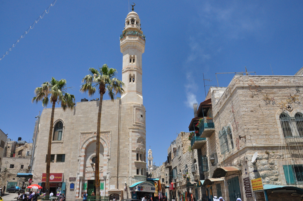
The main attraction in Bethlehem is the Church of the Nativity which stands at one end of Manger Square facing the Mosque of Omar. On the sides of the square are restaurants, souvenir shops, and a modern building that houses the Tourist Information Center, a bookstore, a restaurant and an exhibition hall which currently has a display of creches, the models of Jesus’ birth in the manger from Christian communities around the world, each in their own native style.

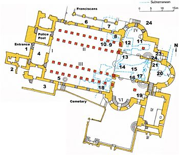
The Church of the Nativity was begun in 327 CE by Emperor Constantine and his mother Helena over the cave that marks the birthplace of Jesus as told in the Gospels of Mathew and Luke; the sanctuary had an octagonal floor plan centered directly above the cave and was completed in 339 CE.
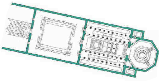
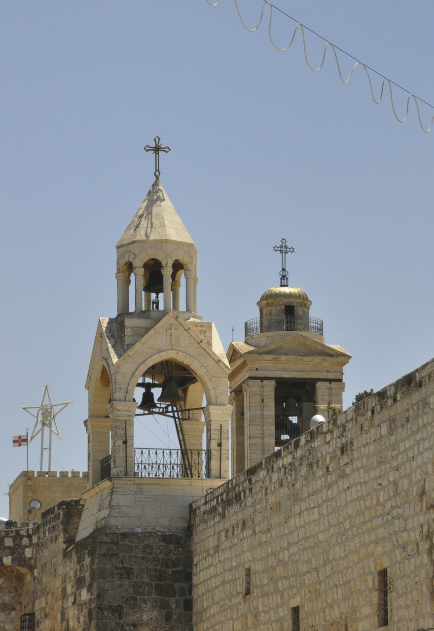
 This church was destroyed by fire during the Samaritan Revolts in 529 CE. Justinian rebuilt a new basilica in 565 CE similar to the original, making it one of the oldest surviving churches. In this plan, the octagonal sanctuary was replaced, being enlarged to three apses. Since then the church has had numerous additions, including its prominent bell towers. The Church of the Nativity is a UNESCO World Heritage Site, the first to be submitted by the Palestine Authority.
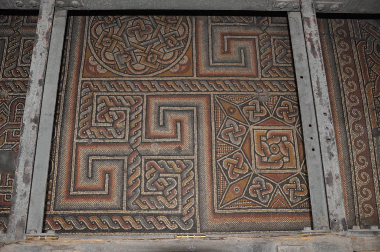
Wooden trap doors give access to portions of the original geometric floor mosaics that survive from Constantine’s church.

Twice the church was spared, by the Persians during their invasion in 614 CE because, according to legend, they were impressed by a representation of the Magi — fellow Persians — that decorated the building. In 1009 the Muslims prevented the application of el Hakim’s decree ordering the destruction of Christian monuments because, since the time of Omar, they had been permitted to use the south transept for worship.
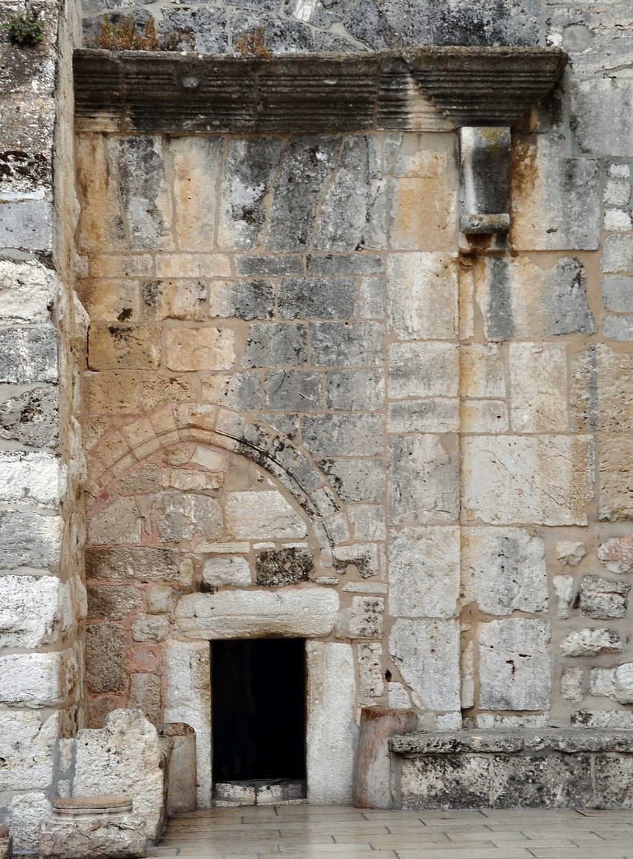
 Justinian’s building had three imposing doorways of which only the central one is now in use (the left entrance is blocked by a buttress, the right by an Armenian hall for pilgrims). The one remaining doorway has been severely constricted – in the Crusader period, it was lowered with a Gothic arch; after 1515, the entrance was further reduced to prevent looters entering with horses and wagons – today it’s called the Door of Humility. Under Crusader rule the church was comprehensively redecorated, the interior walls covered with gold mosaics. and a unique assembly of Crusader art was painted on the red limestone columns. Access to the grotto is via a pair of Crusader Gothic doorways on either side of the raised sanctuary, the bronze metal doors and baptismal font are from Justinian.
Beside the church is an elegant medieval cloister which was restored in 1948 by Barluzzi. The adjoining Church of St. Catherine is built in a more modern Gothic revival style. Beneath the church is a series of caves where St. Jerome lived and worked on the Vulgate, his translation of the Bible from Hebrew into Latin (having previously translated portions from the Greek Septuagint which came from Alexandria) from 384 CE.
From Bethlehem you can drive east through Beit Sahour to Shepherd’s Field, the site where the shepherds saw the Star of Nativity. There are two rival locations, one Greek Orthodox and the other Franciscan. Both sites have been excavated, and there have been churches and monasteries on both sites since the 4th century. This area is also believed to be where Ruth the Moabite gleaned in the fields of Boaz behind the harvesters. Ruth married Boaz and had a son Oved, the father of Jesse who was the father of King David.
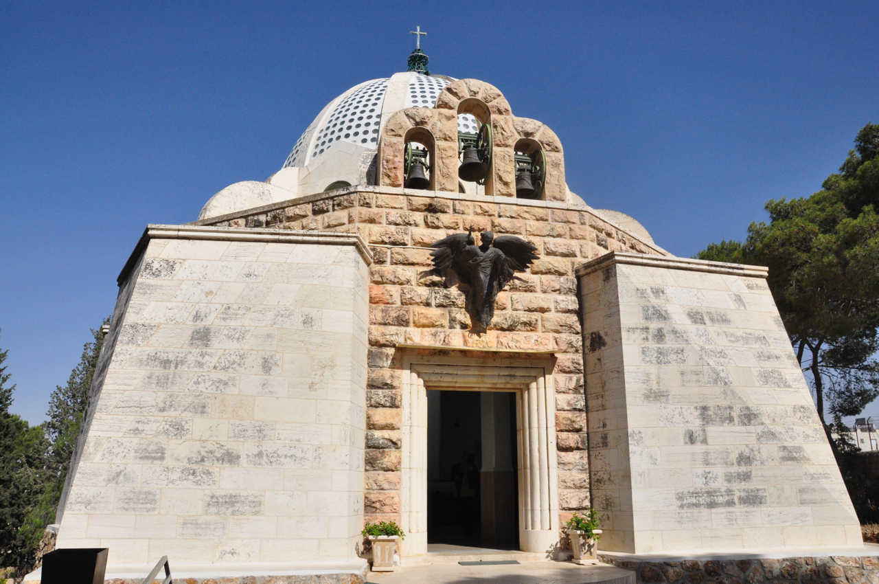
The Greek Orthodox site is at Kanisat al-Ruwat and includes a cave used as a church from the 4th century, of which the barrel-vaulted roof (5th century) still survives; today, a new large church has been built on top. About 600m to the north is the Franciscan site with a low natural cave or rock shelter that is used as a modern chapel. Above is a modern church built by Barluzzi in 1954, shaped like a tent and decorated with a beautiful bronze angel by Duilio Cambellotti.

If you continue east, perched on the cliff above the Kidron valley is the Monastery of Mar Saba dating back to 483 CE.

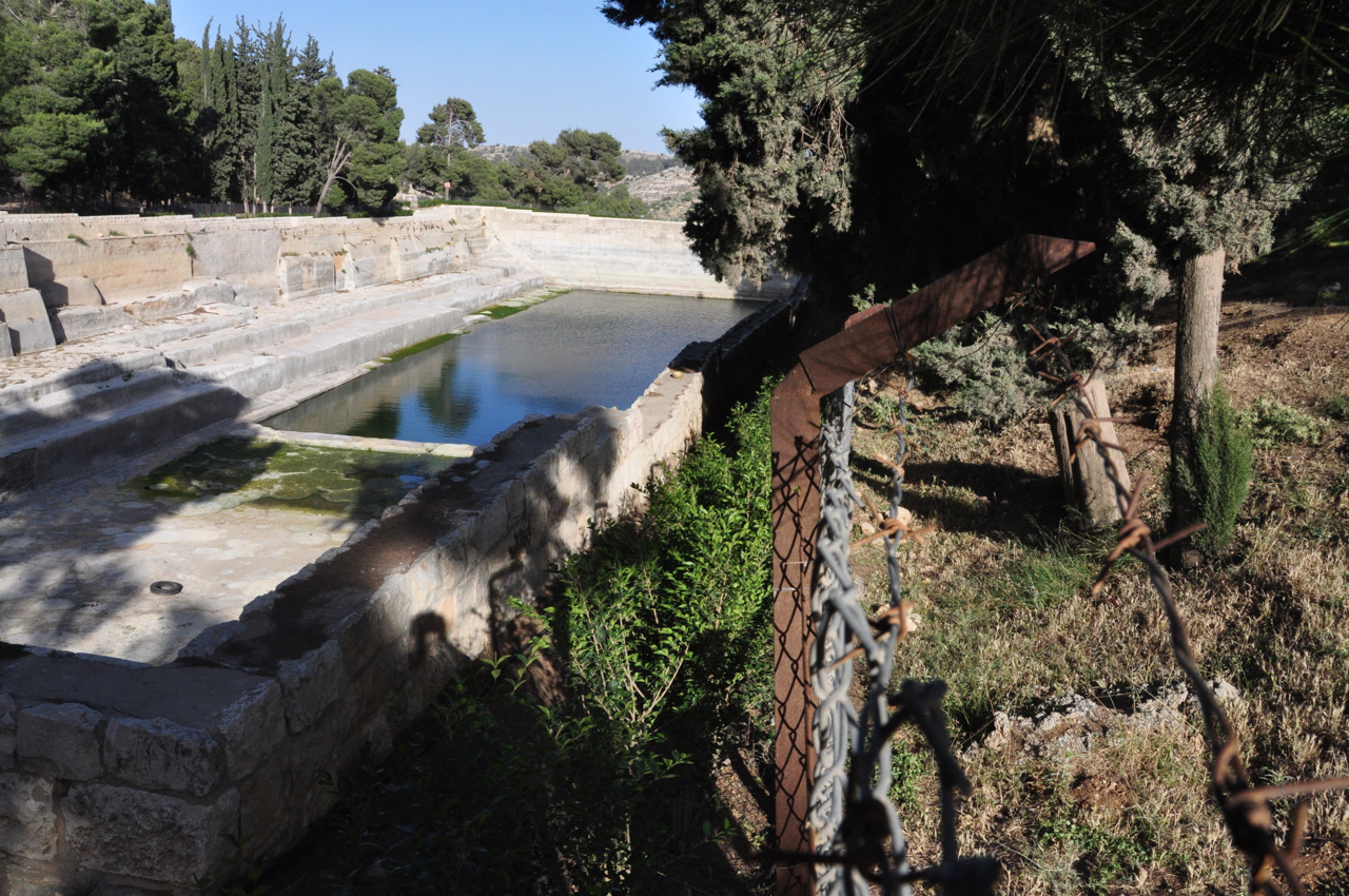
West of Bethlehem are three large reservoirs from the Hasmonean period, called Solomon’s Pools, that stored the water from two aqueducts from springs in the Hebron Hills. From these pools the Upper and Lower aqueducts continued via Bethlehem, Armon HaNatziv, Abu Tor to the Old City (remains of the aqueduct can still be seen along the route); another aqueduct was built by King Herod to bring water to Herodium. The Palestinian Authority have built a large conference center with a restaurant and small archaeological museum overlooking the pools.